 HuntGrid
Weather routing
Weather routing from your boat’s polar
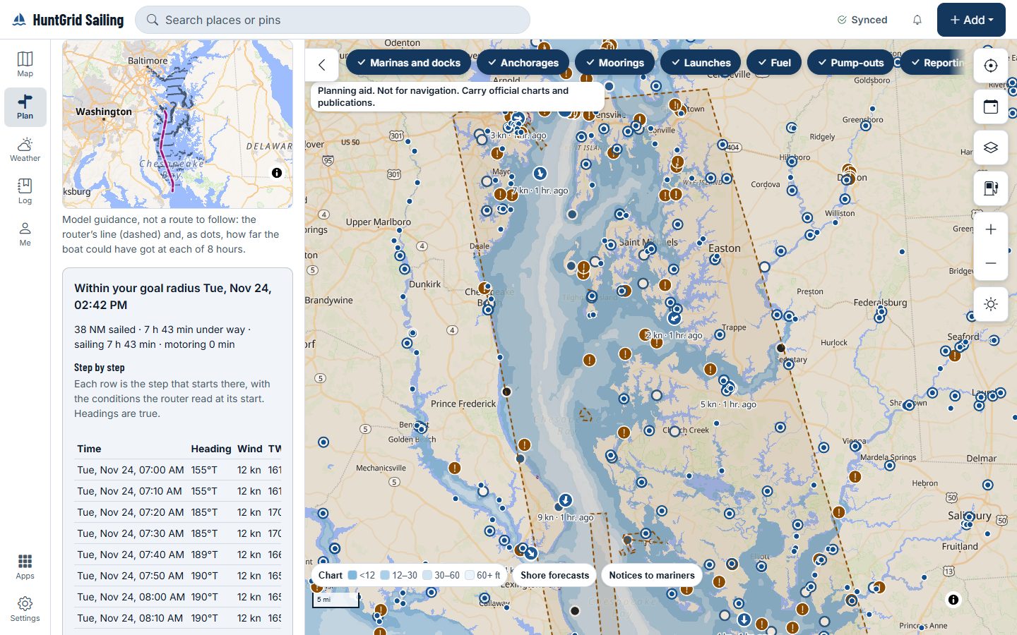
Ask for a route by weather from the passage sheet. The router steps isochrones across the forecast with your boat’s polar and the current, keeps to water deeper than your draft and margin, and answers in words: arrival, distance, hours under sail and motoring, and what your limits ruled out.
Map data © OpenStreetMap contributors, © OpenMapTiles; terrain: Copernicus WorldDEM-30 (credits)
Your boat, your limits, the model named
Every limit comes from your boat profile; one you haven’t set is no limit, and the answer says so.
Blocked by your limit
Wind, gust, wave and wind-angle limits from your profile, and the answer says what each ruled out: “avoids 18:00–23:00 off the cape: blocked by your 25 kn wind limit”.
Sail or motor
Below the boat speed you set, the router motors at your motor speed, or never motors if you turn it off. The answer gives hours under sail, hours motoring and fuel against your tank.
Model handover
High-resolution models to their horizon, then a global one, with the handover marked on the route; past the last model the route stops with “forecast ends here”.
Ensemble members
Route on the members of an ensemble to see how much the answer moves with the forecast.
Zones and traffic lanes
The no-entry zones the route kept out of and the traffic separation schemes it crosses, each with its citation.
Map data © OpenStreetMap contributors, © OpenMapTiles; terrain: Copernicus WorldDEM-30 (credits)
The result
Model guidance you can edit
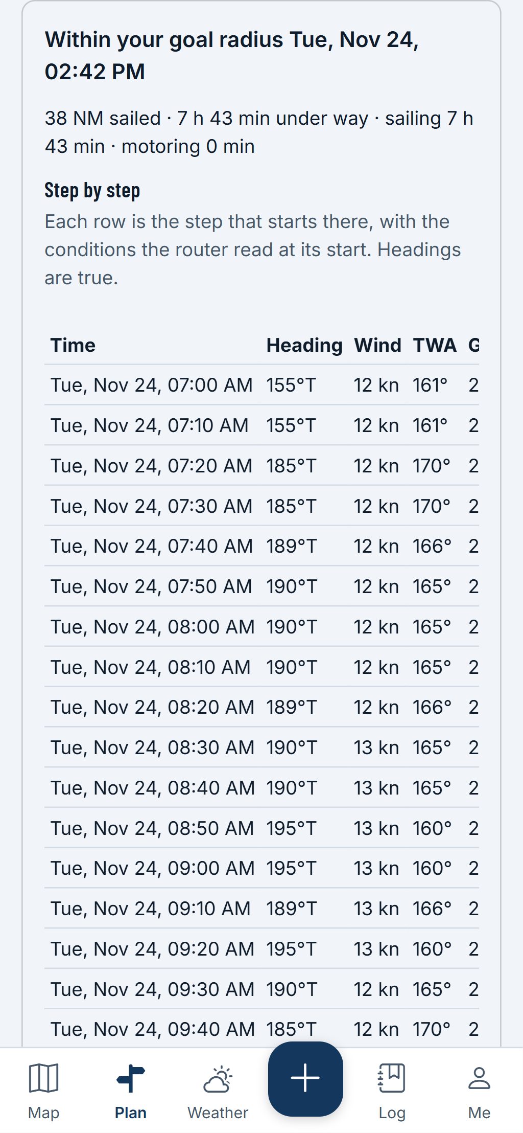
The route and its hourly fronts draw on the map, with a facts table for each point: time, heading, wind, waves, current, boat speed, sail or motor, and tack.
- “Use as my passage” turns the route into legs you can edit, with the number of waypoints you choose.
- Every answer names its model runs and the router’s settings, and says “Model guidance, not a route to follow.”
A planning aid, not for navigation. Carry official charts and Notices to Mariners, and check each fact against its source.
Questions
Still have a question? Read the HuntGrid Sailing help pages or email support@huntgrid.net.
Should I follow the route?
It’s model guidance from one forecast and your polar, not a route to follow. Check it against an official chart, the latest forecast and the conditions you see.
Is it free?
Yes. Everything on this page is in the free plan, with no credit card. HuntGrid Sailing is in open beta, and there are no ads.
Plan your next passage on the map
Create a free account and open HuntGrid Sailing in your browser. The same account works for every HuntGrid app.
Already have an account? Sign in