 HuntGrid
Elk on public land
The elk hunting app for public land and no signal
Elk country is big, steep and mostly out of cell range. HuntGrid puts public land, hunting units and 3D terrain on one map, saves it on your phone, and records your track so you can find the truck again in the dark.
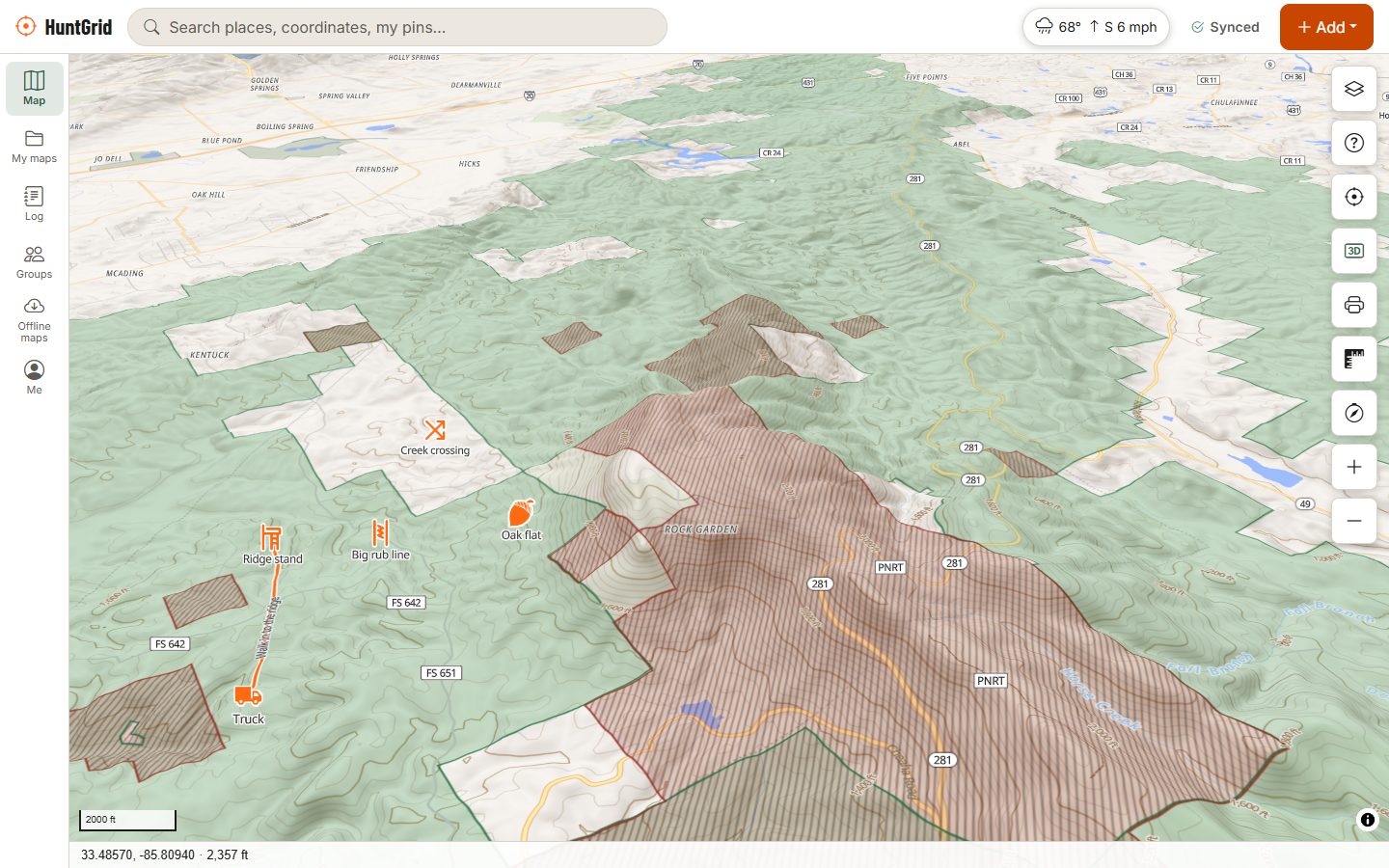
Map data © OpenStreetMap contributors, © OpenMapTiles; terrain: Copernicus WorldDEM-30 (credits)
Plan the hunt
Know the country before you walk it
Most of an elk hunt is decided before opening day: which unit, which drainage, and how to get in and out. Do that work on a big screen, then take it with you.
Hunting units and districts
Unit lines for most states, such as Montana hunting districts, Wyoming hunt areas, Idaho and New Mexico GMUs, and Utah and Nevada hunt units, so you know which unit you're standing in. Colorado and Arizona aren't on the map yet.
Public land, easements and corners
National forest, BLM and state land with the source and date, public access easements, and corner points where public parcels touch only at a corner. Crossing them is legal in some states and trespass in others.
3D terrain and slope
Hillshade, contours, slope shading and 3D terrain show the benches, saddles and dark timber where elk bed. An elevation profile shows the climb on any route you draw.
Migrations and winter range
The Wildlife layer shows published migration corridors, stopovers and winter ranges for some western herds, with a month slider. It is seasonal habitat, never where animals are right now.
Mountain weather
Hourly forecasts, wind and gust maps, radar, official alerts, wildfire perimeters and smoke, and snow depth for late-season hunts.
Map data © OpenStreetMap contributors, © OpenMapTiles; terrain: Copernicus WorldDEM-30 (credits)
In the backcountry
Out of range, still on the map
- Download a whole hunting unit or block of public land before you leave, with terrain, and satellite imagery where its licence allows.
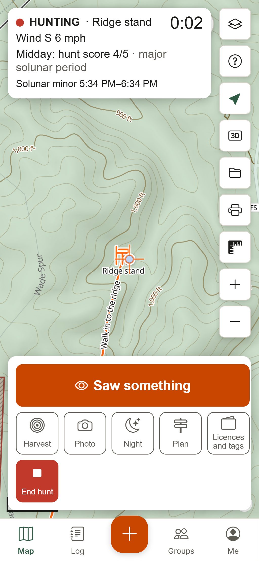
- Record your track as you hike. In the browser, keep HuntGrid open on screen while it records.
- Mark the truck, then use Back to truck for the distance and bearing home. Go to any waypoint or coordinate the same way.
- Draw a bearing line toward a bugle or a herd you glassed, and range rings to plan a stalk or a shot.
- Mark wallows, glassing points, sign and elk sightings as you find them.
- Leave a hunt plan with someone at home: they get an alert if you are not back by the time you set.
Your first elk hunt with HuntGrid
Pick a unit
Turn on hunting units and public land and look for big blocks of public ground with access. Check that unit's licence, draw and season rules on the agency's site.
E-scout the terrain
Use 3D terrain, slope and satellite imagery to find benches, saddles, north-facing timber and water far from roads. Pin glassing points and likely bedding areas.
Plan your routes
Draw your way in and out and check its elevation profile. Roads and trails open to vehicles, with gates other hunters have reported, show where the truck can go.
Download and leave a plan
Download your unit for offline use, mark the trailhead, and leave a hunt plan with someone at home.
Hunt, then get back
Record your track, log the elk you see in three taps, and use Back to truck when the light goes.
Licences, draws, seasons and weapon rules vary by state, province and unit. The official regulations always have the final word.
Questions
Still have a question? Read the help pages or email support@huntgrid.net.
What is the best app for elk hunting?
It depends on what you need most. HuntGrid puts public land, hunting units, 3D terrain and slope, weather and your own pins on one map, saves it for offline use, records your track and guides you back to the truck. Every feature is in the free plan, so you can plan a whole hunt with it before you decide.
Can I see public land for elk hunting?
Yes. HuntGrid shows public land across the US, including national forest, BLM and state land, with the source and date, plus access easements. Tap a spot to see the land type. Boundaries, closures and access can change, so check the signs on the ground and the official regulations.
Does HuntGrid show elk hunting units and GMUs?
For most states, yes, including Montana hunting districts, Wyoming hunt areas, Idaho and New Mexico GMUs, and Utah and Nevada hunt units. A few states, such as Colorado and Arizona, aren't on the map yet. You can download a whole unit for offline use.
Will it work in the backcountry with no cell service?
Yes, once you download your area. Your phone's GPS works without cell service, and your pins and tracks save on the phone. In the browser, track recording runs while HuntGrid is open on screen. Carry a spare battery, a paper map and a compass too.
Is corner crossing legal?
It depends on the state, and the law is still changing. HuntGrid marks corner points where public parcels meet only at a corner, so you can see them, but it does not tell you they are legal to cross. Check the official rules for your state before you step across.
Your next hunt starts on the map
Create a free account, download your area and head out. No credit card, no per-state fees.
Already have an account? Sign in