 HuntGrid
Maps and terrain
3D terrain and topo maps for hunting
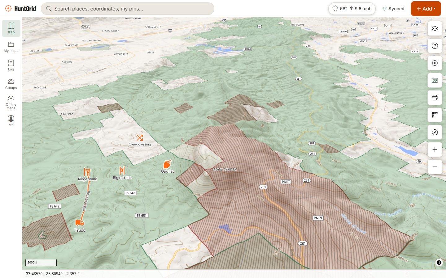
Hillshade, contour lines in feet or metres, slope shading and true 3D terrain show the ridges, saddles, benches and draws that move game, before you ever walk in. The map, terrain and tools work worldwide.
Map data © OpenStreetMap contributors, © OpenMapTiles; terrain: Copernicus WorldDEM-30 (credits)
See the ground the way the deer do
3D terrain
Tilt the map into 3D with adjustable exaggeration to see how ridges and draws connect. The map stays flat until you turn 3D on.
Contours and hillshade
Contour lines in feet or metres to match your settings, over hillshade that makes every rise and dip readable at a glance.
Slope shading
Colours by steepness, with a legend, to spot flat benches on steep sides and the slopes you won’t want to climb with a pack.
Topo, satellite and night
Topo and dark styles, a red night style that keeps your eyes adjusted, and satellite or hybrid where imagery is available.
Elevation and profiles
Elevation under your cursor, and an elevation profile for any line or track with climb, descent and the steepest grade.
Print and coordinates
Print PDF maps at a fixed scale such as 1:24,000 with a lat/long, UTM or MGRS grid and a legend. Coordinates in decimal degrees, DMS, DDM, UTM and MGRS, and legal land descriptions on the Prairies.
How to use it
E-scout a new piece of ground
Start with topo and land
Turn on “Can I hunt here?” so you only study ground you can hunt. Public land map.
Read the shape of the land
Add slope shading and tilt into 3D. Look for saddles between peaks, benches along sidehills, and funnels where cover or terrain pinches together.
Pin your ideas
Mark them with HuntGrid’s 88 hunting icons, including saddle, bench, funnel, bedding area, glassing point and stands.
Plan the route and save it
Draw your walk in, check its elevation profile and measure distances, then save the area for offline with terrain included.
Terrain features worth a closer look
Game often follows the easiest way through the land. These are the shapes many hunters look for first on a topo map.
Saddles
A low dip in a ridge between two high points. Animals crossing the ridge often use it instead of climbing over the top.
Benches
A flat shelf partway up a slope, where contour lines spread apart. Easy travel and a place to bed with a view below.
Funnels and pinch points
Where a steep bank, water or a field edge squeezes travel into a narrow strip. Slope shading makes them easy to spot.
Points and draws
Ridge points that drop toward feed, and draws that carry cool air and scent downhill in the evening. Thermals and wind.
More layers for scouting
Wildlife layer
Waterfowl flyways, mapped ungulate migration corridors in the western US with a month slider, and winter ranges in British Columbia. It shows seasonal habitat use, never live animal locations.
Trails, gates and stands
Tracks, paths, gates, springs, shelters and parking from open map data, plus roads and trails open to vehicles where agencies publish them.
Measure and range
Measure distance and area, draw a bearing line from a point, and put range rings around a stand for your bow or rifle distances.
Questions
Still have a question? Read the help pages or email support@huntgrid.net.
How do I read a topo map for hunting?
Contour lines join points of equal elevation: lines close together mean steep ground, lines far apart mean flat ground. Look for V-shapes pointing uphill (draws), U-shapes pointing downhill (ridges or points), low spots between two high points (saddles) and wider gaps on a hillside (benches).
Can I see contour lines in feet?
Yes. Contours, elevations and profiles follow your units setting: feet or metres.
Does HuntGrid have satellite imagery?
Yes, where imagery is available, including across the US. Satellite and hybrid styles sit beside topo, dark and red night styles, and the imagery can go offline where its licence allows.
Does 3D terrain work offline?
Yes. Include Terrain when you download an offline area and the hillshade, contours, 3D view, slope shading and elevation readouts work with no signal.
Can I print a hunting map?
Yes. Print a PDF at the scale you choose, with a lat/long, UTM or MGRS grid, north arrow, scale bar, legend, title and notes.
Your next hunt starts on the map
Create a free account, download your area and head out. No credit card, no per-state fees.
Already have an account? Sign in