 HuntGrid
Marine weather
Marine weather for sailors, as the agencies issue it
Marine forecasts and warnings from the National Weather Service and Environment and Climate Change Canada show as the agency issued them, with its name, the issue time and a link. Wind and waves from the forecast models run on one time slider, with the model and run named. The app never says the weather suits you: you decide.
Map data © OpenStreetMap contributors, © OpenMapTiles; terrain: Copernicus WorldDEM-30 (credits)
Forecasts, warnings and observations
Each one names its source and time. No warning drawn never means none issued: the Weather tab says what was read and when.
Wind and waves over seven days
Wind barbs in knots, wave heights and current arrows on one time slider, up to seven days ahead. Waves are shaded against the wave limit you set for your boat, in neutral bands when you set none.
Marine forecasts as issued
The coastal, nearshore, Great Lakes, offshore and high-seas forecasts from the NWS, and Environment Canada’s marine forecasts, word for word, with a timeline read from the text and the original one tap away.
Warnings on the map
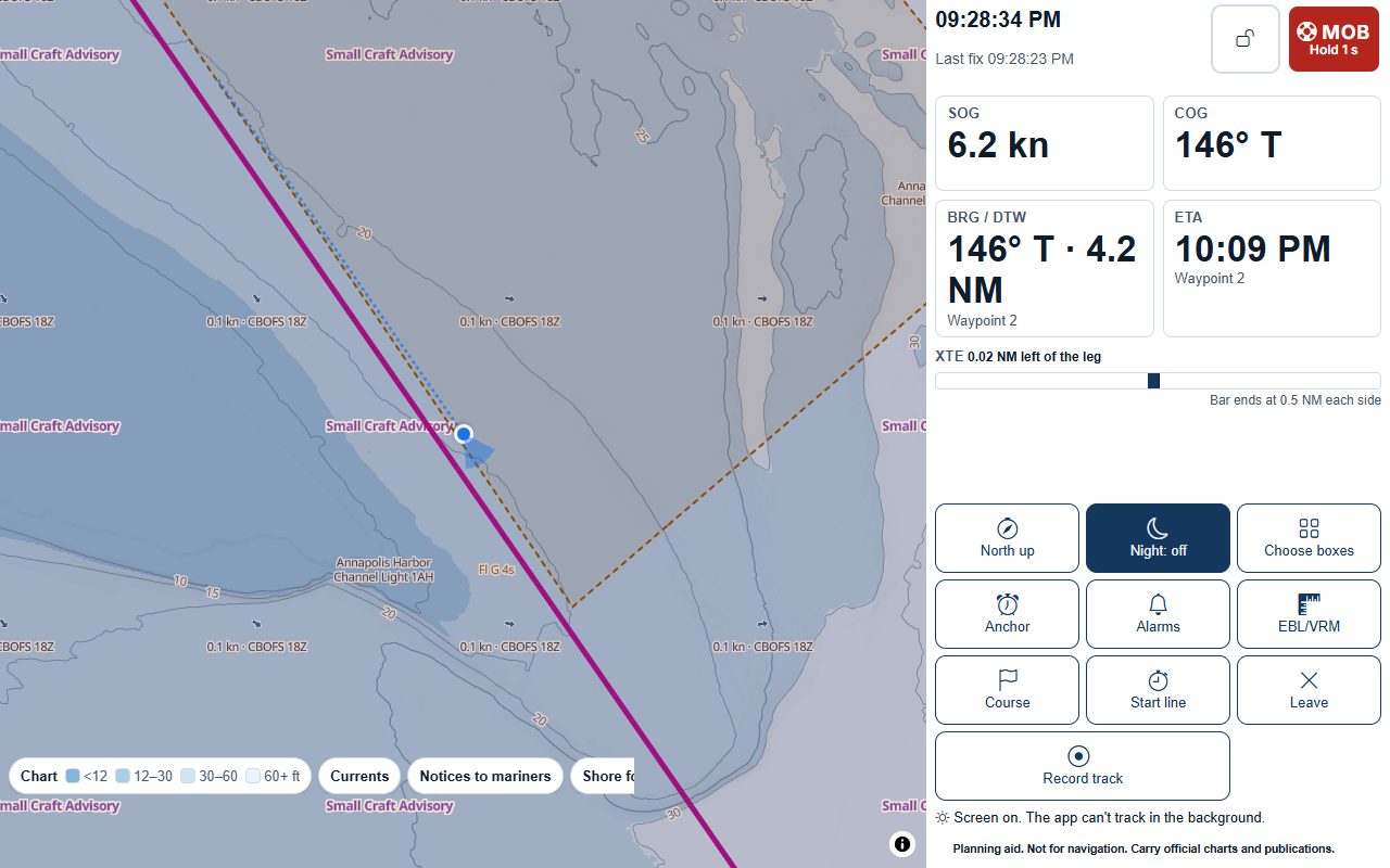
Active NWS marine alerts and Environment Canada marine warnings drawn on their zones, with the issuer and times; tap one to read it as issued. A badge on the Weather tab while one is active for the view or a saved passage.
Buoys
NDBC and Environment Canada buoys: wind, gusts, waves, pressure and its change over 3 hours, air and water temperature, with the station’s owner and the time of each reading. Readings older than an age you set are greyed.
A warning watch for your places
Tick the warnings you want, such as a Small Craft Advisory or a gale warning, for your home port, your favourite harbours and the legs of an upcoming passage. When one is issued, you get an alert with its text, issuer and time. Nothing is ticked until you tick it.
Map data © OpenStreetMap contributors, © OpenMapTiles; terrain: Copernicus WorldDEM-30 (credits)
Along your passage
The wind each leg meets
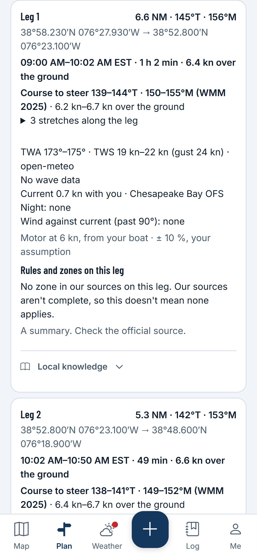
In the passage planner, each leg gives the wind angle and speed, the gusts and the waves at the times you pass, from the model named on the leg, and the marine zones it crosses in order.
- Where a source has no figure, the leg says so, such as “No wave data”, never a guess.
- Environment Canada’s warnings come in French where it issues them; NWS text is in English, and labelled.
A planning aid, not for navigation. Carry official charts and Notices to Mariners, and check each fact against its source.
Questions
Still have a question? Read the HuntGrid Sailing help pages or email support@huntgrid.net.
Will it tell me if it’s OK to go out?
No. It shows the forecasts and warnings as issued and the model figures with their source, and never says conditions suit you. You decide, with your own limits and what you see on the water.
Where do the marine forecasts come from?
From the National Weather Service in US waters and Environment and Climate Change Canada in Canadian waters, shown word for word with the issue time and a link to the agency’s page.
Is it free?
Yes. Everything on this page is in the free plan, with no credit card. HuntGrid Sailing is in open beta, and there are no ads.
Plan your next passage on the map
Create a free account and open HuntGrid Sailing in your browser. The same account works for every HuntGrid app.
Already have an account? Sign in