 HuntGrid
Free hunting app · United States & Canada
The hunting map app that works with no signal
A free hunting app with offline maps for the US and Canada: public land, hunting units, wind, weather, satellite and seasons on one GPS map, plus the best stand for today’s wind. Plan at home, hunt with zero bars, and bring your group along.
- Works offline
- No per-state fees
- iPhone, Android and computer
- English and French
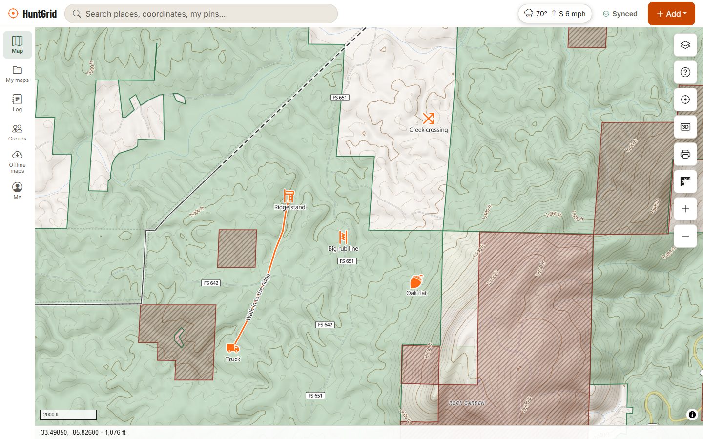
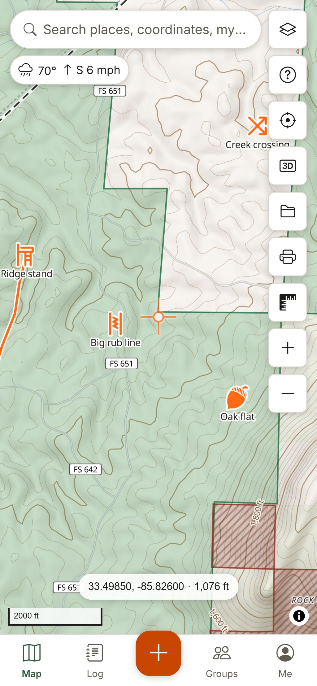
- 63state, province and territory hunting maps
- 88hunting icons for stands, sign and camp
- 0 barsneeded once your area is downloaded
- $0free plan, no credit card
Everything for the hunt, on one map
Built for whitetail stand hunters, public-land elk hunters, waterfowlers, turkey hunters, moose camps and anyone who hunts in more than one state or province.
Offline hunting maps
Download the places you hunt, with topo, your pins, seasons and the forecast, and use them where there's no signal.
Can I hunt here?
Tap anywhere: public land, access program, permission needed or closed, with the rule in plain words and its source.
Hunting units and zones
GMUs, WMUs, deer management units and provincial zones on the map, so you always know which unit you are standing in.
Today: where should I sit?
The next sit with its legal light, wind and a 1 to 5 hunt score, and your stands ranked by how well that wind fits each one.
Wind and scent
See where your scent goes hour by hour, wind arrows across the map and a daily hunt score for every stand.
Hunting weather
Live wind at thousands of weather stations, official 7-day forecasts from NWS and Environment Canada, radar, wind flow and alerts.
Satellite and hybrid maps
USGS aerial imagery across the US and provincial air photos in Ontario and New Brunswick, under your pins and land layers, offline too.
Seasons and legal light
A season calendar from dates a person has checked against the regulations, legal shooting hours with a countdown, sun, moon and solunar times.
3D terrain and topo
Hillshade, contours, slope shading and 3D terrain to find the saddles, benches and funnels before you walk in.
Trail cameras and hunt log
Log sightings and harvests in a few taps. Import photos from any trail camera brand and see activity by hour, moon and wind.
Gear checklists
Packing lists for whitetail, rifle, elk, turkey, ducks and after the shot: tick them off, add your own, reset for the next trip, offline.
Hunt as a group
Shared maps for your camp, check-ins, location sharing only when you turn it on, and a hunt plan that alerts your contacts if you're overdue.
Bring your pins
Import GPX, KML/KMZ, GeoJSON or CSV from other hunting apps and GPS units, and export yours whenever you like.
iPhone, Android and computer
Install it from your browser, use it offline, and keep one account on every device. No app store needed.
Map data © OpenStreetMap contributors, © OpenMapTiles; terrain: Copernicus WorldDEM-30 (credits)
Where to hunt
Know where you can hunt before you go
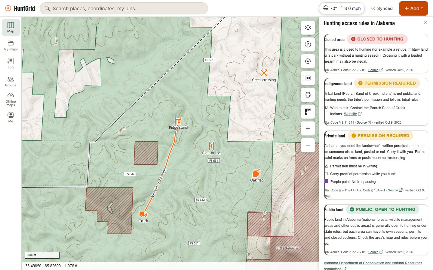
Tap the map and HuntGrid tells you what kind of land you're on and what the rule is, in plain words.
- Public land in all 50 states, Crown land across most of Canada, wildlife refuges, many access programs and easements.
- Hunting units and zones in most states and provinces.
- Parcel lines, and in many US states the owner's name on rural land, so you know who to ask.
- A warning near homes and buildings, and an alert when you walk up to closed land.
- Roads and trails open to vehicles, with gates other hunters have reported.
Every answer shows its official source and date. The regulations always have the final word. More about public land maps.
Map data © OpenStreetMap contributors, © OpenMapTiles; terrain: Copernicus WorldDEM-30 (credits)
Wind and scent
Read the wind before you walk in
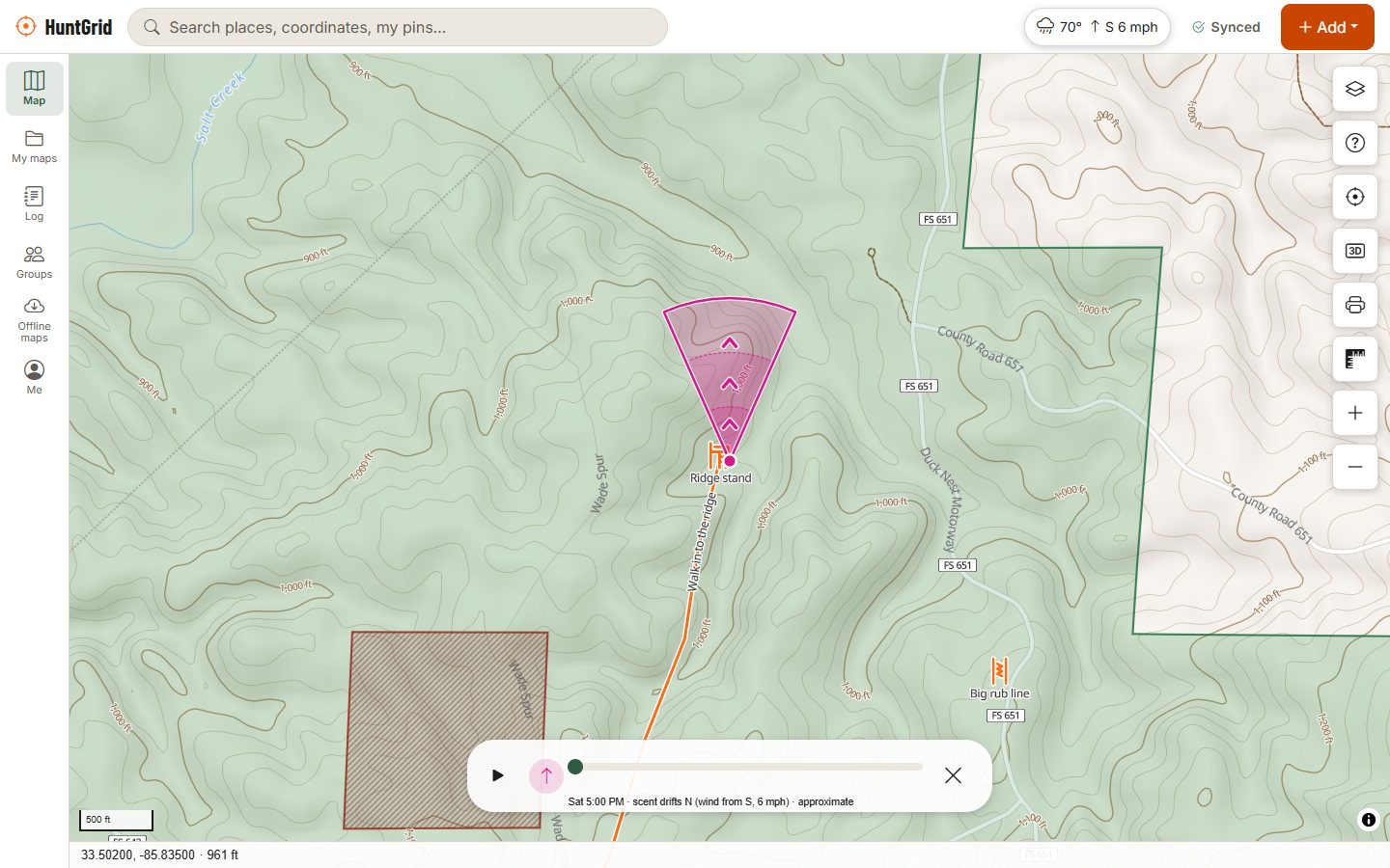
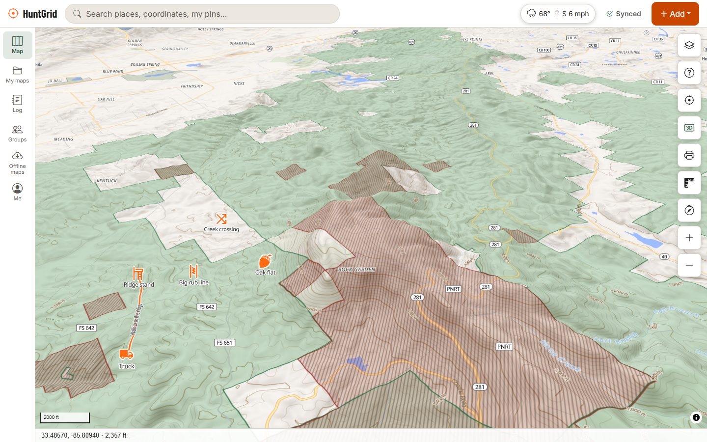
Pick a stand and see where your scent will drift, hour by hour, from the forecast.
- A scent cone with a time slider, wind arrows on the map and a thermals hint for hills.
- A daily 1 to 5 hunt score for each stand, with the reasons.
- Alerts when the wind is right for a stand, the pressure drops or a season opens.
Map data © OpenStreetMap contributors, © OpenMapTiles; terrain: Copernicus WorldDEM-30 (credits)
Maps
See the ground the way the deer do
- 3D terrain, hillshade, contours in feet or metres, and slope shading.
- Topo, dark and red night styles, plus satellite where imagery is available.
- Coordinates in decimal degrees, DMS, UTM and MGRS, and legal land descriptions on the Canadian prairies.
- Maps, terrain and weather work worldwide.
Today
Which stand should I hunt today?
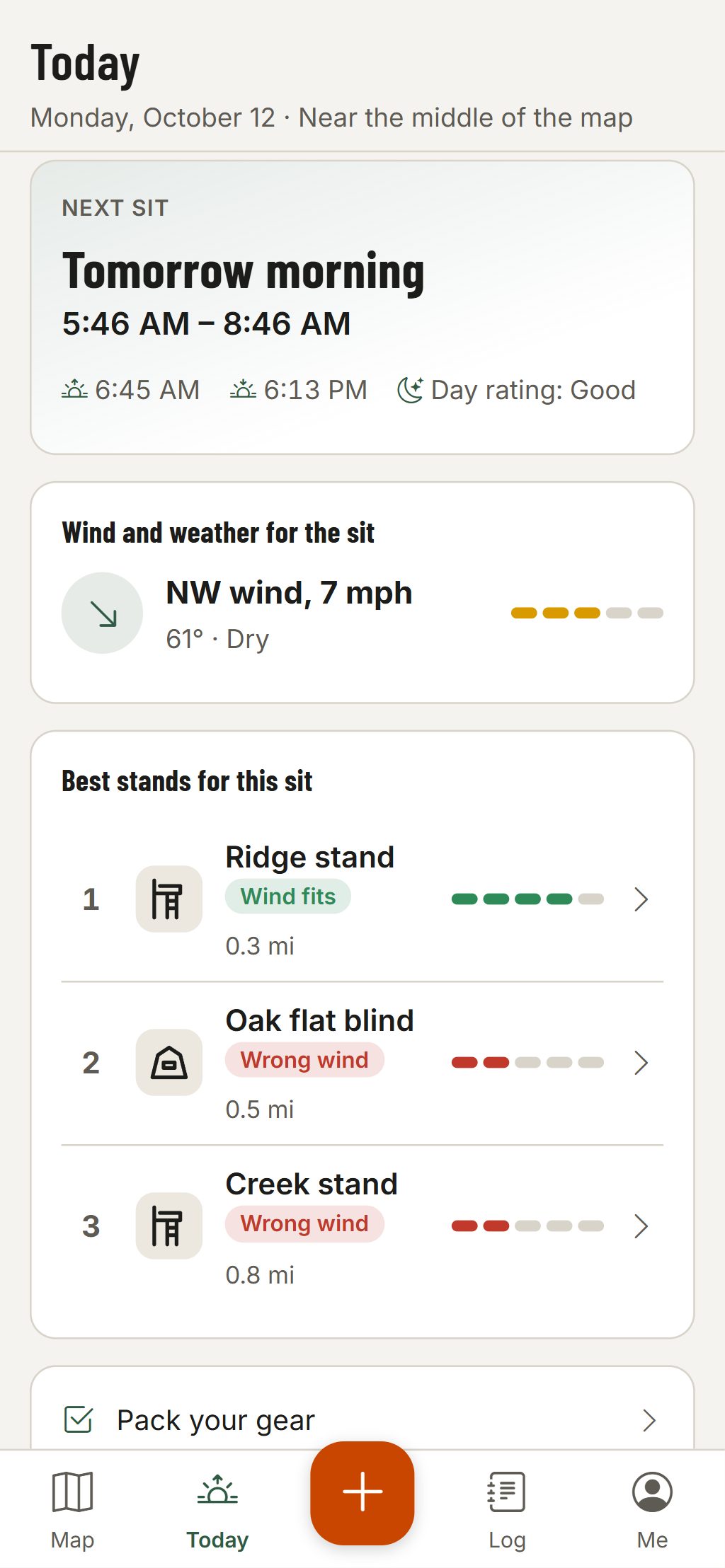
Open Today before you leave and HuntGrid plans the next sit for you.
- The next sit, this morning, this evening or tomorrow, with sunrise, sunset, the solunar rating and legal light where the rule is known.
- The wind and weather for those hours, with a 1 to 5 hunt score and its reasons.
- Your stands ranked by how well that wind fits each one; tap one to open it on the map.
- A gear checklist one tap away, so nothing stays in the truck.
Map data © OpenStreetMap contributors, © OpenMapTiles; terrain: Copernicus WorldDEM-30 (credits)
In the field
Hunt Mode: big buttons, no fuss
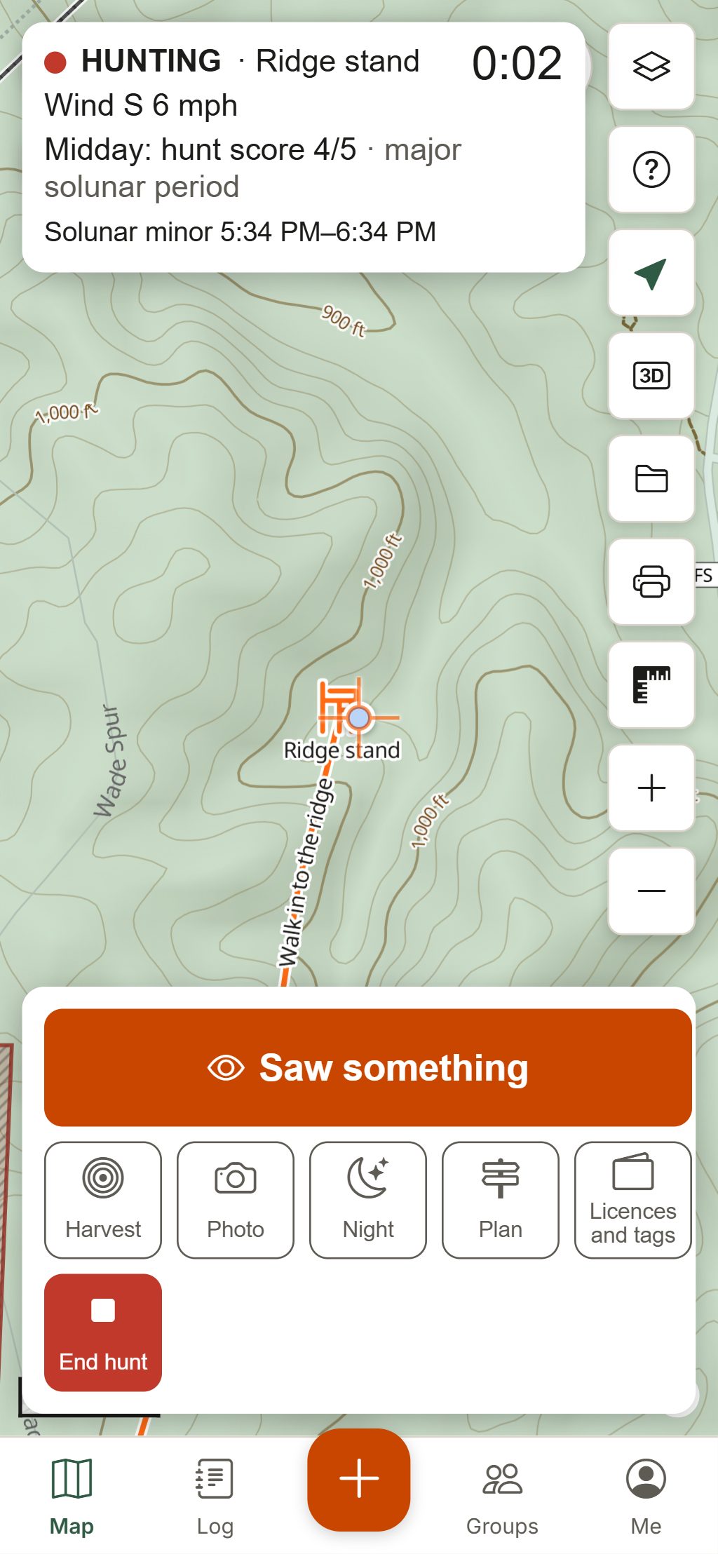
Start a hunt and the screen gives you only what you need, with buttons big enough for cold hands.
- A hunt clock, the wind, your hunt score, the legal-light countdown and solunar times.
- Log a sighting in three taps, record your track, and find your way back to the truck.
- One tap to a red night screen that keeps your eyes adjusted.
- Your licences and tags in a wallet, with reminders to report your harvest.
- No ads, ever, in Hunt Mode or on the map.
Hunting maps by state and province
Find the hunting map for where you hunt
Public land, hunting units and access rules for every US state and Canadian province and territory, with the official wildlife agency for each.
United States
- Alabama
- Alaska
- Arizona
- Arkansas
- California
- Colorado
- Connecticut
- Delaware
- Florida
- Georgia
- Hawaii
- Idaho
- Illinois
- Indiana
- Iowa
- Kansas
- Kentucky
- Louisiana
- Maine
- Maryland
- Massachusetts
- Michigan
- Minnesota
- Mississippi
- Missouri
- Montana
- Nebraska
- Nevada
- New Hampshire
- New Jersey
- New Mexico
- New York
- North Carolina
- North Dakota
- Ohio
- Oklahoma
- Oregon
- Pennsylvania
- Rhode Island
- South Carolina
- South Dakota
- Tennessee
- Texas
- Utah
- Vermont
- Virginia
- Washington
- West Virginia
- Wisconsin
- Wyoming
Offline
Works with zero bars
HuntGrid saves everything on your phone first and syncs when you're back in range, so nothing gets lost on the mountain.
Download your areas
Save the map you're looking at, an area you drew, the ground around a stand, or a whole hunting unit or public land.
Everything you add stays put
Pins, tracks, photos and your log save on the phone with no signal and sync to your other devices later.
Install it in seconds
Add HuntGrid to your home screen from the browser on iPhone, Android or a computer. No app store needed.
-
Free tool
Solunar table and hunting times
Sunrise, sunset, first and last light, moon phase and the major and minor feeding periods for any place, for the next 7 days. No account needed.
-
Guides
Hunting guides from the map
How to find public hunting land, hunt the wind, pick a stand, pack for deer and elk, read a solunar table and hunt where there is no cell service.
Privacy
Your spots stay yours
We don't sell location data
Not your spots, not your tracks, not to anyone.
Share without giving it away
Shared photos have their GPS removed, and share links hide the exact spot unless you choose to show it.
Take it with you
Export everything in standard formats at any time, or delete your account and your data.
Also from HuntGrid: Fishing
HuntGrid Fishing is our free fishing map app. One free account works for both apps: sign in to HuntGrid Hunt or HuntGrid Fishing with the same account, on every device.
Also from HuntGrid: Offroad
HuntGrid Offroad is our free trail map app for ATVs, side-by-sides, dirt bikes, 4x4s and snowmobiles, from official data with the source on every trail. One free account works for every HuntGrid app.
New from HuntGrid: Backcountry (beta)
HuntGrid Backcountry is our free trip planner for canoe and backpacking trips. Draw your route from paddle, portage and hike legs and see how long each leg and each day should take, with daylight and bail-out points for every day. It’s an early beta, growing every week. One free account works for every HuntGrid app.
Pricing
Free to hunt and fish with
One free account for hunting and fishing, on every device, and the same price whether you hunt one state or ten.
Free
$0 forever
- Every map layer, weather tool and feature on this site
- 3 offline areas for the places you hunt
- 100 MB for photos and voice notes on your pins
- Up to 3 hunting groups of your own
- Small ads outside the map, never in Hunt Mode
- The same free account works in HuntGrid Fishing
Premium Later
One price for everywhere
- Ad-free and Pro options are planned
- More offline areas and storage
- One flat price for every state, province and country
- Never per-state add-ons
Prices will be posted here first. Your free account keeps working.
Questions
Still have a question? Read the help pages or email support@huntgrid.net.
Is HuntGrid really a free hunting app?
Yes. Every map layer, weather tool and feature on this site is in the free plan, paid for by a few small ads that never cover the map or show in Hunt Mode. Paid options will come later for people who want them, at one price for every state and province.
Does it really work without cell signal?
Yes. Download the areas you hunt before you go. Your phone's GPS works without cell service, and everything you add saves on the phone and syncs when you're back in range.
Which states and provinces does it cover?
Public land across all 50 states and Crown land across most of Canada, plus hunting units and zones in most states and provinces. Each state and province page says exactly what's shown there. The map, terrain, weather and tools work worldwide. See the hunting map for your state or province.
Does HuntGrid work on iPhone and Android?
Yes, and on computers. HuntGrid is a web app: on iPhone, open it in Safari and choose Share, then Add to Home Screen; on Android, open it in Chrome and choose Install HuntGrid. It opens full screen and works offline like any app, with one account on every device. It isn’t in the App Store or Google Play yet; store apps are planned. How to install it.
Can I switch from onX, HuntStand or my Garmin?
Yes. Export a GPX or KML file from your other app or device and import it in HuntGrid: your stands, pins and tracks come with you. How to bring your pins.
How does HuntGrid pick the best stand?
Tick the wind directions that work for each stand. The Today screen takes the forecast for your next dawn or evening sit, gives each stand a 1 to 5 hunt score from the forecast at its own spot, and ranks them by that score, then by how well the wind fits, then by distance. Always check the wind at the tree too. More about Today.
Does HuntGrid have satellite maps?
Yes. Satellite and Hybrid styles show USGS aerial imagery across the US and provincial aerial photos in Ontario and New Brunswick, and can go offline there. A 10 m Sentinel-2 mosaic for the rest of Canada is being built region by region. About satellite maps.
Where does the land and season information come from?
From government agencies and open public data. Every answer shows its source and date, and season dates are checked by a person before they appear. Always confirm with the official regulations.
Is HuntGrid available in French?
Yes. The whole app is available in English and Canadian French. Voir la page en français.
Your next hunt starts on the map
Create a free account, download your area and head out. No credit card, no per-state fees.
Already have an account? Sign in