 HuntGrid
Departure planner
A departure planner that puts the times side by side
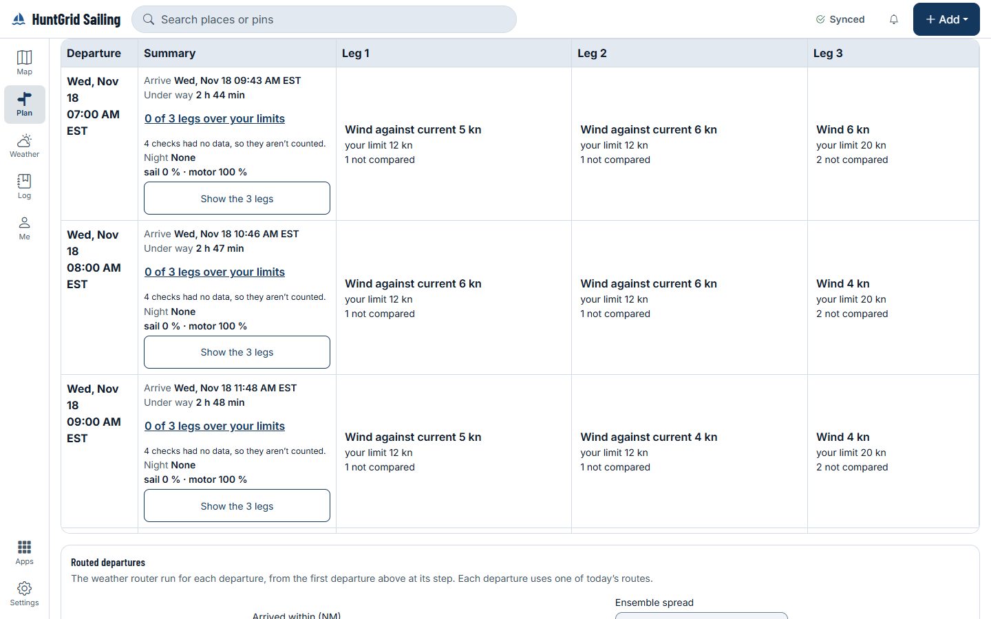
Pick a window and a step, and the planner runs your passage for each departure in it. Each one shows its arrival time, duration, night hours and how many legs go past the wind, gust and wave limits you set for your boat, with the limits named. The app never ranks them: you compare and choose.
Map data © OpenStreetMap contributors, © OpenMapTiles; terrain: Copernicus WorldDEM-30 (credits)
The numbers for each departure
Limits come only from you. Where you set none, nothing is counted against one.
How much the models agree
Where an ensemble forecast covers your passage, each departure says how many of its members exceed your wind limit on the worst leg, names the ensemble and its run, and gives a range for the passage time. Where none covers it, nothing is shown.
The current over the days
A heatmap of departures across the forecast: duration, distance against the current, wind-against-current hours and night hours, with the current’s source per leg. A leg with no current data says “currents not included”.
Arrive in daylight
Set how many hours before sunset you want to arrive, and see the latest departure that does it under each model, with the sunset time at your destination.
Models side by side
The same departures under each model that covers your area, each with its run time and horizon. Where a nearby buoy has a verification figure, it shows; the models are never ranked.
Why this count
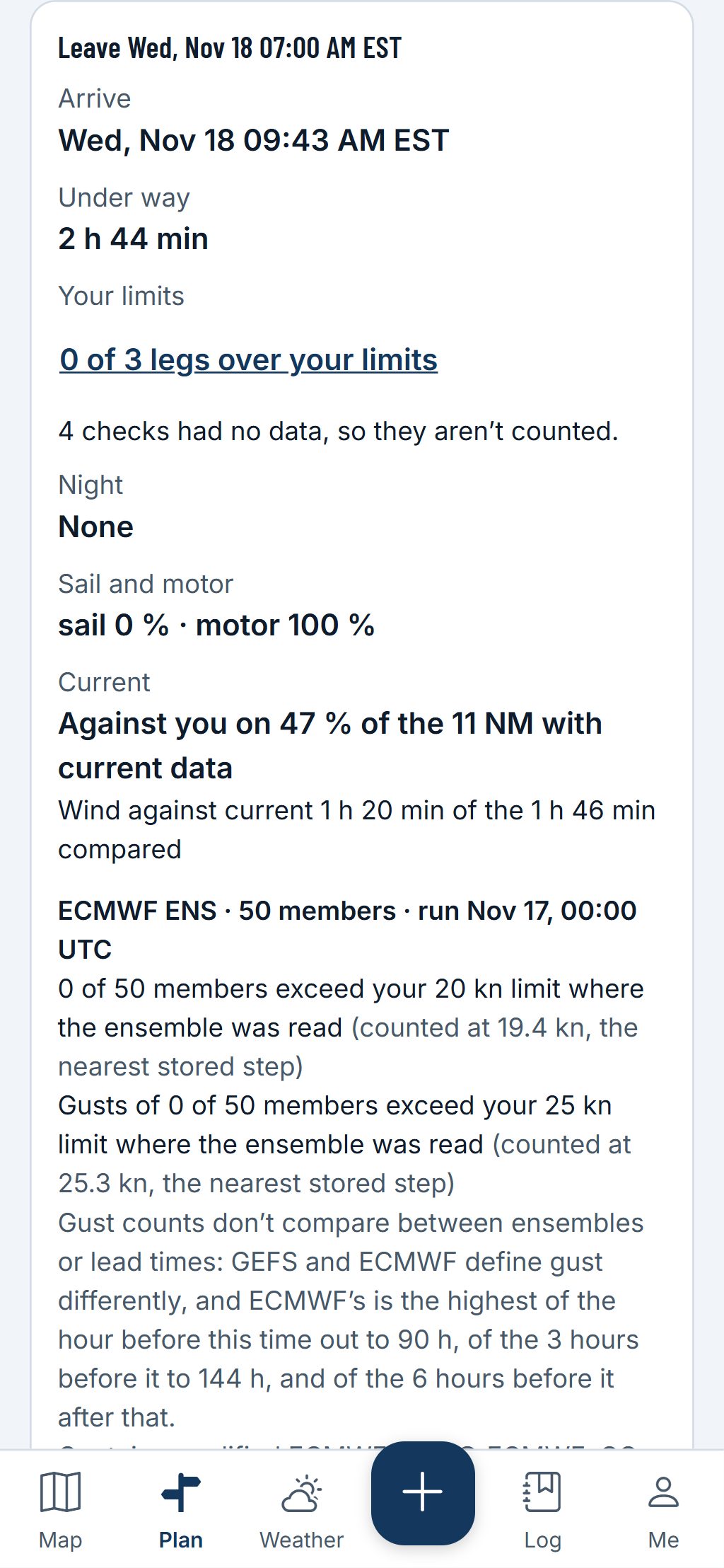
Tap any count or cell for the list behind it: the leg, the time, the value, your limit, the source and the model run.
Map data © OpenStreetMap contributors, © OpenMapTiles; terrain: Copernicus WorldDEM-30 (credits)
On your phone
One card per departure
On a phone, each departure is a card with its times in local time and zone; tap it for the leg-by-leg breakdown.
- Save a comparison to the passage with its model runs, share it with your group, and it goes into the briefing with “forecasts change: check again before you leave”.
- Watch a saved departure: when a new model run changes how many legs go past your limits, you get a notification with the old and new counts and the run times.
A planning aid, not for navigation. Carry official charts and Notices to Mariners, and check each fact against its source.
Questions
Still have a question? Read the HuntGrid Sailing help pages or email support@huntgrid.net.
Does it pick a departure for me?
No. It lays out the figures for each departure with their sources, and you choose. Nothing is coloured as “fine” when it is under a limit.
Which weather models does it use?
The models that cover your area, named on every figure with their run time, such as HRRR, HRDPS, GFS or ECMWF IFS, and the ensembles where they cover the passage.
Is it free?
Yes. Everything on this page is in the free plan, with no credit card. HuntGrid Sailing is in open beta, and there are no ads.
Plan your next passage on the map
Create a free account and open HuntGrid Sailing in your browser. The same account works for every HuntGrid app.
Already have an account? Sign in