 HuntGrid
Anchorages
Anchorages: open water by wind direction, depth and rules
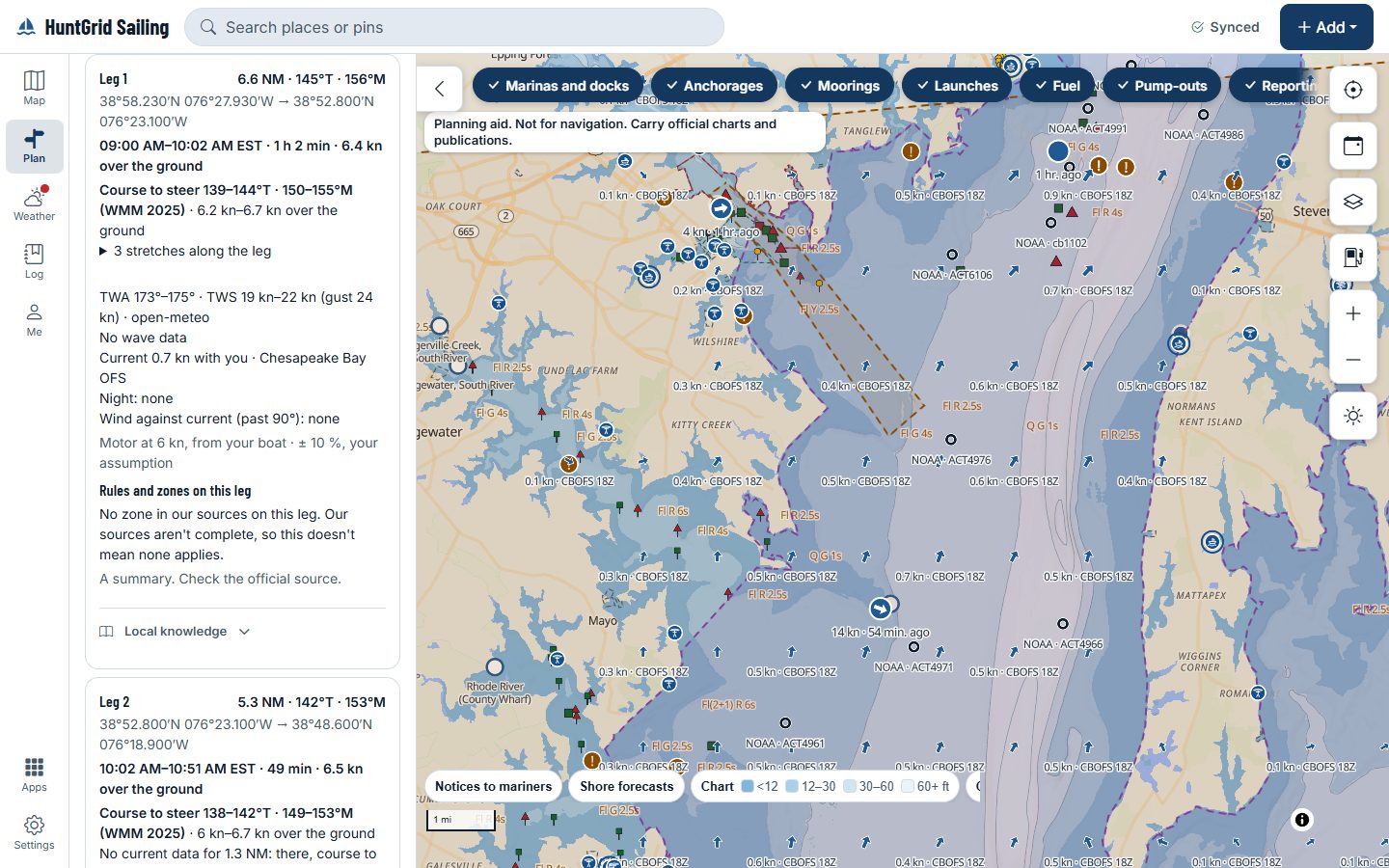
Tap an anchorage on the map for its sheet: its name, kind and source, and a rose of how far the open water runs off it toward each of eight compass directions, in nautical miles. The forecast wind for the next 72 hours sits on the rose, with the fact in words. The figures are side by side; the call is the skipper’s.
Map data © OpenStreetMap contributors, © OpenMapTiles; terrain: Copernicus WorldDEM-30 (credits)
An anchorage’s sheet
Distances, depths and rules, each with its source. The sheet gives facts, never a verdict on the place.
Open water in eight directions
How far the water runs from the anchorage to the first shore toward N, NE, E and round to NW, measured on OpenStreetMap’s coastline, rivers and breakwaters. Past 50 nautical miles it reads “over 50 nm”. A place not measured yet says so, never zero.
Today’s wind against it
Each forecast step for the next 72 hours is a dot on the rose, and a sentence gives the fact: wind from 200° at 18 knots on Saturday at 02:00 crosses 14 nautical miles of open water.
Charted depth
The range of charted depths inside the anchorage’s outline, or within the swing radius you enter, with its chart datum and cells. Two sources on two datums show as two ranges, and wrecks, rocks and obstructions aren’t in the range: the sheet says so.
The rules at anchor
A strip answers “Can I anchor here?” from the rules we hold for the place, each with its citation, and says “unknown” where none of our sources covers it.
Map data © OpenStreetMap contributors, © OpenMapTiles; terrain: Copernicus WorldDEM-30 (credits)
Once the anchor is down
An anchor watch, on a second device if you like
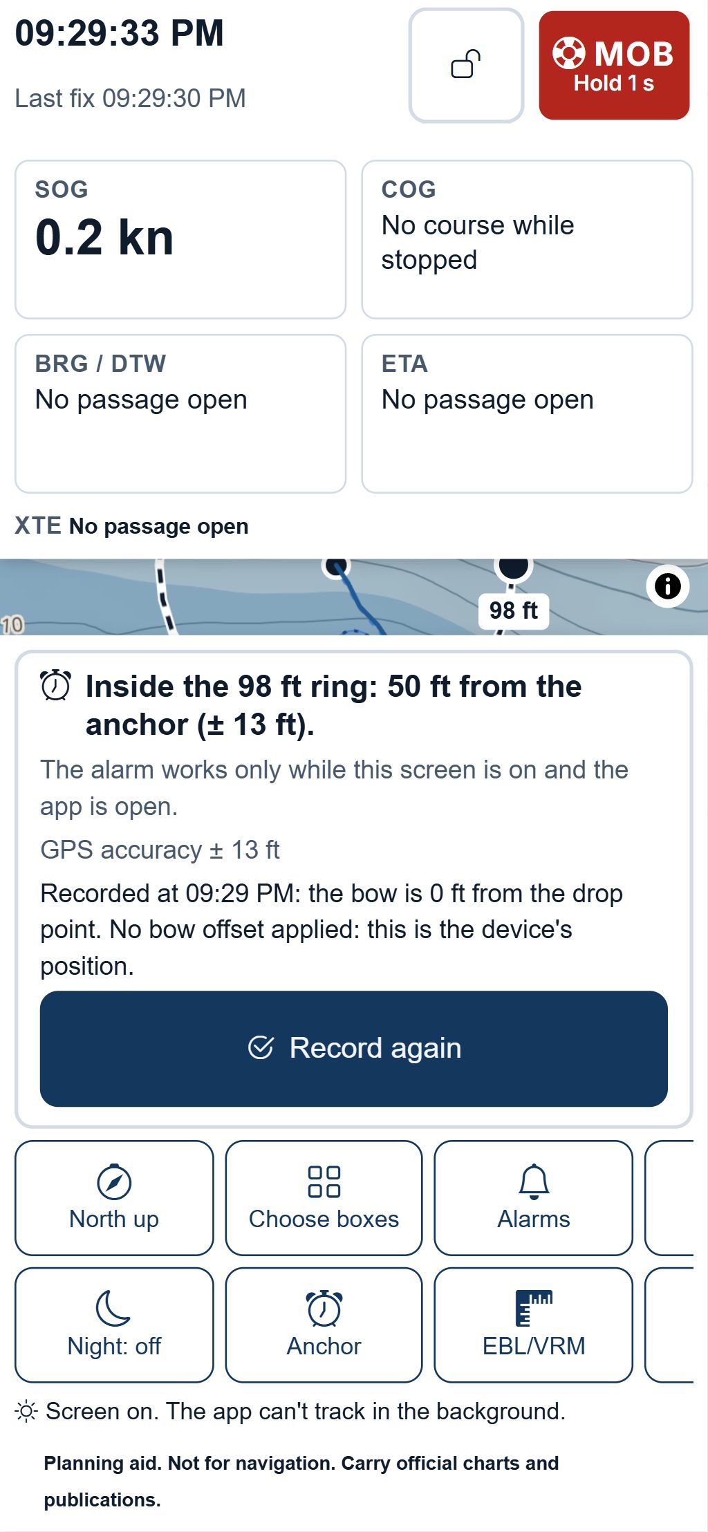
Set the anchor and drag the alarm ring to the radius you want; the watch sounds when the boat leaves it, and shows its distance from the anchor and the GPS accuracy.
- Use an old phone or tablet on a charger as the watch device, with a dimmed screen and a battery warning at the level you set where the browser reports it.
- Share the watch with your group: crew ashore see the ring and get the drag alert, and an alert if the watch device stops reporting.
- The alarm works only while the watch screen is on and the app is open, and the app says so.
A planning aid, not for navigation. Carry official charts and Notices to Mariners, and check each fact against its source.
Questions
Still have a question? Read the HuntGrid Sailing help pages or email support@huntgrid.net.
Does it tell me which anchorage to pick?
No. It shows the open water in each direction, the forecast wind and the charted depth, each with its source, and never ranks anchorages. You choose, with an official chart.
Where do the anchorages come from?
From OpenStreetMap and public sources, each named on its sheet. The distances are measured on OpenStreetMap’s coastline, credited on the sheet. Piers on piles don’t stop a measurement, and the sheet says so.
Is there a default swing radius?
No. The field starts empty; the depth range then covers the anchorage’s outline or the mark itself, and says which. The number you enter stays on your device.
Is it free?
Yes. Everything on this page is in the free plan, with no credit card. HuntGrid Sailing is in open beta, and there are no ads.
Plan your next passage on the map
Create a free account and open HuntGrid Sailing in your browser. The same account works for every HuntGrid app.
Already have an account? Sign in