 HuntGrid
Spring and fall black bear
The black bear hunting app built on wind and sign
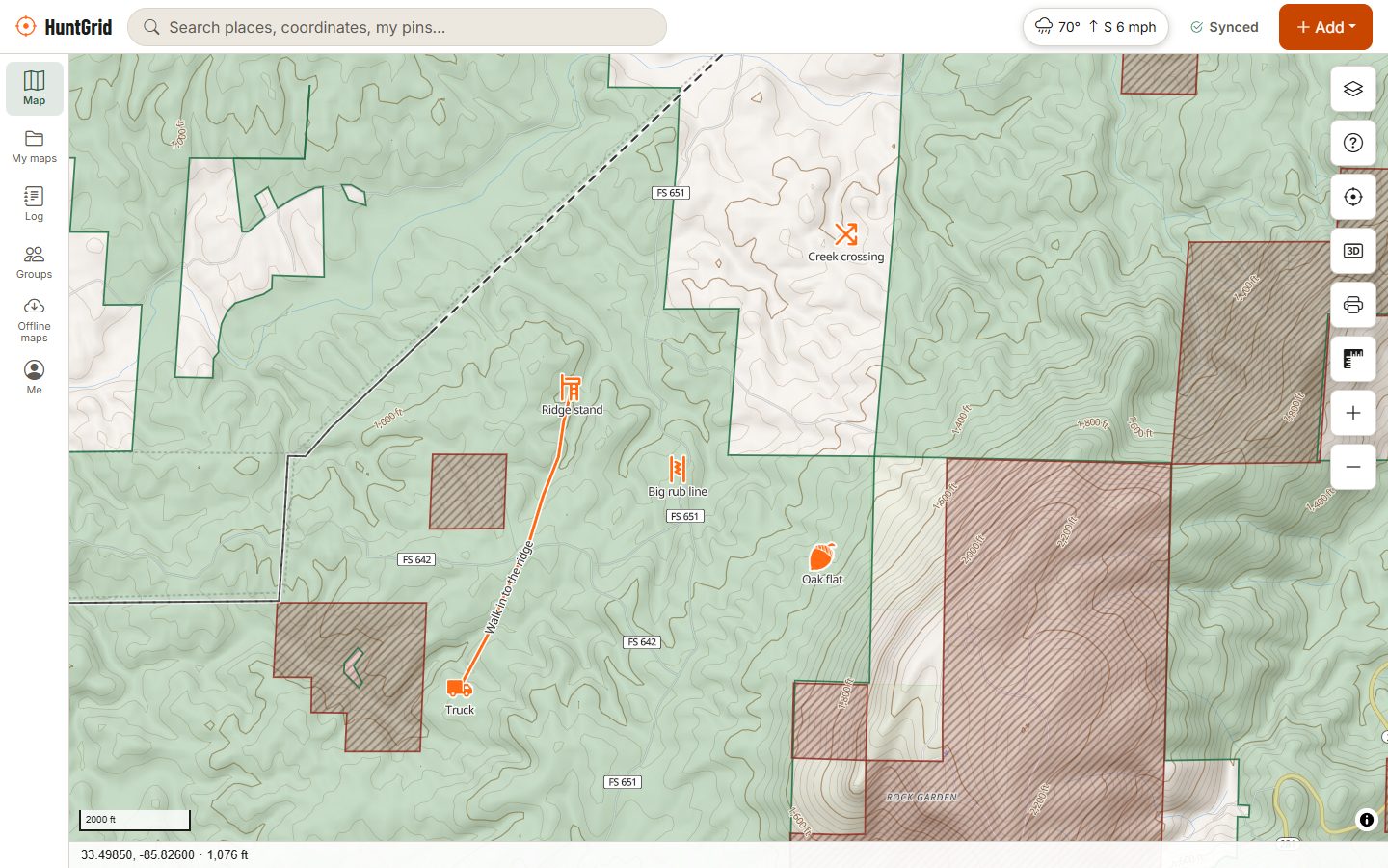
A bear's nose is its best defence. HuntGrid shows where your scent will drift, keeps your trail cameras and sign on the map, and tells you what kind of land you're on.
Map data © OpenStreetMap contributors, © OpenMapTiles; terrain: Copernicus WorldDEM-30 (credits)
How bear hunters use HuntGrid
Follow the food, play the wind
Bears go where the food is and leave the moment they smell you. The map keeps both in front of you.
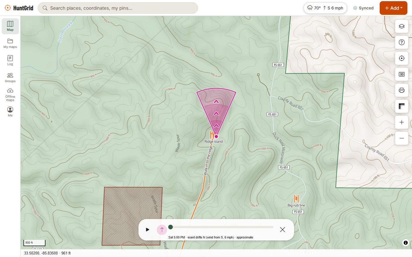
Scent cone at every stand
Step through the forecast hour by hour to see where your scent goes, with wind arrows on the map and a thermals hint for hills. Each stand gets a daily hunt score.
Trail cameras with activity
Put cameras on the map with the way they face, import photos from any brand, tag the bears, and see when they visit by hour, moon, temperature, wind and pressure.
Food and sign
Mark mast trees, crop fields, springs, water and beaver ponds, plus tracks, scat and hair, and draw the travel routes between food and thick cover.
Terrain and cover
Hillshade, contours, slope shading, 3D terrain and satellite imagery where available show the benches, draws and thick bottoms where bears travel and bed.
Land and local rules
Public land across the US and Crown land across most of Canada, with the source and date. Where HuntGrid has checked a jurisdiction's notices on baiting, trail cameras or drones, they show with their source.
Map data © OpenStreetMap contributors, © OpenMapTiles; terrain: Copernicus WorldDEM-30 (credits)
Spring and fall
Two seasons, two different bears
Where a jurisdiction has both seasons, bears behave differently in each. The map helps you follow the food as it changes.
- Spring: bears leave the den hungry and look for the first green growth in clearings, on road edges and along wet ground. Hillshade and contours help you find the south-facing slopes that green up first.
- Fall: bears feed hard on acorns, beechnuts, berries and crops before denning. Mark mast trees and crop fields and watch your cameras for the shift.
- Always: hunt the wind. Your scent cone and hunt score help you choose which stand to sit, and when to stay home.
- Methods such as baiting or hounds, spring seasons and rules on females with cubs are set by each state and province. Check the official regulations before you plan a hunt.
Your first bear hunt with HuntGrid
Check the rules first
Find out which seasons, methods and units are open to you this year. The official regulations decide; HuntGrid links to them where it has them.
Scout the food
Use terrain and satellite imagery to find green-up in spring or oak ridges and crop edges in fall, then confirm with boots on the ground.
Hang cameras
Put cameras on trails and food sources, import the photos and tag the bears. The activity charts show whether they visit in daylight.
Pick the stand by the wind
Give each stand its good winds and check the scent cone before you go. Download the area so it all works with no signal.
After the shot
Mark the hit site, blood and last blood, wait before you follow, and draw the recovery path. Bears often leave little blood, so track carefully and bring a partner.
Questions
Still have a question? Read the help pages or email support@huntgrid.net.
What is the best app for bear hunting?
The one that helps you beat a bear's nose. HuntGrid puts a scent cone, wind arrows, trail cameras with activity charts, sign icons, 3D terrain and public and Crown land on one map that works offline. Every feature is in the free plan, so you can try it on your own spots.
Is bear baiting legal where I hunt?
It depends on your state or province. Baiting is allowed in some places, restricted in others and banned in many. HuntGrid doesn't decide that for you: check your jurisdiction's official regulations. Where HuntGrid has checked a jurisdiction's notice on baiting, it shows on the map's card with its source.
Does HuntGrid work with my trail cameras?
Yes, with any brand. Put each camera on the map with the way it faces, import its photos, tag the bears, and see visits by hour of day, moon, temperature, wind and pressure. Trail camera laws differ between jurisdictions, so check yours.
Why does the wind matter so much for bears?
A bear's sense of smell is far better than ours, so a bad wind can end a hunt before it starts. HuntGrid draws your scent cone through the forecast hours, but forecasts can be wrong: check the real wind on site and sit the stand it favours.
Can I hunt bears on Crown land?
In many provinces Crown land is open to hunting with the right licence, but not everywhere: parks, refuges and other closures apply, and non-residents often face different rules. HuntGrid shows Crown land across most of Canada with its source and date; the official regulations have the final word.
Your next hunt starts on the map
Create a free account, download your area and head out. No credit card, no per-state fees.
Already have an account? Sign in