 HuntGrid
Passage planner
A passage planner, with a briefing to print
Draw a passage on the map, or import it as GPX, and split it into legs. Each leg gets an arrival time from your boat’s speeds, and the tide, current, wind and waves it meets at those times, each with its source and model run. The numbers are side by side; the call is the skipper’s.
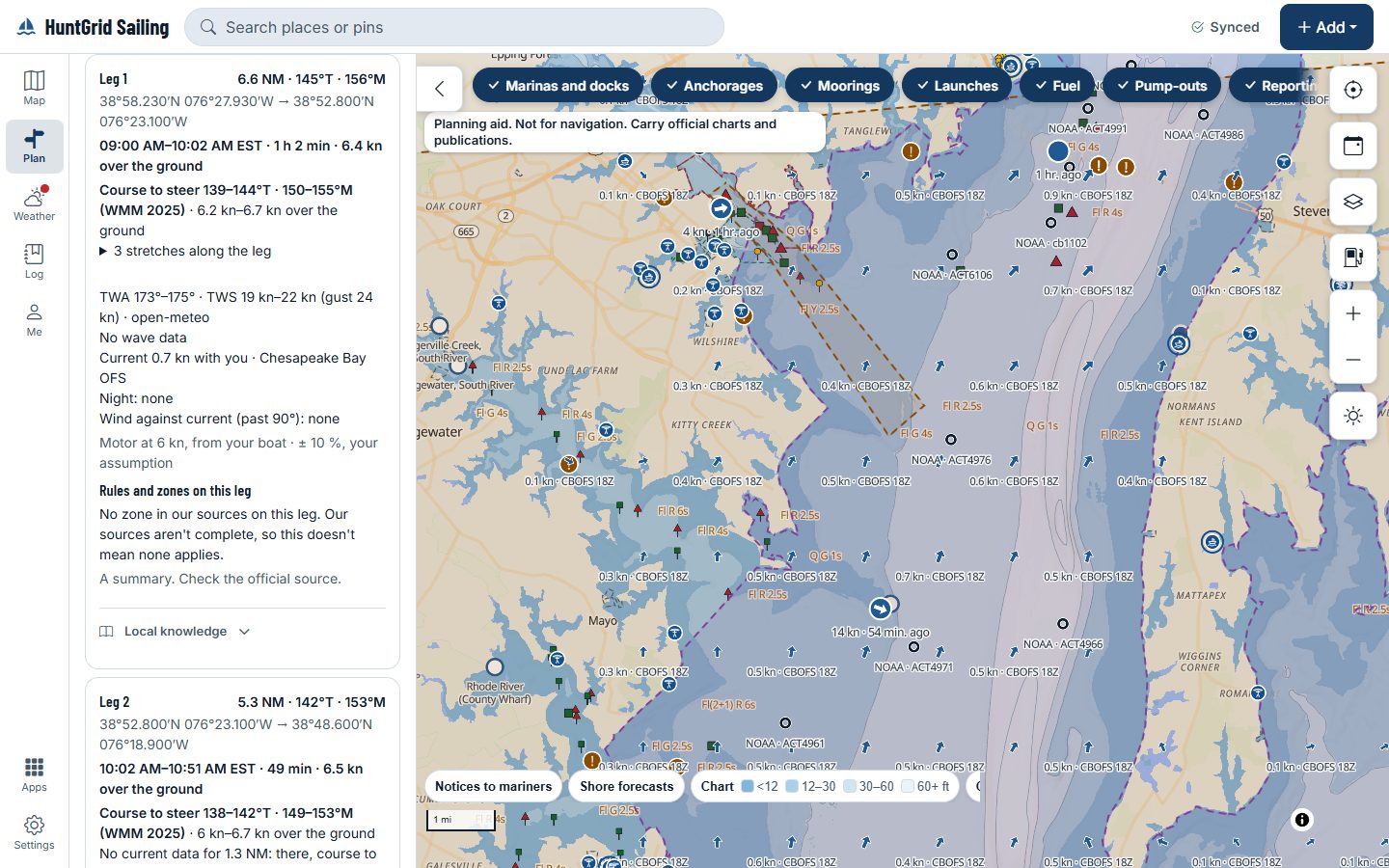
Map data © OpenStreetMap contributors, © OpenMapTiles; terrain: Copernicus WorldDEM-30 (credits)
Each leg, at your times
Every figure names where it comes from: the chart and its datum, the tide station or model, the forecast model and its run.
Depth and air draft at your arrival time
The shallowest charted depth on each leg below its chart datum, the predicted tide at the time you pass, and your draft, side by side. Bridges and overhead cables on the leg show their published clearance next to your air draft.
Wind against current
The hours on each leg when the wind blows against the current, and the wave steepness the forecast gives for them.
Tidal gates
For a pass or a narrow channel on your route, the times its current turns, from the station or model named on the leg.
Sunset and night hours
Sunrise and sunset at each stop, and how many hours of each leg fall at night.
Ports along the way
The harbours near your route, with how far off each one is, so you can see your options before you leave.
A briefing to print or share
The route map, the legs, tide and current times, sunrise, sunset and the moon, the forecast per model with its run time, and the warnings for the zones you cross. Print it, save it as a PDF, or share a read-only link that expires after seven days and never shows your home position.
Fuel, water and holding tank
Your boat’s tanks and burn rate against the passage’s engine hours and days, as figures.
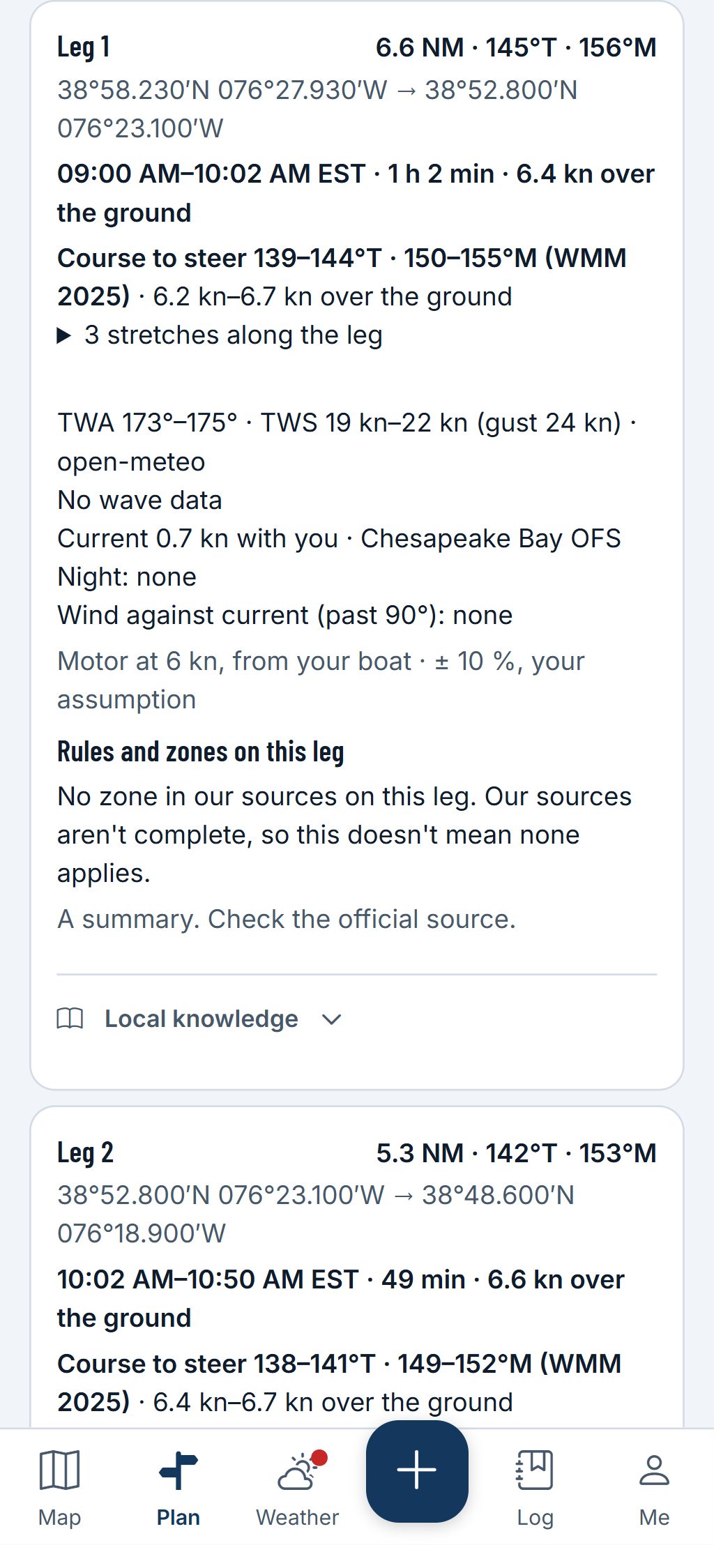
Map data © OpenStreetMap contributors, © OpenMapTiles; terrain: Copernicus WorldDEM-30 (credits)
Each leg
A card for every leg
Each leg’s card gives its distance and bearings, its times and speed over the ground, and what it meets on the way, with the source of every figure.
- A course to steer that allows for the current and your leeway, in true and magnetic, with the magnetic model named.
- The wind angle and speed from the forecast model, and the current from the model or station that gives it.
- The rules and zones we know on the leg. It’s a summary: check the official source. Where our sources have none, it says they aren’t complete.
A planning aid, not for navigation. Carry official charts and Notices to Mariners, and check each fact against its source.
Questions
Still have a question? Read the HuntGrid Sailing help pages or email support@huntgrid.net.
Will it tell me when to leave?
No. It shows the figures for the times you choose, each with its source. The departure planner puts several departure times side by side, and you pick.
Can I bring my route from another app?
Yes. Import a route as GPX, and export your passage as GPX for your chartplotter.
Is it free?
Yes. Everything on this page is in the free plan, with no credit card. HuntGrid Sailing is in open beta, and there are no ads.
Plan your next passage on the map
Create a free account and open HuntGrid Sailing in your browser. The same account works for every HuntGrid app.
Already have an account? Sign in