 HuntGrid
Tides and currents
Tides and currents, each with its station and datum
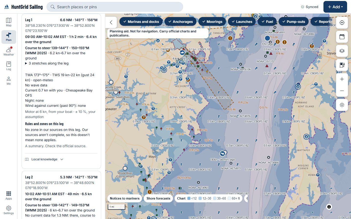
Every height says where it comes from and which datum it’s on: “NOAA prediction · station · MLLW”, or “Model estimate · FES2022 · MSL”. Current arrows name their model and run, and NOAA current stations are labelled apart. Heights on two different datums are never added together.
Map data © OpenStreetMap contributors, © OpenMapTiles; terrain: Copernicus WorldDEM-30 (credits)
Where each figure comes from
A place no source covers says “no data”, never zero.
NOAA tide predictions
Harmonic and subordinate stations, a subordinate one named with its reference station, on MLLW. Where NOAA observes, the observed level and how far it is from the prediction.
In Canada: model estimates
Canadian tide heights are FES2022 model estimates on mean sea level, labelled as such. They are not the Canadian Hydrographic Service’s tide tables, which we link for you to check.
The St. Lawrence and storm surge
On the St. Lawrence, Environment Canada’s river level model with its run, and “datum not stated by the source”. Its storm surge shows as its own fact, never added to a tide on another datum.
Great Lakes levels
Today’s lake level above Low Water Datum, the datum Great Lakes charts use, from the nearest NOAA station on the same lake, with its distance and the time read.
Current stations and model currents
NOAA current stations with flood, ebb and slack times; between them, arrows from the finest model that covers the place, then coarser ones, eased together at their edges, with none drawn next to land.
HF radar, now
Surface currents measured by shore radar on US coasts, with the hour measured and the network credited. Measured only: never blended into a forecast or carried forward.
Map data © OpenStreetMap contributors, © OpenMapTiles; terrain: Copernicus WorldDEM-30 (credits)
In the passage planner
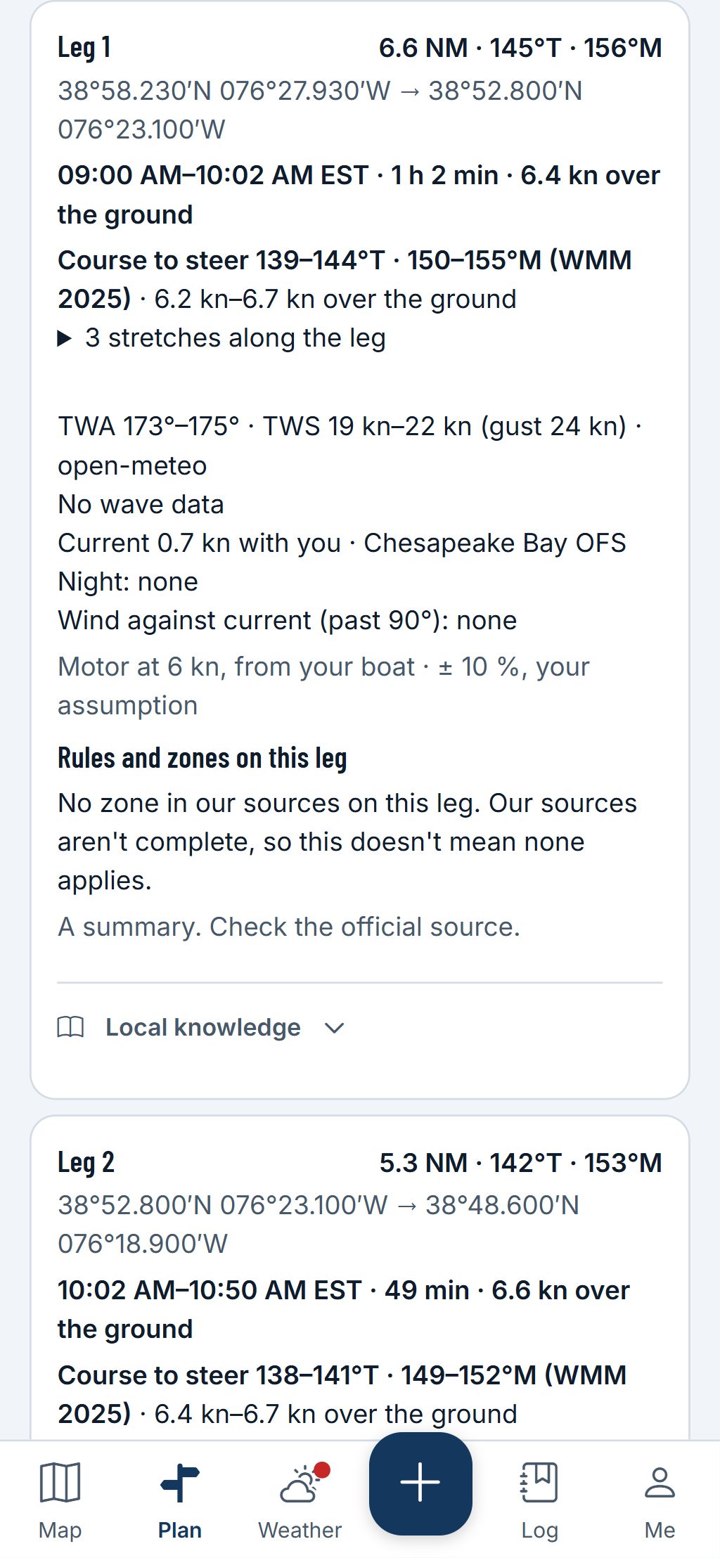
Each leg’s tide and current, at your times
Each leg gives the current it meets at the times you pass, with the model or station named, and the predicted tide beside the charted depth below its chart datum and your draft.
- Tide and depth are added only when both are on the same chart datum; otherwise they show side by side.
- A leg with no current data says “currents not included”.
A planning aid, not for navigation. Carry official charts and Notices to Mariners, and check each fact against its source.
Questions
Still have a question? Read the HuntGrid Sailing help pages or email support@huntgrid.net.
Are these Canadian tide tables?
No. In Canada the heights are FES2022 model estimates, labelled as such, not the Canadian Hydrographic Service’s tables. Check the official tables before you rely on a height.
Can I print a tide table?
For US waters, our free tide tables by state list NOAA’s predicted highs and lows for each station, with its datum.
Is it free?
Yes. Everything on this page is in the free plan, with no credit card. HuntGrid Sailing is in open beta, and there are no ads.
Plan your next passage on the map
Create a free account and open HuntGrid Sailing in your browser. The same account works for every HuntGrid app.
Already have an account? Sign in