 HuntGrid
Six HuntGrid apps · United States & Canada
Lidar terrain in the HuntGrid apps
Zoom in anywhere the United States or Canada has flown lidar and the map’s shading, contour lines, slope colours and elevation readouts come from it: laser surveys that see the ground under the trees. It’s in every HuntGrid app with a land map (all but Sailing), in offline areas, and on the free plan.
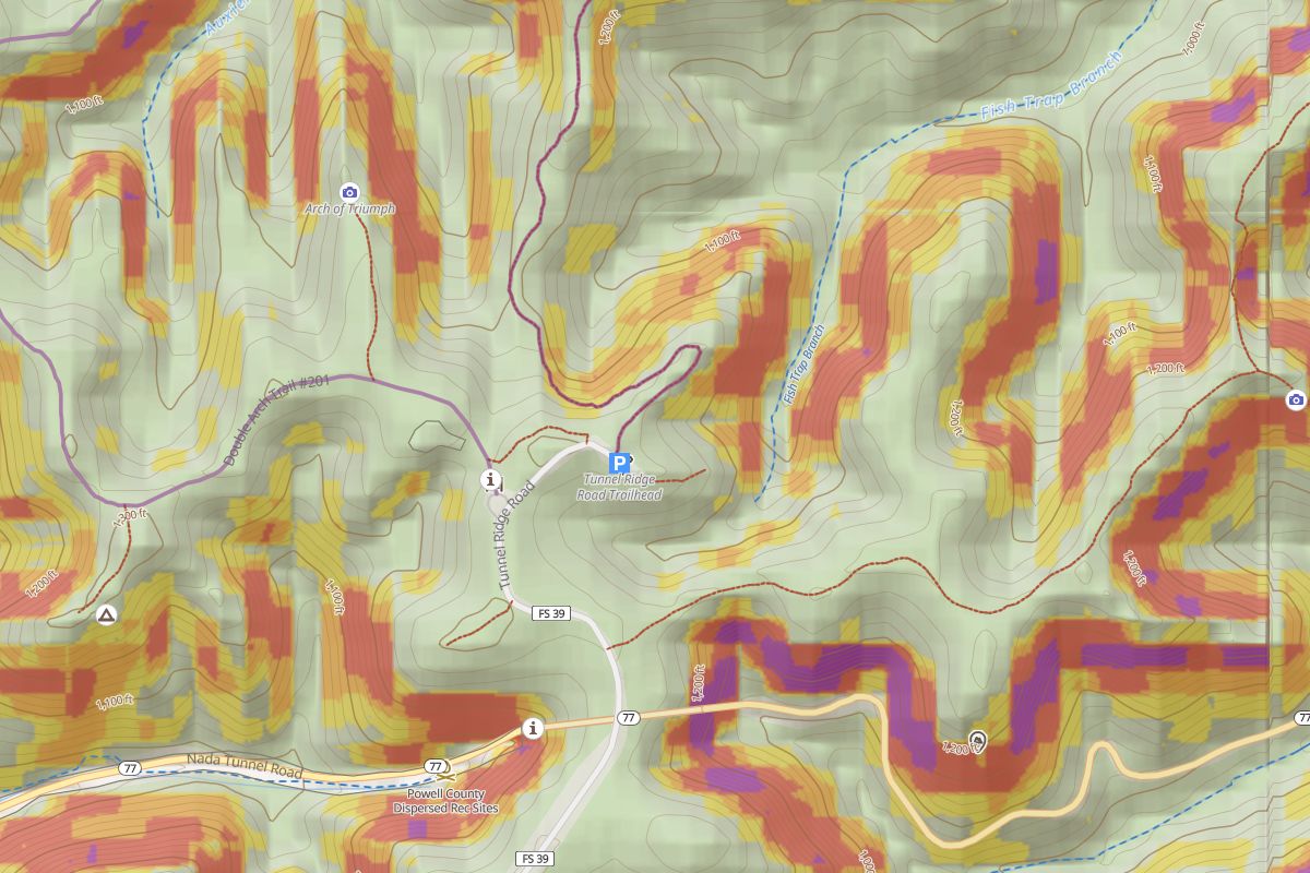 30 m terrain
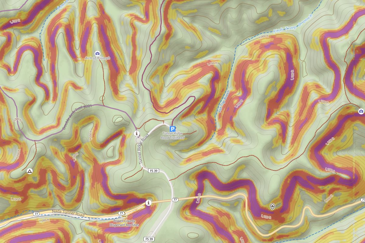 Lidar
What lidar changes on the map
Lidar (light detection and ranging) is a laser survey flown from an aircraft. Agencies turn it into bare-earth elevation models, with the trees and buildings taken out. HuntGrid draws its terrain from those models when you zoom in.
Sharper shading
Hillshade shows the small stuff: side draws, benches, cut banks, old roads and ditches that the 30 m world terrain blurs together.
Contour lines that fit
Contour lines are traced from the lidar too, so they follow each small valley and spur instead of cutting across them.
Slope shading
The slope-angle colours (25–30°, 30–35°, 35–45° and steeper) are worked out on your phone from the same detailed terrain.
Elevation readouts
The elevation the map shows for a spot you pick and for your pins comes from the lidar where there is some.
In your offline areas
Offline areas you download include the lidar tiles for the area, so the detail is there with no signal.
In six apps, free
HuntGrid Hunt, Fishing, Offroad, Backcountry, Climbing and Rockhounding all read the same terrain (Sailing’s chart keeps the land plain). It isn’t a paid add-on.
9 tools built on the detail
Where there is lidar, the apps read more from it than the shading.
Lidar detail here
The Terrain section of the Layers panel says whether the map under you has lidar detail or the standard 30 m terrain.
The 3D view
The 3D view reads the lidar too, on phones as well as computers.
Relief detail
A layer that brings out old roads, ditches, berms and other small bumps and hollows, worked out on your device.
Terrain shapes
A layer that marks ridges, benches, draws and valleys with published thresholds (Weiss 2001).
Hunt: ground facts on a tap
Tap the map for the ground’s elevation and slope, labelled lidar or standard 30 m, with its shape where there is lidar.
Climbing: steep rock
A Steep rock layer shades ground of 60° and steeper, from zoom 12.
Fishing: bank slope
Shore access sheets show how steep the bank is at the access point, from lidar only.
Backcountry: flat ground nearby
What’s here? says whether there’s flat ground nearby, for reference only and never as a campsite rating.
Offroad: grades on a planned route
A planned route’s summary gives its steepest grade and side slope, a reading of the ground and not a rating of the trail.
Canopy height, modelled. Two more layers show how tall the trees are and where the openings and edges are. They come from a modelled canopy map (Meta and WRI, imagery mostly 2014–2020), not from lidar, and say so in their legend.
Same spot, two terrains
Each pair is the same view of the live app. One is drawn with lidar; the other with the lidar turned off, which is what the map shows where no lidar has been flown.
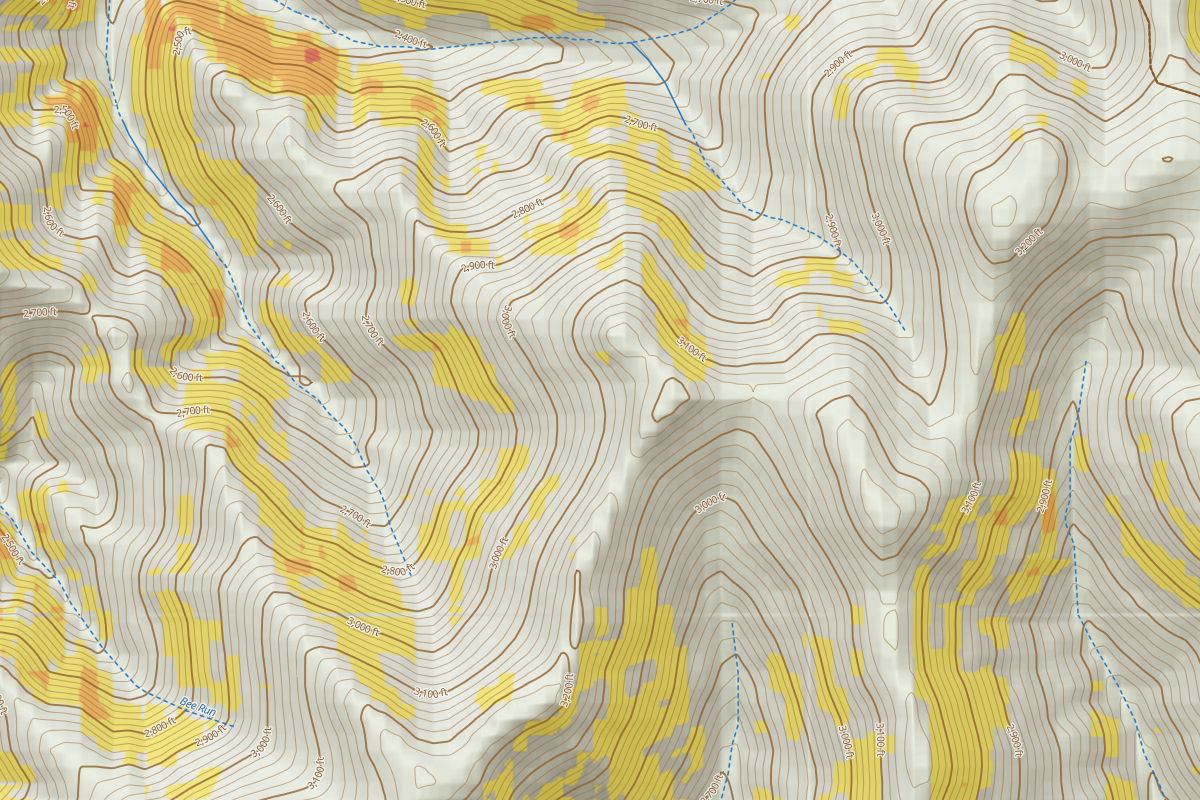 30 m terrain
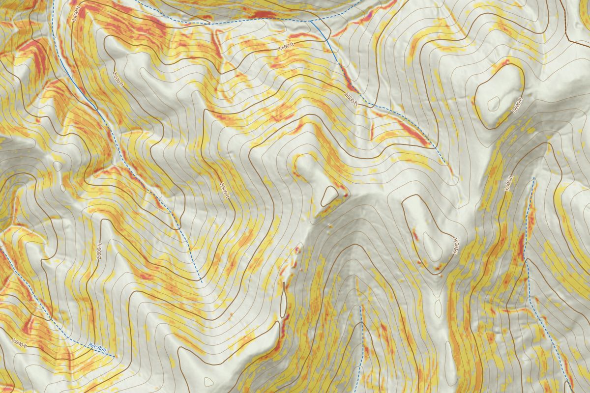 Lidar
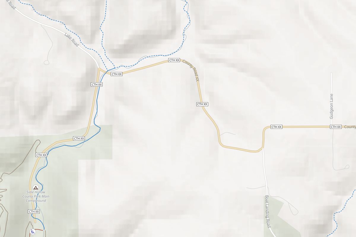 30 m terrain
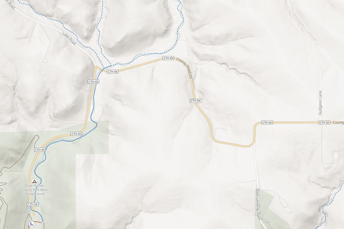 Lidar
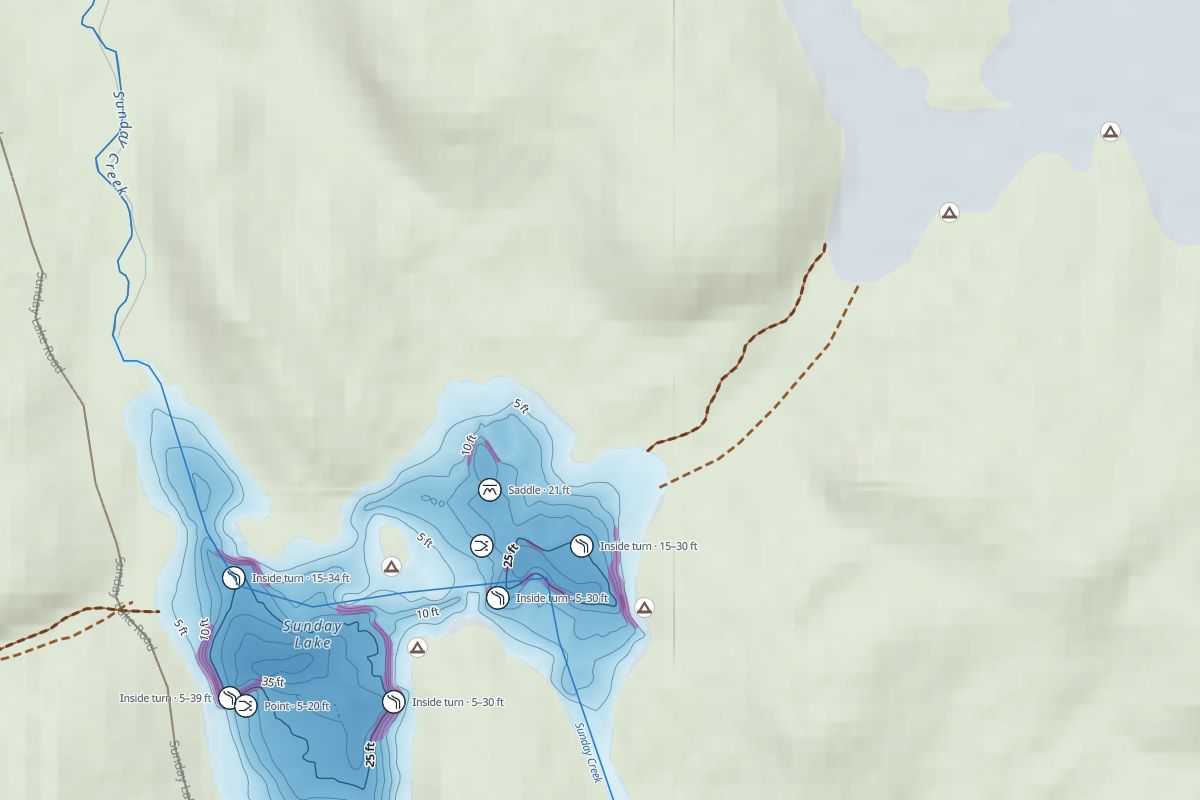 30 m terrain
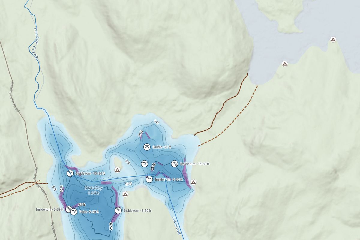 Lidar
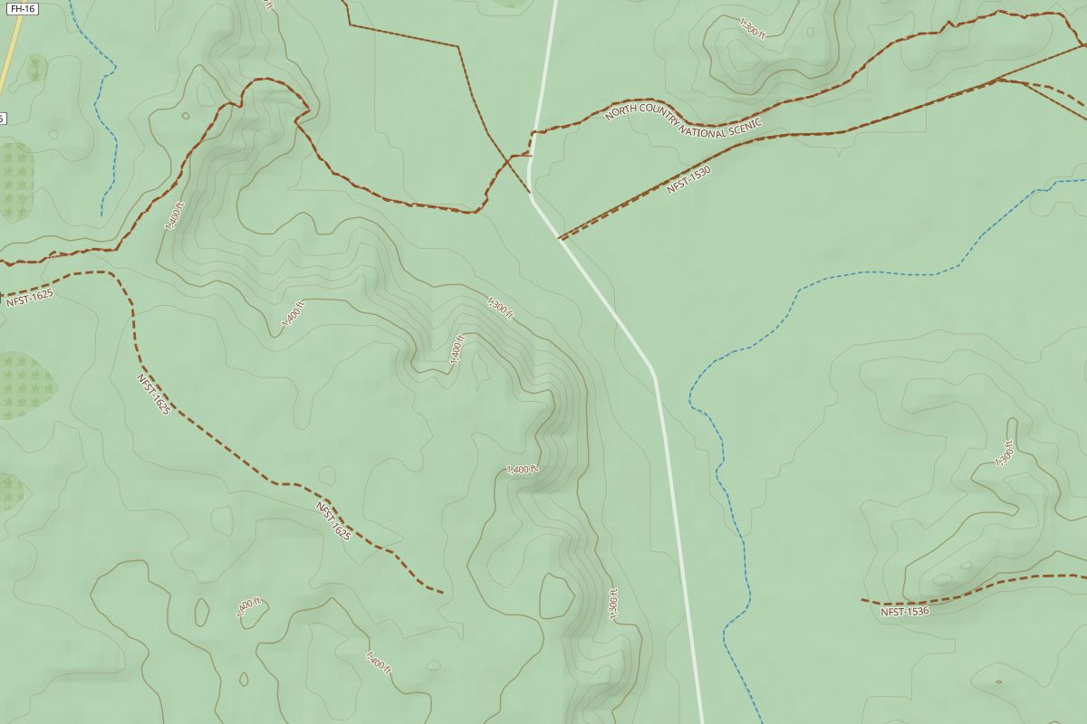 30 m terrain
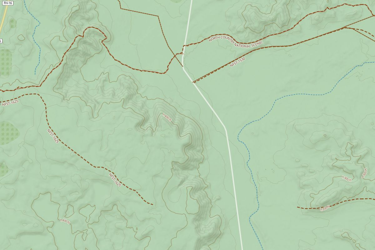 Lidar
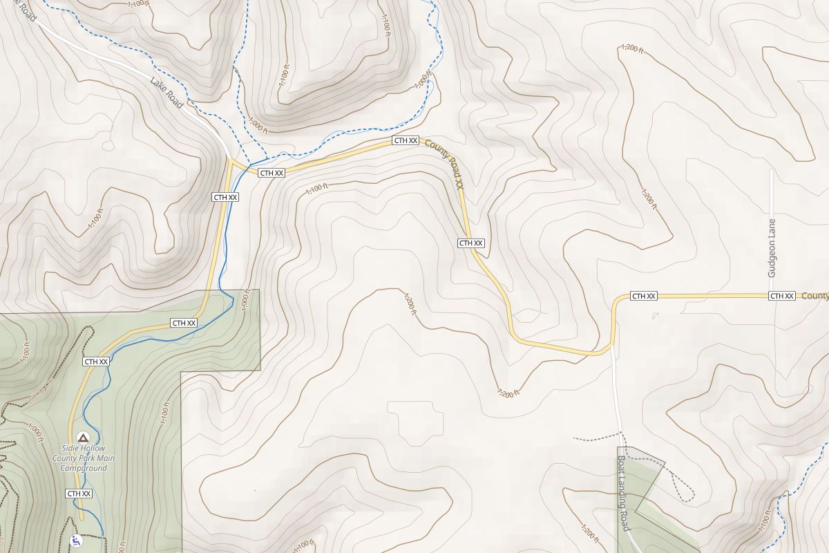 30 m terrain
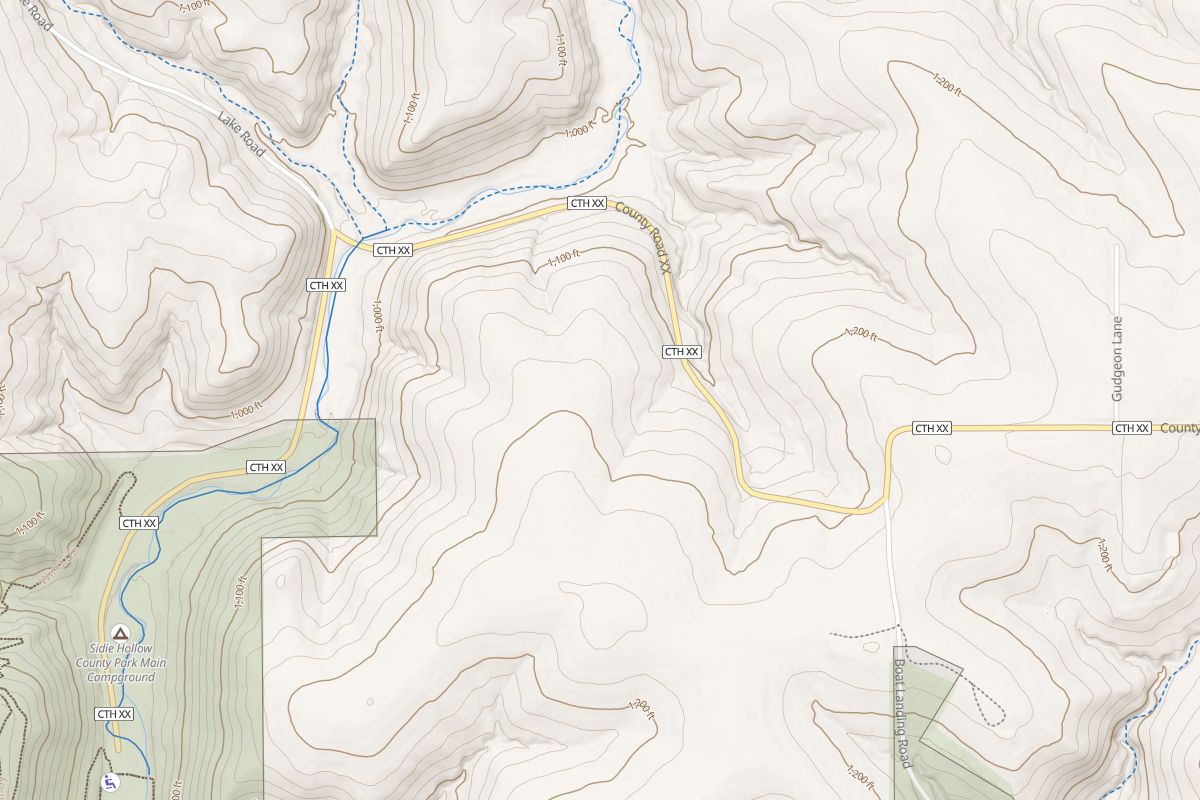 Lidar
Where there’s lidar
- United States
- The USGS 3D Elevation Program (3DEP): 1-metre lidar elevation models where they’ve been flown, and 3DEP’s 10-metre model elsewhere. Public domain.
- Canada
- Natural Resources Canada’s High Resolution Digital Elevation Model (HRDEM) wherever it’s been flown, under the Open Government Licence – Canada. The far north isn’t covered yet.
- Everywhere else
- The 30 m Copernicus world terrain, as before. Places without lidar look exactly the way they did.
The lidar is packaged by Mapterhorn from those public sources. HuntGrid shows it at map zoom 14, which still shows old roads, skid trails and ditches; closer in, the map stretches those tiles.
What stays on the 30 m terrain, on purpose
A few tools use the coarser terrain because they work at a bigger scale, and detail would mislead them:
- HuntGrid Hunt’s thermals hint, which reads the drainage, not each ditch.
- HuntGrid Offroad’s avalanche-terrain prompt: at lidar detail, a road cut looks like a 30° slope.
- HuntGrid Climbing’s horizon for the sun on a wall, which works at the scale of the valley.
- HuntGrid Fishing’s 3D lake view, so the land still meets the lake bed.
Good to know
Lidar models are made at different times by different agencies, so new roads, cuts and slides may not be in them, and some areas were flown years ago. Use the map with what you see on the ground. It’s a planning aid, not a survey.
See it in your app
Open any HuntGrid app, zoom in on a hill near you and look at the shading and the contour lines.
Questions
Still have a question? Read the help pages or email support@huntgrid.net.
Is the lidar free?
Yes. It’s part of the map in every HuntGrid app on the free plan, with no add-on to buy.
Which apps have lidar?
HuntGrid Hunt, Fishing, Offroad, Backcountry, Climbing and Rockhounding read the same terrain, so the detail is the same whichever of them you open. HuntGrid Sailing’s chart draws no land relief.
Does the lidar work offline?
Yes. Offline areas you download include the lidar tiles for the area where there are some, so the shading, contour lines and elevation keep their detail with no signal.
Where is there lidar?
In the United States, wherever the USGS 3D Elevation Program has 1-metre lidar models, with its 10-metre model elsewhere. In Canada, wherever Natural Resources Canada’s HRDEM has been flown; the far north isn’t covered yet. Elsewhere the map uses the 30 m world terrain.
Can I turn the lidar off?
There’s no switch: the app reads lidar automatically when you zoom in where there is some, and the 30 m terrain everywhere else.
Your next hunt starts on the map
Create a free account, download your area and head out. No credit card, no per-state fees.
Already have an account? Sign in