 HuntGrid
Spring and fall turkey
The turkey hunting app for roosts, ridges and first light
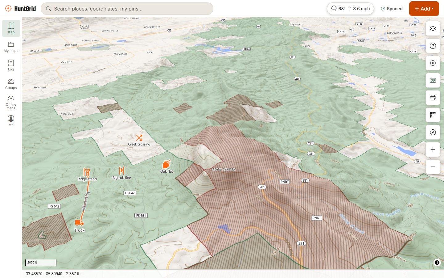
Roost them at dusk, be set up before first light, and know the ground between you and the bird. HuntGrid keeps your roosts, strut zones and setups on one map with sunrise times and the terrain, on your phone with no signal.
Map data © OpenStreetMap contributors, © OpenMapTiles; terrain: Copernicus WorldDEM-30 (credits)
How turkey hunters use HuntGrid
From the roost to the setup
A good morning starts the evening before. Put what you hear and see on the map, then plan an approach that the bird never notices.
Roosts and strut zones
Mark roosts, strut zones and dust bowls with their own icons, plus fields, food plots, water and your ground blinds.
Plot a gobble
Heard a gobble at dawn? Draw a bearing line from where you stand toward the sound. A second line from another spot crosses near the bird.
Ridges, benches and obstacles
Contours, hillshade and 3D terrain show the ridges birds roost on, the benches and open woods where they strut, and the creeks and fences that can hang a gobbler up.
Sunrise and legal light
Sunrise, sunset, twilight and moon times for any place. Where HuntGrid has your jurisdiction's checked shooting-hours rule, it counts down to it, in Hunt Mode too.
Public land and permission
Public land across the US, Crown land across most of Canada and some state access programs, each with its source and date, plus parcel lines to know whose land you are next to.
Map data © OpenStreetMap contributors, © OpenMapTiles; terrain: Copernicus WorldDEM-30 (credits)
Safety first
Habits that keep every turkey hunter safe
Turkey hunters wear full camouflage and sound like the bird, so good habits matter more than in most hunts.
- Sit against a tree wider than your shoulders, where you can see well in front of you.
- Never stalk a gobble: it may be another hunter calling.
- Identify the bird completely before you shoot, and avoid red, white, blue and black in your clothing.
- Check your state or province's blaze orange rules for turkey hunting: they vary.
- Share your setup with your group, and check in when you head back.
Your first turkey hunt with HuntGrid
Find the ground
Turn on the land layers and look for public land or access programs with a mix of mature timber and openings. On private land, ask first.
Scout from the map
Use satellite imagery and terrain to find fields and openings next to timbered ridges, and pin listening spots on high ground.
Roost a bird
Listen at dusk. Draw bearing lines toward the gobbles and mark the roost, then plan a setup that keeps a ridge or cover between you and the tree.
Download and set up early
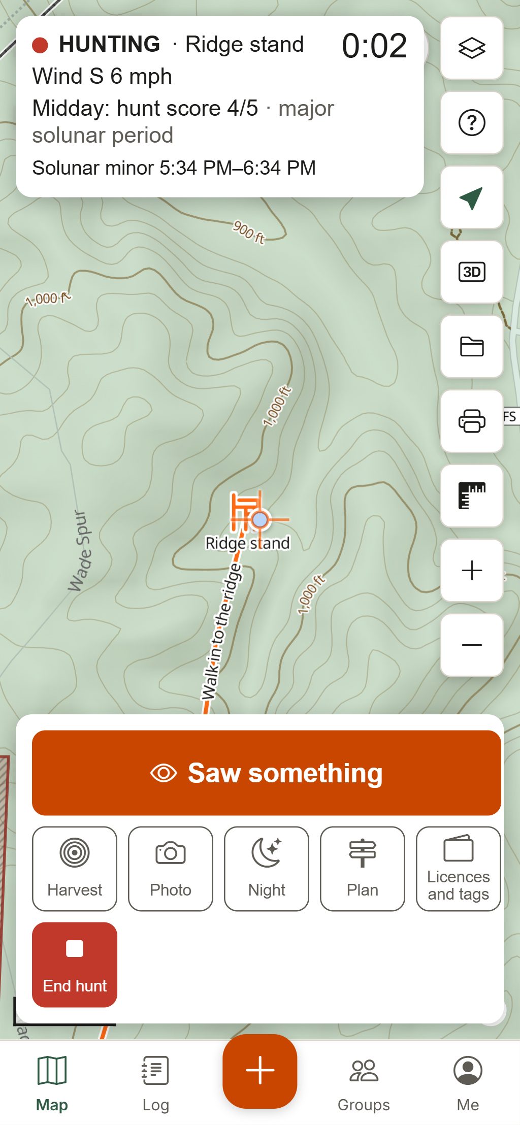
Download the area, then use Go to on your setup waypoint in the dark. The red night screen keeps your eyes adjusted.
Hunt and log
Start a hunt for Hunt Mode, log the birds you see in three taps, and keep a photo of your tag in the licence wallet.
Seasons, bag limits, shooting hours, calling and decoy rules vary by state, province and zone. The official regulations always have the final word.
Questions
Still have a question? Read the help pages or email support@huntgrid.net.
What is the best app for turkey hunting?
The one that fits your hunt. HuntGrid gives turkey hunters roost and strut zone icons, bearing lines to plot a gobble, 3D terrain, public land, and sunrise and twilight times for the exact spot, on a map that works offline. Every feature is in the free plan.
Does HuntGrid show legal shooting hours for turkey?
HuntGrid computes sunrise, sunset and twilight for the exact place, and counts down to legal light where it has a checked rule for your jurisdiction and season. Turkey shooting hours often differ from other seasons and vary by state and province, so confirm them in the official regulations.
How do I mark a turkey roost on the map?
Add a waypoint and choose the Roost icon, or use Strut zone and Dust bowl for daytime spots. If you only heard the bird, draw a bearing line from where you stood toward the gobble; a second line from another spot crosses near the roost.
Can I find public land for turkey hunting?
Yes. HuntGrid shows public land across the US and Crown land across most of Canada with its source and date, plus some state access programs such as Michigan's HAP and Missouri's MRAP. For private land, parcel lines and, in many US states, the owner's name help you ask for permission.
When does spring turkey season open?
It depends on your state or province, and often on the zone. HuntGrid's season calendar shows openers and closers for your favourite species once a person has checked them against the official regulations. Until then, go by your wildlife agency's regulations.
Your next hunt starts on the map
Create a free account, download your area and head out. No credit card, no per-state fees.
Already have an account? Sign in