 HuntGrid
Backcountry guide · 5 min read
Planning a canoe-camping trip in Quebec
The Sépaq’s and Parks Canada’s portages and trails on one map with their source, a page for each park, portage times from your own carries, the wind on big lakes and a trip plan, ready before you load the canoe.
On this page
A canoe-camping trip in Quebec is planned with a map: the lakes, the portages between them, each night’s campsite and the wind on open water. This guide follows that planning in HuntGrid Backcountry, the free trip planner, and says where each piece of data comes from. Official park maps, rules and posted signs control.
What the map shows in Quebec
- The Sépaq’s portages and trails, in Quebec’s national parks and in wildlife reserves such as La Vérendrye and Mastigouche, from its open data on Données Québec. That data has no canoe-camping campsites: the ones on the map come from OpenStreetMap.
- In La Mauricie National Park, Parks Canada’s trails and backcountry campsites.
- CanVec trails from Natural Resources Canada, across Quebec.
- OpenStreetMap’s portages and canoe routes, kept apart from official data and labelled as such.
Every portage, trail and campsite names its source and date, and the ones from an unverified source say so. Some official data is several years old: check the date on the card before counting on a portage.
The coverage map shows, park by park, whether its portages and campsites come from an official source, mostly from OpenStreetMap, or only from OpenStreetMap.
The park pages
Each park has its page on backcountry.huntgrid.net: the kilometres of trails, the portages and the campsites counted in official sources and in OpenStreetMap, side by side, with their date, the sources and a link to the park’s official page. For canoe camping in Quebec:
- Mont-Tremblant National Park (Sépaq)
- Jacques-Cartier National Park (Sépaq)
- Opémican National Park (Sépaq)
- La Mauricie National Park (Parks Canada)
Draw the route, portage by portage
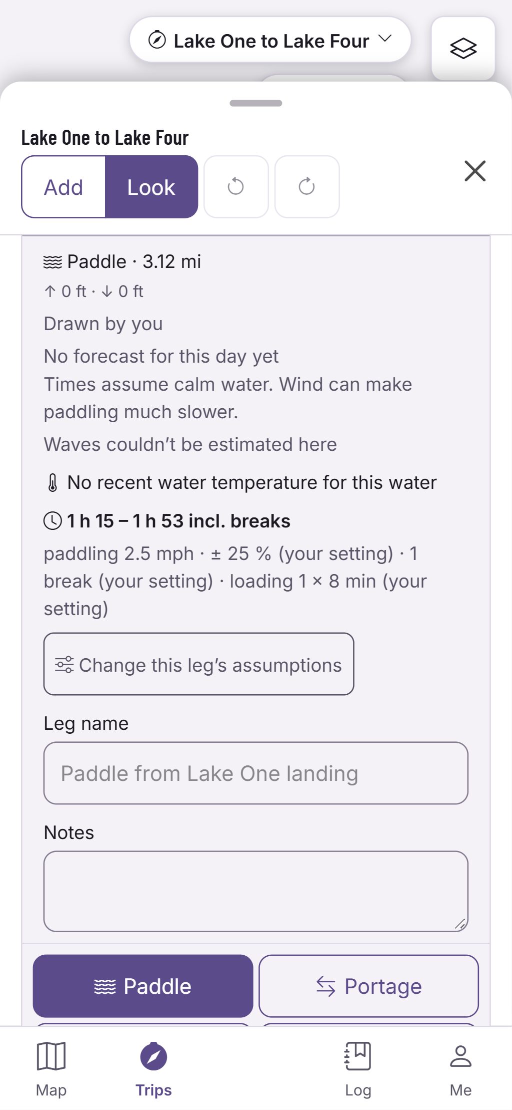
Draw the trip on the map as paddle and portage legs, from the put-in to the take-out. Tap both ends of a mapped portage and the leg follows its trail, with its length. Each leg gets a time range rather than a single time: its distance, its climb, the current and the forecast wind, and for a portage, how many trips you make with the canoe and packs, plus loading at each end. The assumptions are listed, and you can change them.
Planning portages explains portage times in detail.
Wind on big lakes
On big lakes and reservoirs, the wind often decides the day. For each open-water leg, the app shows the forecast wind with its source and time. Set your own wind limit: each day then lists the hours that keep every crossing under it, and a day with no such hours says so. It is the forecast and your limit side by side, never a go-ahead. Planning around wind on big lakes.
The park’s rules
Along the route, the app shows the card of each park you cross. A rules card is our summary, not the law; a park with no verified card points to its official page. Official park rules, maps and posted signs control. The app makes no bookings: you can note your reservation number at each camp.
Leave a trip plan
Leave a trip plan with someone you trust: the route, the party and when you expect to be back. Check in from the trip to move the time; if you’re overdue, your contact gets an email. The plan complements, never replaces, a satellite messenger or personal locator beacon. Leaving a trip plan.
Take the map offline
Expect no cell signal on the water. Before you go, download the trip: the map along every day, the cards and the itinerary stay on the phone. On the water, Trip Mode shows the day, the time left to camp, the daylight left and the nearest way out.
Questions
Still have a question? Read the HuntGrid Backcountry help pages or email support@huntgrid.net.
Are the Sépaq’s canoe-camping campsites on the map?
The ones you see come from OpenStreetMap and are labelled so: the Sépaq’s open data holds its trails and portages, not its campsites. Check the park’s official map for your site.
Can I book a campsite in HuntGrid Backcountry?
No. The app makes no bookings. Book with the park, then note your reservation number at the camp in your trip.
Does the trip plan replace a satellite messenger?
No. Your contact gets an email if you’re overdue, but nobody can track you or send help from it. The plan complements, never replaces, a satellite messenger or personal locator beacon.
Your next trip starts on the map
Create a free account and open HuntGrid Backcountry in your browser. The same account works for every HuntGrid app.
Already have an account? Sign in