 HuntGrid
Trip planner
Plan a trip leg by leg, with an honest time for each
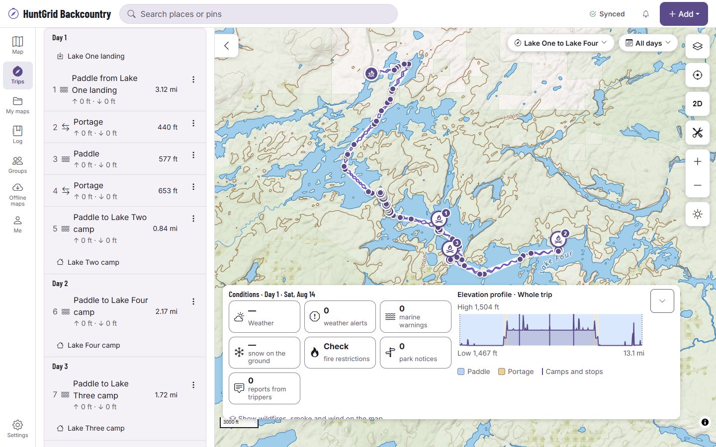
Tap the map to draw your trip as paddle, portage and hike legs. Each leg gets a time range worked out from its distance, climb, carries, current and the forecast wind, and the card says which assumptions it used, so you can change them.
Map data © OpenStreetMap contributors, © OpenMapTiles; terrain: Copernicus WorldDEM-30 (credits)
Draw the trip you’ll actually do
One trip can mix every way of travelling. The planner keeps each leg’s mode, its line and where its facts come from.
Paddle, portage, hike and more
Pick a mode, or let the planner tell water from land as you tap. River legs follow the river’s line, and a shuttle, drive or floatplane leg takes the time you give it.
Snap to portages and trails
A leg can follow a mapped portage, trail or access point. Each one names its source and date, and OpenStreetMap features are labelled apart from official ones.
Camps and stops
Mark camps, put-ins and take-outs, water, bail-outs, resupplies and parking on the route.
Climb and profile
Each leg and each day has its climb, its descent and an elevation profile.
Checks on the line
A paddle leg that crosses land or a hike that crosses water is flagged, and mapped hazards near a paddle or portage leg show on its card.
Bring a route in
Import a GPX or KML file and turn its lines into legs you can edit.
Each leg’s time
A range, and why
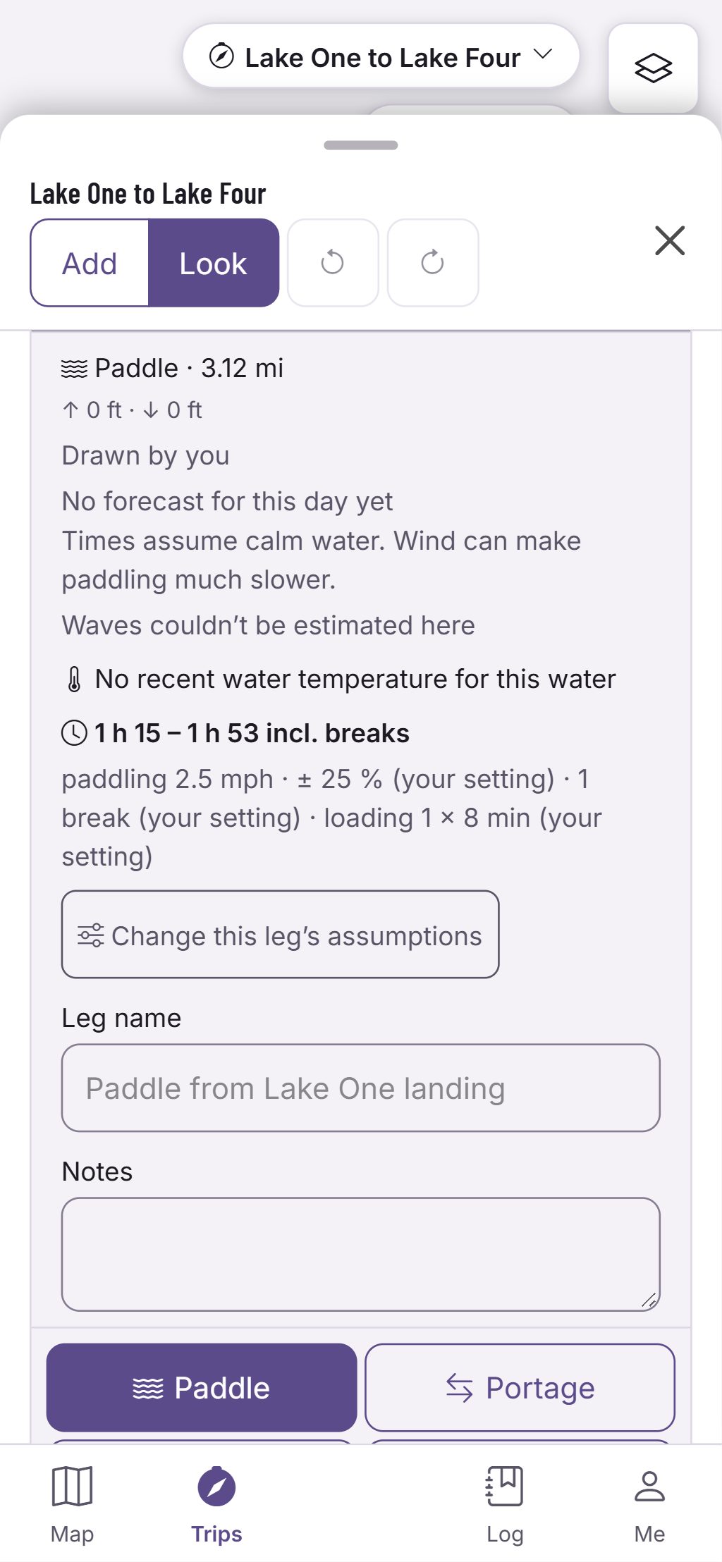
A leg’s card gives its time as a range with the likely time in it, then a line that says what went into it.
- Hiking from published walking-speed models, by the slope, the surface and your load.
- Portages walked once per pass: single, double or triple carry.
- Paddling by your boat and pace, with river current from a nearby gauge and the forecast wind on the leg when there is one.
- Breaks are counted, and every value is one you can change for the trip or for a single leg.
Estimates for planning, not promises. Official park maps, rules and signs control.
Questions
Still have a question? Read the HuntGrid Backcountry help pages or email support@huntgrid.net.
Is a time a promise?
No: a planning range with its assumptions. Wind, water levels, loads and the party change the real time, so each leg shows the pace, the carries and the breaks it assumed.
Can I use my own pace?
Yes. Set relaxed, steady or strong for each way of travelling, your boat and your carry style, for every trip or for this one.
Is it free?
Yes. Everything on this page is in the free plan, with no credit card. HuntGrid Backcountry is in open beta, and there are no ads.
Your next trip starts on the map
Create a free account and open HuntGrid Backcountry in your browser. The same account works for every HuntGrid app.
Already have an account? Sign in