 HuntGrid
Backcountry guide · 6 min read
Planning a long remote canoe trip
Two or three weeks on lakes far from roads: the route, the days that hinge on the wind, the food and the weight it adds, the fishing rules and the trip plan, worked out before you go and kept on your phone.
On this page
A long canoe trip on remote lakes is planned twice: once at home, and again every morning on the water. This guide follows one such trip through HuntGrid Backcountry, from the first line on the map to the recap at home, and names the part of the app each step uses. The paces, limits and amounts are yours: the app keeps them as your settings and shows them beside every estimate.
Draw the route across the lakes and portages
Start a trip, then draw it on the map as paddle, portage and hike legs, from the put-in to the take-out. Mark the camps, the water stops, the bail-outs and any resupply as stops along the way. Each leg gets a time range rather than a single time, worked out from its distance, its climb, how many times you carry each portage, the current and the forecast wind, with the assumptions listed so you can change them.
Every portage, trail and campsite on the map names its source and date, and the ones from an unverified source say so. Official park maps, rules and posted signs control.
Split the days and keep spare ones
Split the route into days with a camp each night and a plan B camp. Each day card shows its hours on the move, sunrise and sunset, and the daylight left after the last leg. Add spare days to the trip for wind or weather: when a day goes wrong, use one from the day’s card and the rest of the plan moves with it.
Plan around the wind on big lakes
Wind builds waves on open water. On the Beaufort scale, a moderate breeze of 11 to 16 knots raises small waves that grow longer, with whitecaps fairly often.[1] How much wind you will paddle in is your call, not the app’s.
Set your own wind limit on open water in the trip’s day checks. With a forecast, each day card then lists the hours that keep every open-water leg under your limit. A day with no such hours says so and shows the spare days you have left. It is the forecast and your limit side by side, never a go or no-go.
Food and fuel, day by day
Plan the food by day and meal, with its weight and energy. Save a day’s breakfast or dinner as a meal and add it to the other days from your saved meals. Stove fuel comes from your own amount per hot meal, so it follows the menu.
When the plan is ready, make a food packing list: it adds the plan up by food, ready to tick off as you pack.
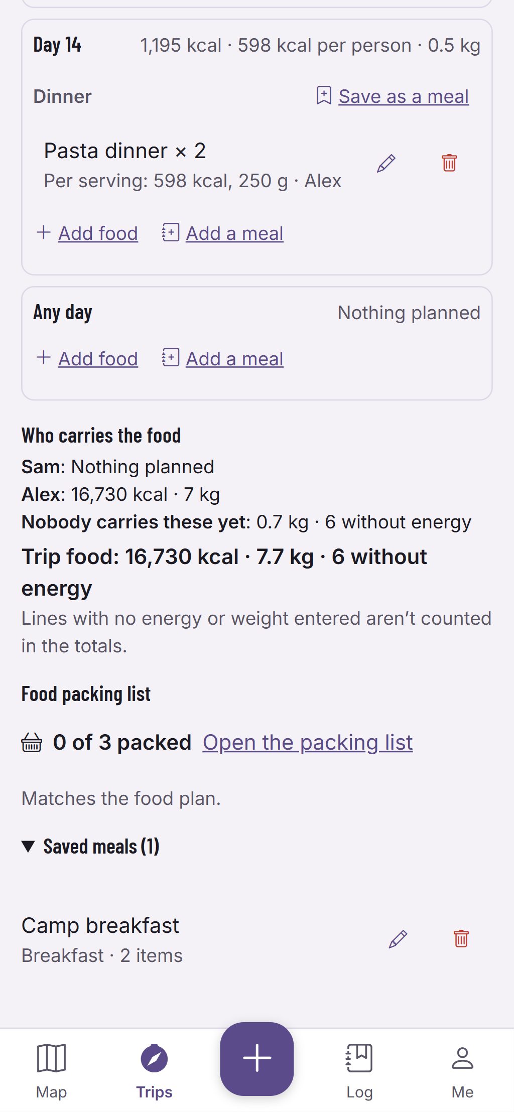
Weight that falls as the food is eaten
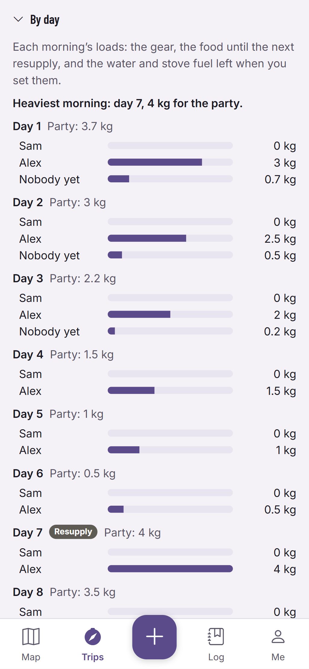
Give each food line and piece of gear to the person who carries it. The weights panel shows each load morning by morning: it falls as the food is eaten and rises again where a resupply stop adds food. The heaviest morning is named, so you can see before you go which morning carries the most.
Fishing licences and rules for the trip’s lakes
Fish are a bonus at camp, never a meal the plan counts on. For the lakes along the route, the trip shows HuntGrid Fishing’s species and its summary of the rules on the dates of the trip, and whether a licence in your wallet covers those dates. It is a summary: check the official regulations for each lake before you go. On the trip, log a catch in Trip Mode: it shows on its day in the recap.
Leave a trip plan
Leave a trip plan with someone you trust: the route, the party and when you expect to be back. Check in from the trip to move your time back, and your contact is alerted if you’re overdue. It is a backup, not a rescue service: carry a satellite messenger or a personal locator beacon too.
Take the trip offline
Before you lose signal, download the trip. The map along every day, the cards, the last conditions and the itinerary are kept on the phone, and the trip says when it is ready offline. On the water, Trip Mode shows the day, the distance and time left to camp, the daylight left and the nearest way out.
The recap
Back home, the trip recap puts the plan beside what you did: the recorded track, your notes, photos and catches day by day, and your pace against the estimates, which helps plan the next trip. Make an image of the trip to share, with as much of the route as you choose to show.
More about HuntGrid Backcountry.
Sources
The facts and figures above come from these official pages, read on November 10, 2026. The words and drawings are ours.
Questions
Still have a question? Read the HuntGrid Backcountry help pages or email support@huntgrid.net.
Does HuntGrid Backcountry tell me when it’s calm enough to cross?
No. It shows the forecast wind on each open-water leg beside the limit you set yourself, and the hours that keep every leg under it. Whether to go is your decision.
Does the trip plan replace a satellite messenger?
No. Your contact is alerted if you’re overdue, but nobody can track you or send help from it. Carry a satellite messenger or a personal locator beacon.
Does the plan count on the fish we catch?
No. Fish are shown as a bonus at camp: the food plan, its weight and the packing list never count on them.
Your next trip starts on the map
Create a free account and open HuntGrid Backcountry in your browser. The same account works for every HuntGrid app.
Already have an account? Sign in