 HuntGrid
Offline
Trip packs and Trip Mode, with no signal
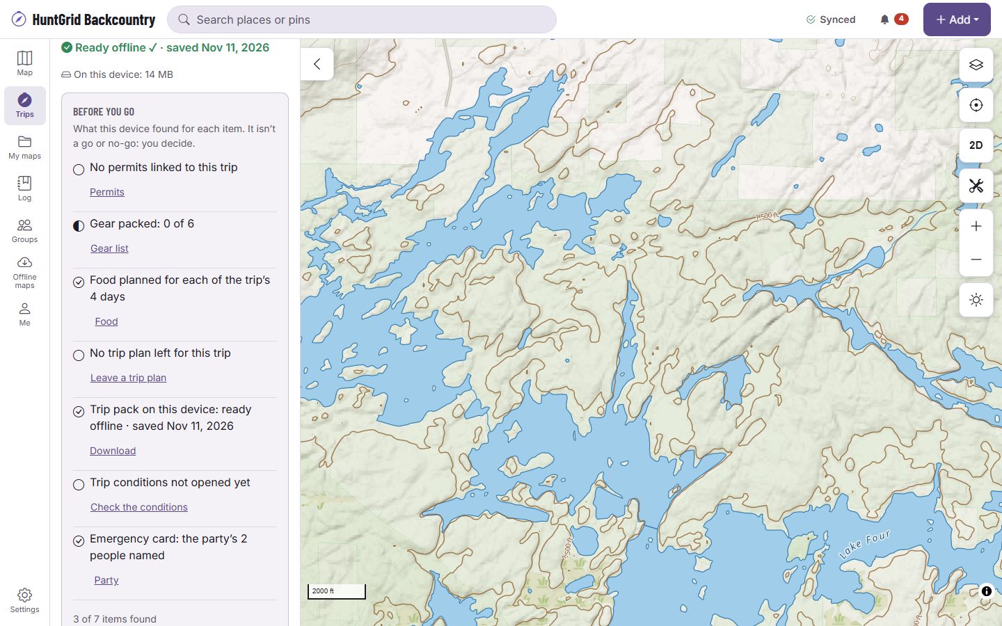
Download the trip before you go. Its pack holds the map along each day’s legs and around its camps, water and exits, the feature and park cards, the last conditions and the itinerary. Then a check says “Ready offline” with the date, or exactly what’s missing.
Map data © OpenStreetMap contributors, © OpenMapTiles; terrain: Copernicus WorldDEM-30 (credits)
A pack for the trip you drew
The pack follows your route, not a rectangle around it, so it stays small.
One area per day
Each leg is covered to the width you pick for its mode, with a circle around each camp, water stop and exit. The size is shown before anything downloads.
Ready offline, or what’s missing
After the download, every leg, camp and exit is checked against what’s on the phone. A gap is named, such as a day’s portage that isn’t in the pack, with Download again.
Everything keeps working
With no signal, the map, the leg and day cards, the conditions you last read with their age and the itinerary all open, and what you add syncs back in range.
Updates and cleanup
Move a leg or add a camp after the download and the trip says it’s out of date: Update fetches only the days that changed. After the trip you’re offered Remove, never automatically.
Before you go
A checklist of facts on the trip: permits, the gear list packed, food for every day, the trip plan left, the pack ready, conditions last checked and the emergency card. It never says go or no-go.
Map data © OpenStreetMap contributors, © OpenMapTiles; terrain: Copernicus WorldDEM-30 (credits)
Trip Mode
Big buttons for wet hands and gloves
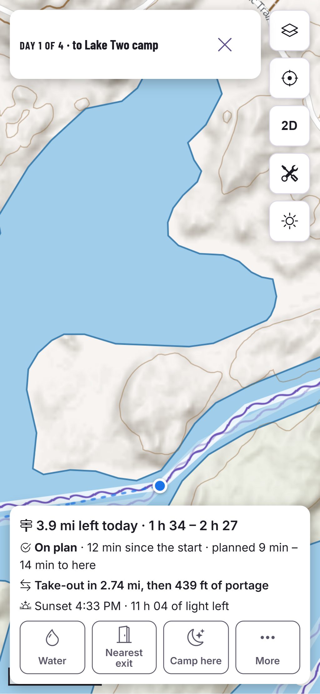
Start the trip and Trip Mode shows the day, your position on the day’s route, the distance left, a time range to camp for what’s left, sunset and the light left.
- On plan, behind or ahead, against the day’s time range, and how far you are off the planned line past the distance you set.
- Cues before each take-out and put-in on a mixed trip, spoken only when you turn voice on.
- Water and Nearest exit from where you are, with their source. Treat all water.
- Camp here re-plans the days left and shows them beside the plan before anything changes.
- The emergency card, with your party, tonight’s planned camp and your trip plan’s contact.
Estimates for planning, not promises. Official park maps, rules and signs control.
Questions
Still have a question? Read the HuntGrid Backcountry help pages or email support@huntgrid.net.
Does it need a signal on the trip?
No, once the trip is downloaded and says Ready offline. Expect no cell signal out there: carry a satellite messenger or beacon.
Do the conditions update offline?
No. The pack keeps the last conditions you read, each with its age, until you’re back in range.
Is it free?
Yes. Everything on this page is in the free plan, with no credit card. HuntGrid Backcountry is in open beta, and there are no ads.
Your next trip starts on the map
Create a free account and open HuntGrid Backcountry in your browser. The same account works for every HuntGrid app.
Already have an account? Sign in