 HuntGrid
Backcountry guide · 5 min read
How long will this hike or paddle take?
No one can tell you exactly how long a day on the trail or the water will take. HuntGrid Backcountry gives each leg a range with the likely time in it, and shows what it assumed so you can make it yours.
On this page
Planning a trip starts with a question that has no exact answer: how long will it take? Pace changes with the ground, the load, the party, the weather and the day. This guide explains how HuntGrid Backcountry estimates a leg’s time, and how to bring the estimate closer to the way you travel.
A range, not a single time
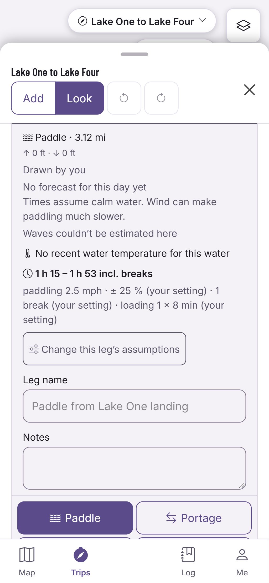
Every leg gets a time range with its likely time inside, and its card says what went into it: the pace, the spread of the range, the breaks and any loading time. Values that come from a published source name it; values that are your own settings say so. The trip and each day add their legs up, so you see a range for the whole day, too.
Hiking: slope, load and surface
Walking time comes from published walking-speed models. The pace slows on steep climbs and steep descents, and is quickest on a gentle downhill, read along the leg’s elevation profile. A full tripping pack walks slower than a day pack. Off-trail ground slows the pace further, and a rough or faint trail, or a line you drew by hand over unknown terrain, widens the range instead of guessing a pace for it.
Paddling: the boat, and the current on rivers
A tandem canoe’s pace on flat water comes from a national park’s published canoe-route times; other boats start from your own setting, since no official speed was found for them. On a river, the current from a nearby gauge adds to your speed going downstream and takes away from it going upstream. With no gauge, the leg is timed as flat water and the card says that the current isn’t known.
Wind is shown, not guessed
No published rule says how much a headwind slows a paddler, so times assume calm water and the card says so. When a forecast covers the leg, its card shows the wind at the hour you’ll be on it. If you know how much the wind slows you, set your own headwind slowdown and the app applies it.
Make the pace yours
Choose relaxed, steady or strong for each way of travelling in your pace profile, and your boat and how you carry portages. Change any value for one trip, or for a single leg. When you already know how long a leg takes, enter it, and that leg uses your time. The pace calculator in the toolbox times a hike, a paddle or a portage on the same model, and the help page “How times are estimated” names every source.
From legs to days
Split the trip into days and each day card adds its legs up into a range of moving time, then puts your arrival beside sunrise, sunset and the end of civil twilight at camp. A day that may end after dark says so. It is a plan for the day, never a promise of the time you’ll reach camp.
Questions
Still have a question? Read the HuntGrid Backcountry help pages or email support@huntgrid.net.
Why a range instead of one time?
Because the real time depends on things no map knows: the wind, the water level, the load and the party. The range shows how wide that uncertainty is, with the likely time inside it.
Can I use my own pace?
Yes. Set relaxed, steady or strong in your pace profile, change any value for a trip or a single leg, or enter the time you already know for a leg.
Does the time include breaks?
Yes, unless you turn them off. The card lists the breaks it counted, and any loading time at a put-in or take-out.
Your next trip starts on the map
Create a free account and open HuntGrid Backcountry in your browser. The same account works for every HuntGrid app.
Already have an account? Sign in