 HuntGrid
Day by day
Day by day: camps, daylight, spare days and ways out
Move the camps and the trip splits into days. Each day card shows its legs, its time range and when you leave, its camp, and the moving time beside the daylight, so a long day shows before you’re out there.
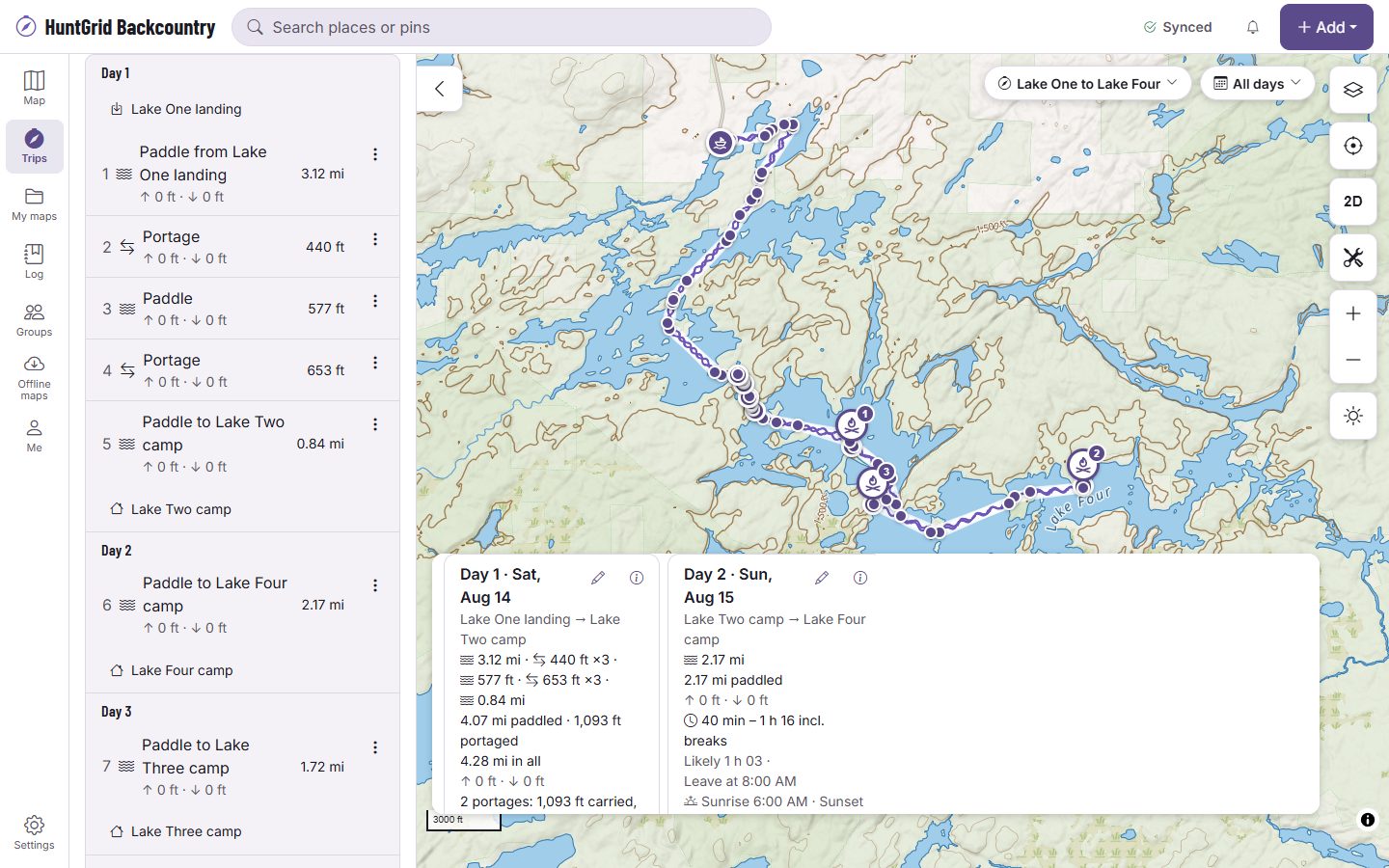
Map data © OpenStreetMap contributors, © OpenMapTiles; terrain: Copernicus WorldDEM-30 (credits)
Everything a day needs, on one card
Time and daylight
The day’s moving time as a range, sunrise and sunset at the day’s place, and the daylight left after the last leg. Set your own margin or longest day and the card says when a day goes past it.
Bookings and permits
Add the site, lake or zone you booked for each night and the card checks how far the camp is from it. An entry-point permit is checked against the day you start there.
Plan B camps and spare days
Add a plan B camp and compare it with the plan, or keep spare days for wind and weather and spend one with a tap.
Ways out
The nearest exits from each camp, with a range back along your route and a straight-line distance that says it isn’t a route.
An itinerary to print
Every day on one page, with the camps’ coordinates, to print or to leave with someone at home.
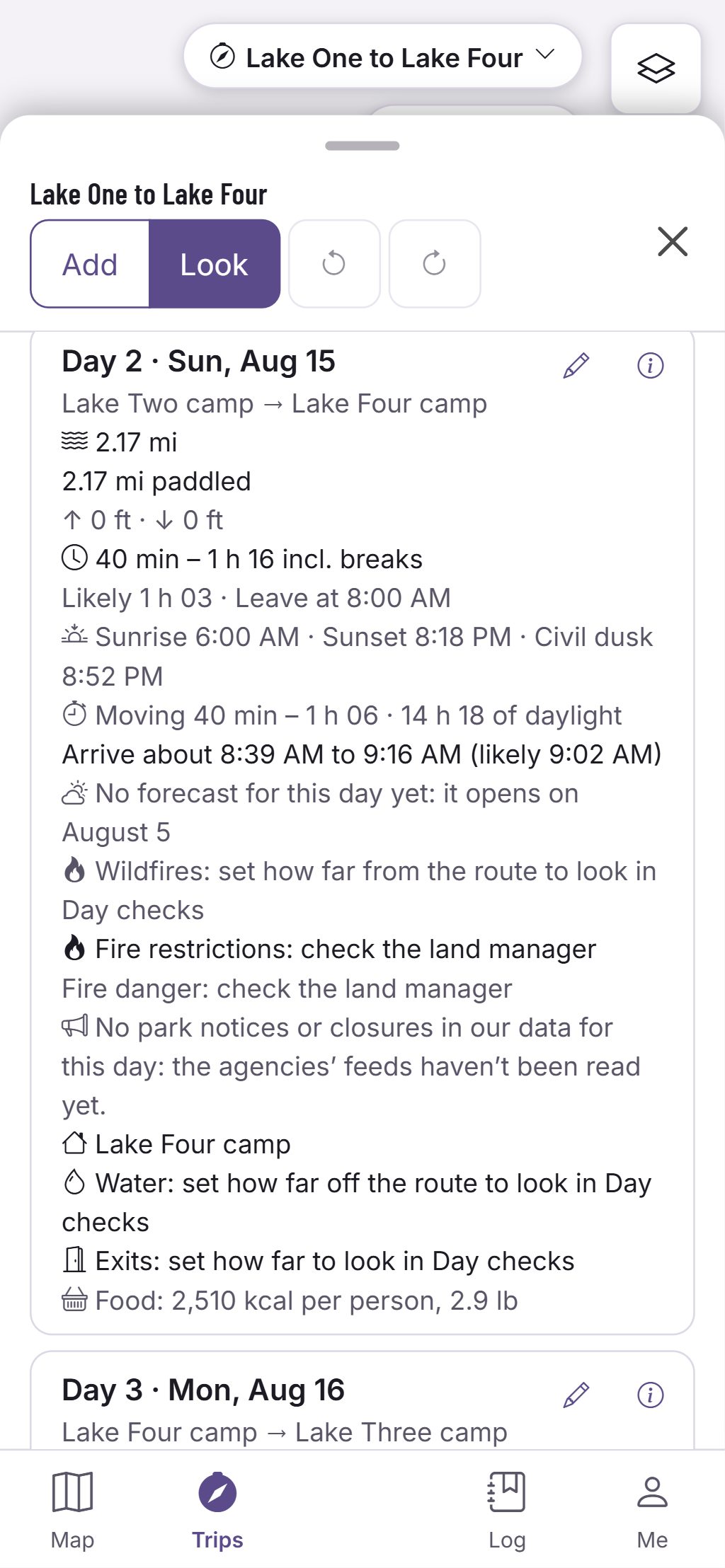
Water along the day
Where the water is, with its source
On a hike, the day card lists the mapped water near the route and the longest stretch between it, each with its source and date.
- Treat all water. A spring on the map is where someone mapped one, not a promise it’s running.
- Where the map couldn’t be read, the card says it couldn’t check, never that there’s no water.
- Set litres per day or per hour of hiking and it gives the water to carry on each stretch.
Estimates for planning, not promises. Official park maps, rules and signs control.
Questions
Still have a question? Read the HuntGrid Backcountry help pages or email support@huntgrid.net.
Does it know which campsites are free?
No. It doesn’t check availability. Book with the park, then add the booking to the night and the card checks the camp against it.
What is a straight-line exit?
The distance and direction to an exit as the crow flies, with a time for it. It isn’t a route: the real way is longer and may cross water or cliffs.
Is it free?
Yes. Everything on this page is in the free plan, with no credit card. HuntGrid Backcountry is in open beta, and there are no ads.
Your next trip starts on the map
Create a free account and open HuntGrid Backcountry in your browser. The same account works for every HuntGrid app.
Already have an account? Sign in