 HuntGrid
Plan a crag day
Plan a crag day: your crags today, a day list and a printed day sheet
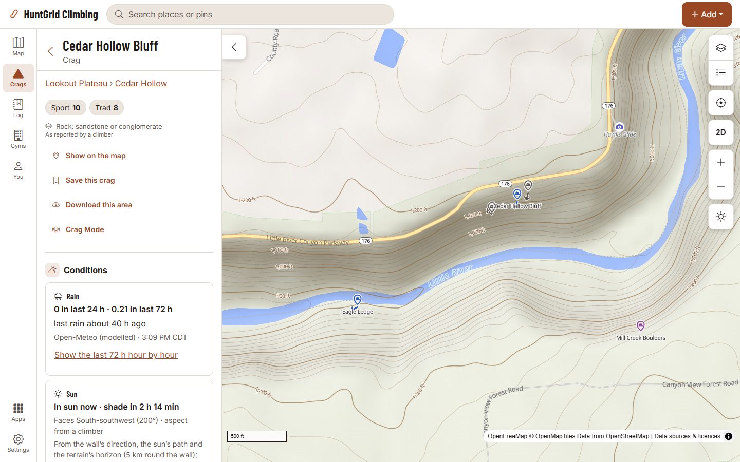
Today lists your saved crags with the rain reported there and when it was read. Long-press routes into a day list, plan it with your group, see each crag’s forecast for that day, then print the day sheet with the approach and the closures in force.
Map data © OpenStreetMap contributors, © OpenMapTiles; terrain: Copernicus WorldDEM-30 (credits)
From the night before to the base of the wall
Today
Your saved crags and the nearest ones, each with the last rain reported and its source. The longest without rain reported come first, crags without rain facts after them, and crags closed today last.
Day lists
Long-press a route to put it on a day list, even with no signal. The list adds up the length and pitches, and counts what isn’t known instead of guessing it.
That day at each crag
For the list’s day: rain and its chance, the temperature range, wind and gusts, and the sun on each wall, with the forecast’s source and time.
Plan with your group
Plan a list with a group and everyone in it sees the same routes. A share link leaves the day out unless you choose to include it.
Parking and the walk in
Where to park, the approach on the map and a walking time range with its climb, at a day-pack or heavy-rack pace. Steep or scrambling sections aren’t modelled, and the sheet says so.
A printed day sheet
The routes in order with their topos, an approach map and a crag map, and each closure as its issuer published it. A crag with none on file says “Access: unknown”. Print it or save it as a PDF.
Find a partner
An opt-in card with a city you type, your crags, grades, styles and free days. No location is used or shown, and only climbers with a card can search.
When to go
A crag’s twelve months: highs, lows and rain days, modelled from ERA5 and labelled so, with the months a yearly closure covers.
Busy days
The busiest weekdays and months at a crag, from public ticks only, shown once enough climbers have logged there.
Camping nearby
Official campgrounds within 30 km, with the agency and a link to its page. None mapped doesn’t mean there is no camping.
Webcams
Park webcams near a crag, each linking to the park’s own camera page.
Map data © OpenStreetMap contributors, © OpenMapTiles; terrain: Copernicus WorldDEM-30 (credits)
On your phone
Check the crag before you drive
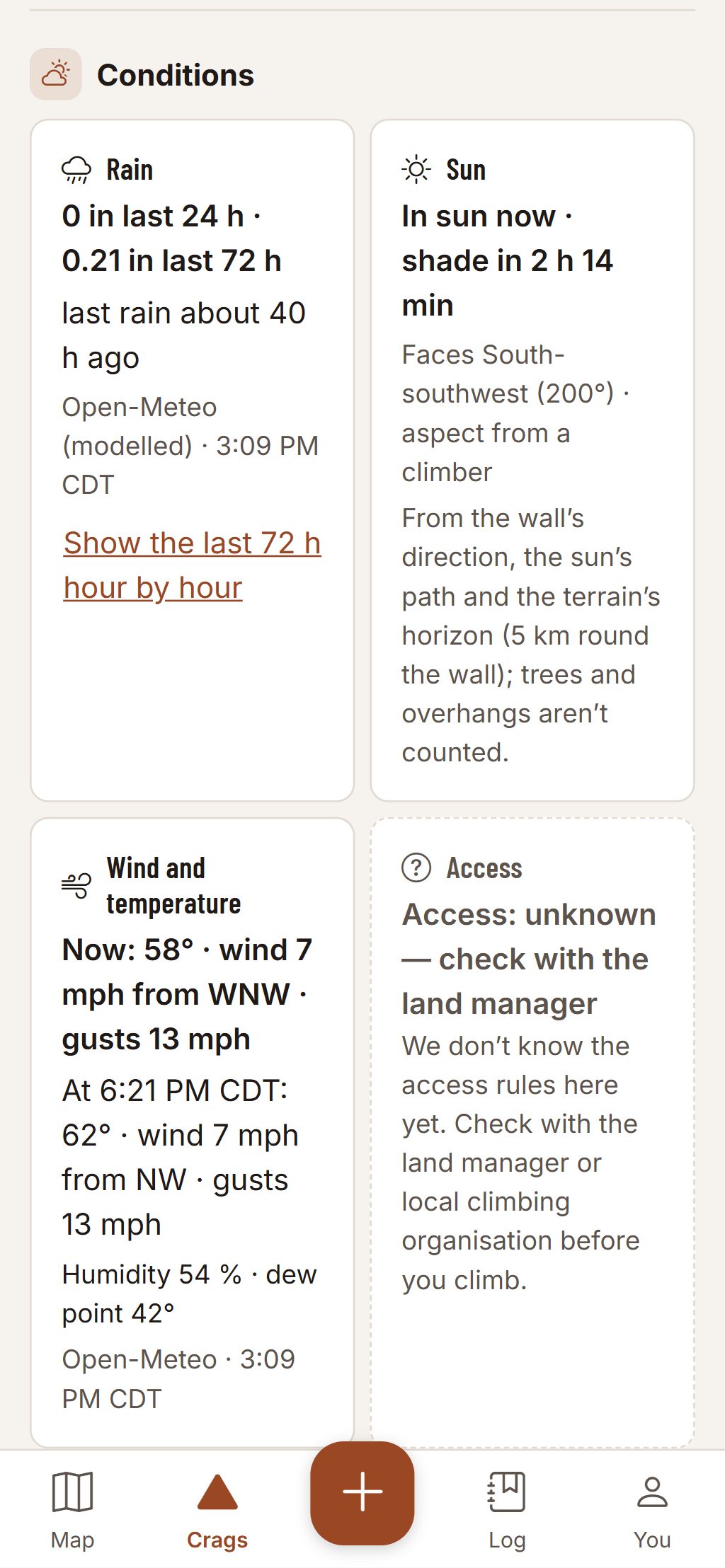
Each crag’s sheet gives its facts with their source and time, never a verdict: you judge the rock.
- Rain in the last 24 and 72 hours and the hours since the last rain.
- Where we don’t know the access rules, the crag says “unknown”: check with the land manager or the local climbing organisation.
- Save the crag and download its pack, and the plan still reads with no signal.
Climbing can kill. Route information comes from other climbers and public sources and can be wrong. Check the rock, gear and anchors yourself.
Questions
Still have a question? Read the HuntGrid Climbing help pages or email support@huntgrid.net.
Who sees my day list?
Only you, unless you plan it with a group or send a share link. A link leaves the day out unless you choose “With the day”.
Does the partner finder use my location?
No. Your card names a city you type and its country. No position is stored or shown, and deleting the card hides you at once.
Is it free?
Yes. Everything on this page is in the free plan, with no credit card. HuntGrid Climbing is in open beta, and there are no ads.
Your next crag day starts on the map
Create a free account and open HuntGrid Climbing in your browser. The same account works for every HuntGrid app.
Already have an account? Sign in