 HuntGrid
Crag conditions
Crag conditions: the rain at the crag, with its source
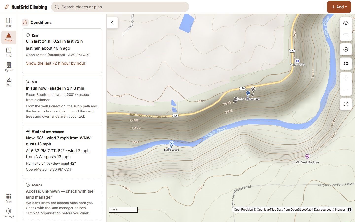
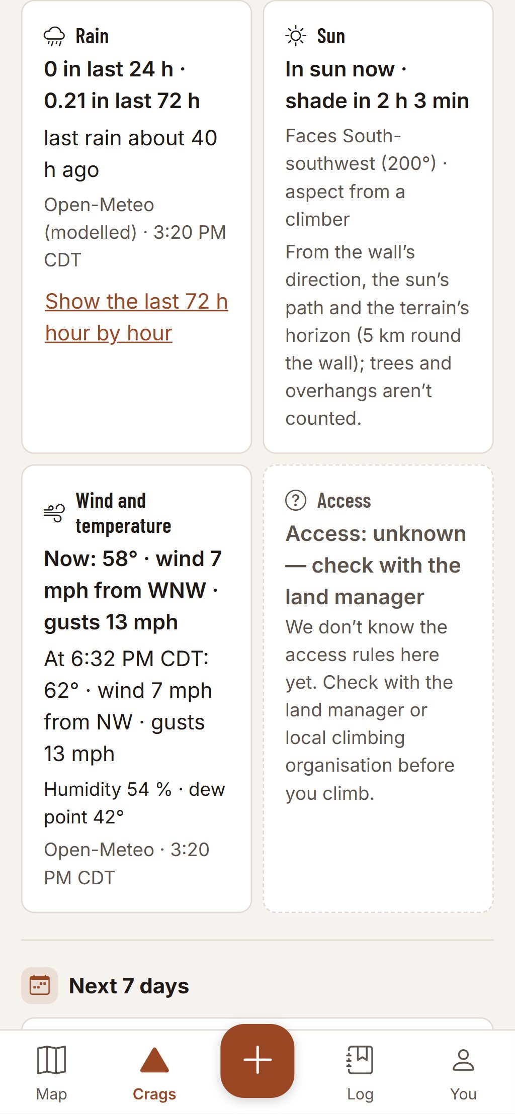
Tap a crag and the conditions strip shows the rain that fell there, the wind and the temperature, each with its source and the time it was read. The app never says the rock is dry: rock dries differently by type, aspect and wind, so you judge it at the crag.
Map data © OpenStreetMap contributors, © OpenMapTiles; terrain: Copernicus WorldDEM-30 (credits)
Facts, each with its source and time
Where a value is missing, the tile says “unknown” and for how many hours, never 0 mm.
Rain
Millimetres of rain in the last 24 and 72 hours, and how many hours since the last rain.
Wind and temperature
Now and for the next three hours, from the forecast, with its source.
Sun or shade on each wall
Which way each wall faces and its sun hours, from the terrain. Trees and overhangs aren’t in the model, and the sheet says so.
The next seven days
Rain, temperature and wind day by day for the week, with the wall’s sun hours each day, and crag filters like “no rain in 48 h” or “shade after 13:00”.
Cited cautions
Where a land manager publishes a rule about wet rock, such as for sandstone, the crag quotes it with its source and a link.
Rock type
From public geology maps, labelled with the map it comes from, or “rock: unknown”.
Lightning, alerts and daylight
The nearest lightning detected, how far and how long ago, with its source; weather alerts as the agency wrote them; sunset and dark at the crag, with the approach time beside them.
Mapped hazards and shelter
Loose rock, a high first bolt, shelter from rain, overhang or slab, as mapped in OpenStreetMap and credited to it, with filters for crags tagged sheltered, overhanging, slab or beginner-friendly.
Map data © OpenStreetMap contributors, © OpenMapTiles; terrain: Copernicus WorldDEM-30 (credits)
On your phone
The strip at the top of every crag
Tap a tile for its detail and its source.
- Hourly rain bars for the last 72 hours.
- With no signal, the last values stay on the sheet with the time they were read: “offline · conditions from 06:40”.
- The same strip for every crag, in English or French.
Climbing can kill. Route information comes from other climbers and public sources and can be wrong. Check the rock, gear and anchors yourself.
Questions
Still have a question? Read the HuntGrid Climbing help pages or email support@huntgrid.net.
Will it tell me if the rock is dry?
No. It shows the rain, the time since it stopped, the wind and the temperature, each with its source. You decide at the crag. Where a land manager publishes a rule about wet rock, the crag quotes it and links to it.
Where does the rain data come from?
From weather data with its source named on each tile. When a source has a gap, the tile says how many hours are missing instead of showing zero.
Is it free?
Yes. Everything on this page is in the free plan, with no credit card. HuntGrid Climbing is in open beta, and there are no ads.
Your next crag day starts on the map
Create a free account and open HuntGrid Climbing in your browser. The same account works for every HuntGrid app.
Already have an account? Sign in