 HuntGrid
Closures and access
Climbing closures, as the land manager published them
Walls close for nesting raptors, cultural sites, restoration and emergencies, and the notices are spread across park and land manager pages. HuntGrid Climbing shows each closure as its issuer published it: who issued it, the place it names, its dates and a link to the notice. Where nothing is on file, the crag says “Access: unknown”, never a green tick.
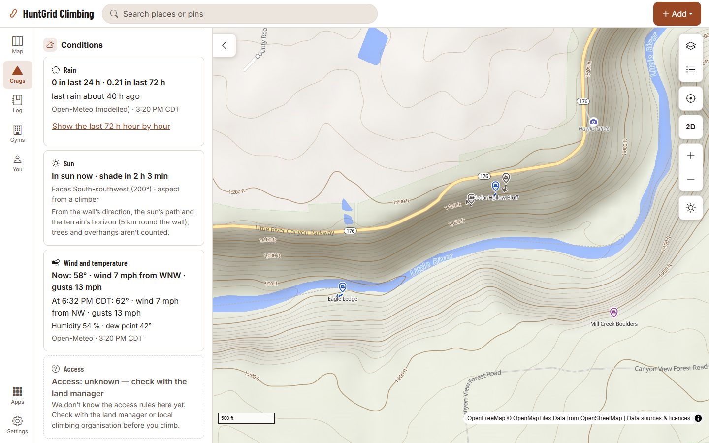
Map data © OpenStreetMap contributors, © OpenMapTiles; terrain: Copernicus WorldDEM-30 (credits)
Every closure with its issuer, dates and notice
A summary in our words, never the notice itself: read the issuer’s notice and the signs at the crag before you climb.
Closures as published
Raptor nesting, cultural, seasonal, restoration and emergency closures, each with its issuer, the place it names, its dates or the issuer’s own words about them, and Read the notice. We check each one against the notice before it shows.
Requests stay requests
When an issuer asks climbers to stay off a wall rather than closing it, as for some raptor nests, the crag says so in those terms and never shows it as closed.
Park alerts
Alerts from the US National Park Service and BC Parks that mention climbing, read every few hours, shown under “Park alerts” on the crags inside that park once we have checked them, with the issuer’s words and a link.
The land manager’s rules
Published rules for the land a crag is on: permits, the bolting policy, group size, dogs, camping. Each in our words with its source and the date we read it. They don’t say whether you can climb today.
Closures on the map
Closed areas are hatched with a red outline, requests dashed, and a closure that names only a crag gets a struck-circle pin at that crag, never at a nest. Closures outside their dates fade.
The unknown ring
A dashed grey ring marks the crags we have no cited rules for. It means we don’t know, not that there is no closure.
Closures in an offline pack
A crag pack carries its closures, rules and the date they were read, and the sheet works out which are in force on the day, even with no signal.
Closure alerts
Save a crag and turn on the alert: when a closure we have checked is in force there, you hear about it once a season, in the app, by push or by email.
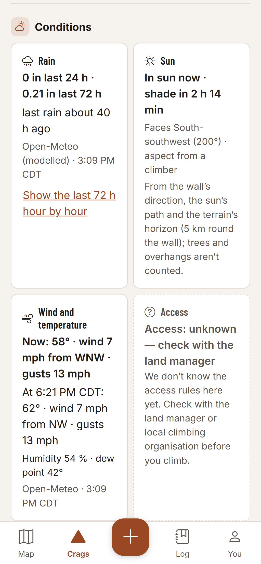
Map data © OpenStreetMap contributors, © OpenMapTiles; terrain: Copernicus WorldDEM-30 (credits)
The Access tile
Four answers, never a go-ahead
The Access tile on every crag sheet gives one of four answers, and a closure in force puts a banner at the top of the sheet: who issued it, what is closed, the dates and Read the notice.
- Closed: a closure in force, with its issuer and dates.
- Request: the issuer asks climbers to stay off.
- Rules: the land manager’s published rules, with their source.
- “Access: unknown — check with the land manager”, wherever nothing is on file.
Climbing can kill. Route information comes from other climbers and public sources and can be wrong. Check the rock, gear and anchors yourself.
Questions
Still have a question? Read the HuntGrid Climbing help pages or email support@huntgrid.net.
If no closure shows, can I climb there?
Not necessarily. It means we have no closure on file. Closures change, some are posted only at the trailhead, and we add them as we check them. Read the land manager’s page and the signs at the crag.
Where do the closures come from?
From the land managers’ and parks’ own pages and notices, and from the National Park Service’s and BC Parks’ alerts, never from other climbing apps. Each shows its issuer and links to the notice.
Why isn’t a raptor nest on the map?
A closure shows at the place its issuer named, the crag or the area, never finer. We never map a nest.
Is it free?
Yes. Everything on this page is in the free plan, with no credit card. HuntGrid Climbing is in open beta, and there are no ads.
Your next crag day starts on the map
Create a free account and open HuntGrid Climbing in your browser. The same account works for every HuntGrid app.
Already have an account? Sign in