 HuntGrid
Conditions
Conditions along the route, and the hours under your wind limit
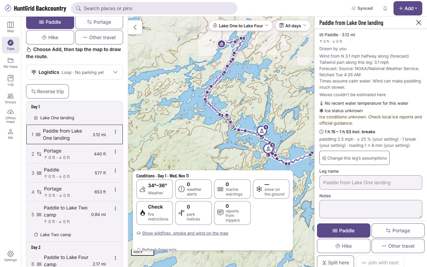
Pick a day and the strip under the map shows its conditions: weather, wind and water, gauges, snow, fire and smoke, and notices. Each fact names its source and when it was read, and an agency’s warning is shown in its own words.
Map data © OpenStreetMap contributors, © OpenMapTiles; terrain: Copernicus WorldDEM-30 (credits)
Facts with their source and time
Conditions follow your route and your dates, leg by leg and day by day.
Weather and wind
The forecast for each day and camp, the wind on each paddle leg at the hour you’ll be on it, and weather alerts for the trip’s days.
Lakes, coasts and rivers
The longest open-water fetch and a wave band on lake legs, marine forecasts and warnings on big water, tides and currents on the coast, water temperature and ice, and river gauges with their trend.
Snow and heat
Snow along hiking and portage legs, and the day’s high where you’ll be walking.
Fire and smoke
Fire perimeters near the route, the smoke forecast, and links to the fire restrictions that cover the trip.
Notices and seasons
Park alerts and closures on the trip’s days, and hunting seasons open on your dates where we have them verified.
Wind windows
Set your own wind limit
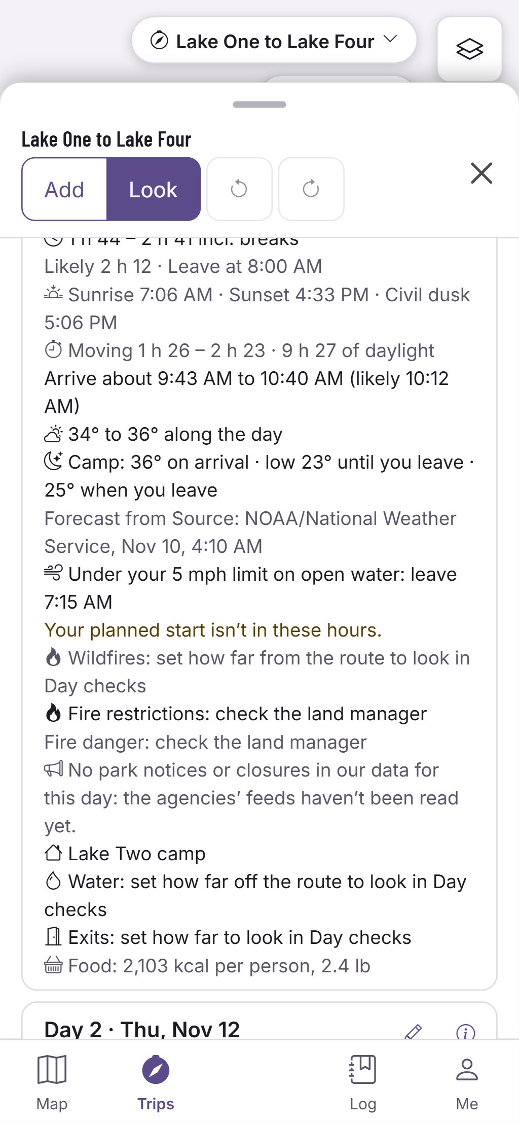
Set the most wind you’ll paddle in. Each day card then shows the hours every open-water leg of the day is under it in the forecast, and the start times that fit.
- Start times stay inside the day’s daylight.
- When no hour fits, the card says so and offers a spare day.
- With no limit set, it shows the forecast wind on each crossing and nothing else.
- The last forecast stays on the phone with its age, for when there’s no signal.
Your limit is your setting, not ours. Wind and waves are facts from a forecast, and a forecast can be wrong. Official park maps, rules and signs control.
Questions
Still have a question? Read the HuntGrid Backcountry help pages or email support@huntgrid.net.
Where does the forecast come from?
From the weather providers HuntGrid uses, such as the national weather services of the US and Canada. Each fact names its source and the time it was read.
Does it say when a crossing is too windy?
No. It shows the forecast wind and waves and, if you set one, whether they’re under your own limit. The call on the water is yours.
Is it free?
Yes. Everything on this page is in the free plan, with no credit card. HuntGrid Backcountry is in open beta, and there are no ads.
Your next trip starts on the map
Create a free account and open HuntGrid Backcountry in your browser. The same account works for every HuntGrid app.
Already have an account? Sign in