 HuntGrid
Offshore
Offshore trip planner and fuel range
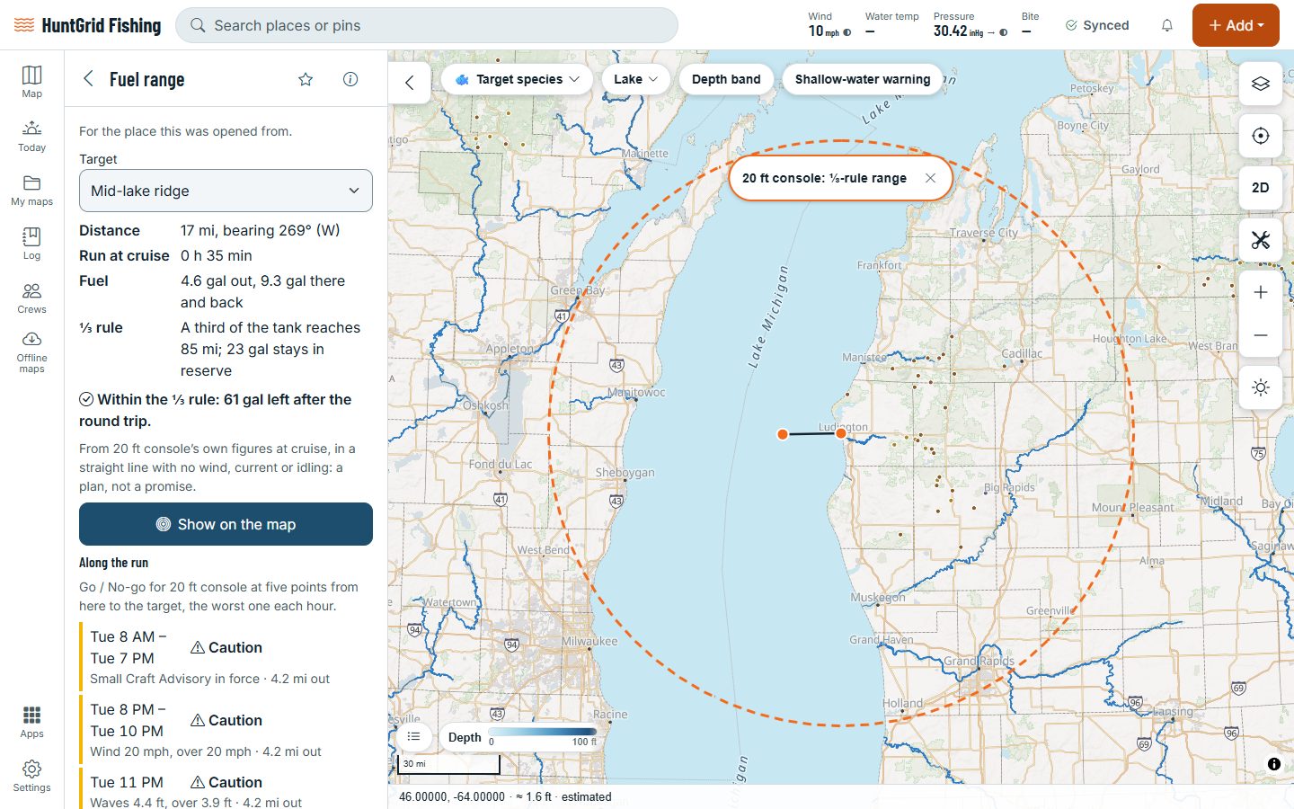
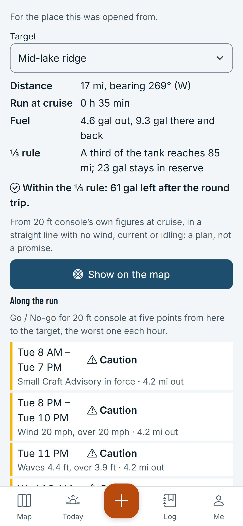
Pick your boat and a spot out there. The Fuel range tool gives the distance and bearing, the run time at cruise, the fuel out and back and what’s left, and draws the one-third rule ring on the map: a third out, a third back, a third in reserve.
Map data © OpenStreetMap contributors, © OpenMapTiles; terrain: Copernicus WorldDEM-30 (credits)
Your boat’s numbers, not a guess
The tool works from the cruising speed, tank and fuel use you entered for your boat. A figure you haven’t entered is named, never filled in for you.
Distance and bearing
From where you start to the spot you pick, with the run time at your cruising speed.
Fuel out and back
The fuel for the run there and back, and what’s left in the tank after the round trip.
The one-third rule ring
A dashed ring on the map shows how far a third of your range reaches, and the tool says whether the run stays within the rule.
Sea state hour by hour
Go, Caution or No-go for your boat at points along the run, each hour to the end of tomorrow, with the reason and where it applies.
The zones’ forecasts
The marine forecast of each zone the run crosses, in the agency’s own words, with the time it was issued.
Breaks on the way
The sea surface temperature and water colour breaks the run crosses, each with its distance out, its strength and the image’s date.
Map data © OpenStreetMap contributors, © OpenMapTiles; terrain: Copernicus WorldDEM-30 (credits)
Out there
More for the offshore run
The planner sits in the Toolbox and works offline from your boat’s figures. The forecasts along the run come from the last ones your phone saved.
- Where a point on the run can’t be told, the hour says Unknown instead of Go.
- Artificial reefs, wrecks and platforms from public government data on the map, with a GPX export.
- State waters, federal waters and Canada’s fishing areas drawn as lines, so you know whose rules apply.
- Marine closed areas and protected areas, with a reminder to check the current regulations.
- An offshore download keeps the temperature and water colour maps of the day on your phone.
The plan is a straight line with no wind, current or idling: a plan, not a promise. Go / Caution / No-go is a second opinion, never a reason to go. Not for navigation.
Questions
Still have a question? Read the HuntGrid Fishing help pages or email support@huntgrid.net.
What is the one-third rule?
Plan to use a third of your fuel going out, a third coming back, and keep a third in reserve. The planner draws that third of your range as a ring and says whether a run stays inside it.
Where do the fuel numbers come from?
From the cruising speed, tank size and fuel use at cruise you enter for your boat. If one is missing, the tool tells you which and links to the boat form; it never assumes a number.
Does it plan a route around land or shoals?
No. The run is a straight line from the start to the spot. Use official charts and your own judgment to navigate.
Can I see artificial reefs and wrecks?
Yes. Reefs, wrecks and platforms published by government agencies are a map layer, each with its source, and you can export them as GPX.
Your next fishing trip starts on the map
Create a free account and open HuntGrid Fishing in your browser. The same account works for HuntGrid Hunt.
Already have an account? Sign in