 HuntGrid
Marine weather
Marine forecast and go/no-go for your boat
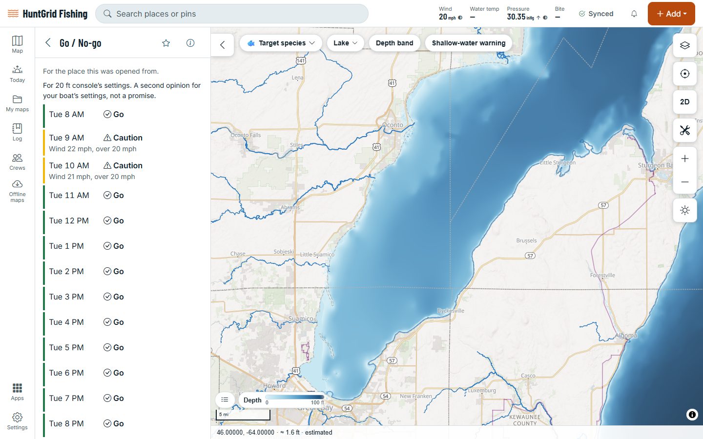
Add your boat once. Each hour’s wind, gusts, wave height and wave period are then checked against that boat’s limits: Go, Caution or No-go, with the reasons. Tap the water to read the marine forecast for that zone, exactly as the weather service issued it.
Map data © OpenStreetMap contributors, © OpenMapTiles; terrain: Copernicus WorldDEM-30 (credits)
Before you leave the dock
Go, Caution and No-go compare the forecast with your boat’s settings. They’re a second opinion, not a promise: the call is always yours.
Your boat’s limits
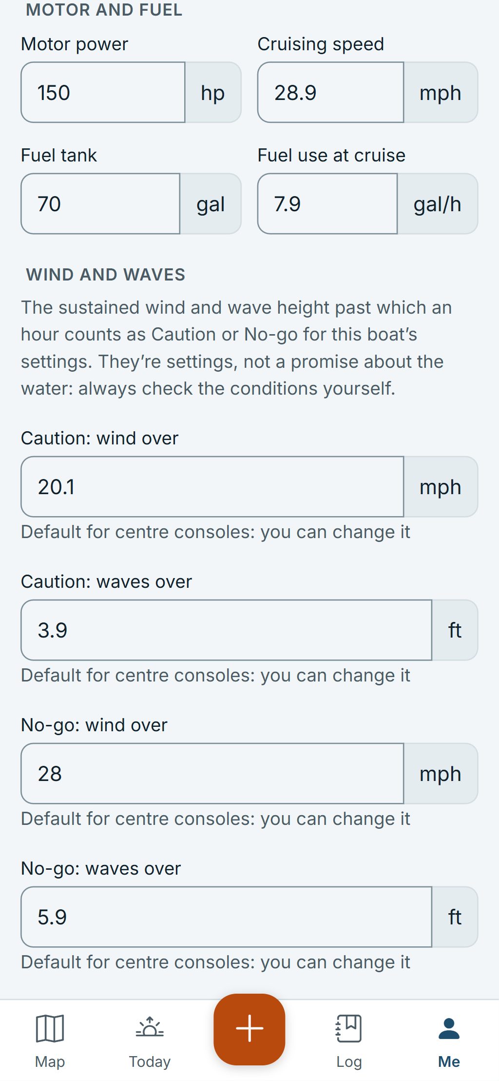
Every kind of boat, from a kayak to one over 30 ft, starts with default wind and wave limits. Change them in your boat’s profile.
Hour by hour, with reasons
Each hour gets its own answer and what drove it, like gusts over your limit or waves too high for your boat.
The forecast as issued
Marine forecasts from the US National Weather Service and Environment and Climate Change Canada, unaltered, with the issuing office.
Open wave models
Wave height and period come from open wave models by ECMWF, NOAA and Météo-France, run on HuntGrid’s own servers.
Marine warnings
Small craft advisories, gales, storms and other marine warnings on the map. An active warning means at least Caution.
Buoys
Wind, waves, sea temperature and air pressure measured at buoys, with the age of each reading.
Waves and wind on the map
Wave height and wind over the water, with a time slider to see them hour by hour.
Waves on inland lakes
Where no wave model covers a lake, wave height is worked out from the wind and the stretch of water it blows across, labelled “estimated”.
Map data © OpenStreetMap contributors, © OpenMapTiles; terrain: Copernicus WorldDEM-30 (credits)
Your boat
Set up your boat once
Your boat’s profile holds what the forecast is checked against. It works offline and syncs to all your devices.
- Kind, length, beam and draft, motor, cruise speed and fuel.
- The wind and wave limits for Caution and No-go, with defaults for its kind that you can change.
- Your boat’s Go, Caution or No-go shows on the Today tab too.
- A downloaded area keeps the latest marine forecast with you, with its age.
HuntGrid isn’t an emergency device and Go isn’t a promise: watch the sky and the water, and carry a marine VHF radio and the gear the law requires for your boat.
Questions
Still have a question? Read the HuntGrid Fishing help pages or email support@huntgrid.net.
What do Go, Caution and No-go mean?
Each hour, the forecast wind, gusts, wave height and wave period are compared with your boat’s limits. Go is inside them, Caution is past the Caution limits and No-go is past the No-go limits. The reasons are listed with each hour.
Where do my boat’s limits come from?
Each kind of boat starts with default wind and wave limits, lower for a kayak than for a 25 ft centre console. They’re yours to change: you know your boat and your crew.
Where do the forecasts come from?
Marine forecasts come from the US National Weather Service and Environment and Climate Change Canada and are shown exactly as issued. Wave height and period come from open wave models (ECMWF, NOAA and Météo-France).
Does Go mean I should go out?
No. Go means the forecast is inside the limits you set. Forecasts can be wrong and conditions change fast: look at the water, check the latest forecast and make the call yourself.
Your next fishing trip starts on the map
Create a free account and open HuntGrid Fishing in your browser. The same account works for HuntGrid Hunt.
Already have an account? Sign in