 HuntGrid
Rivers
Hatches, your fly box and float trips
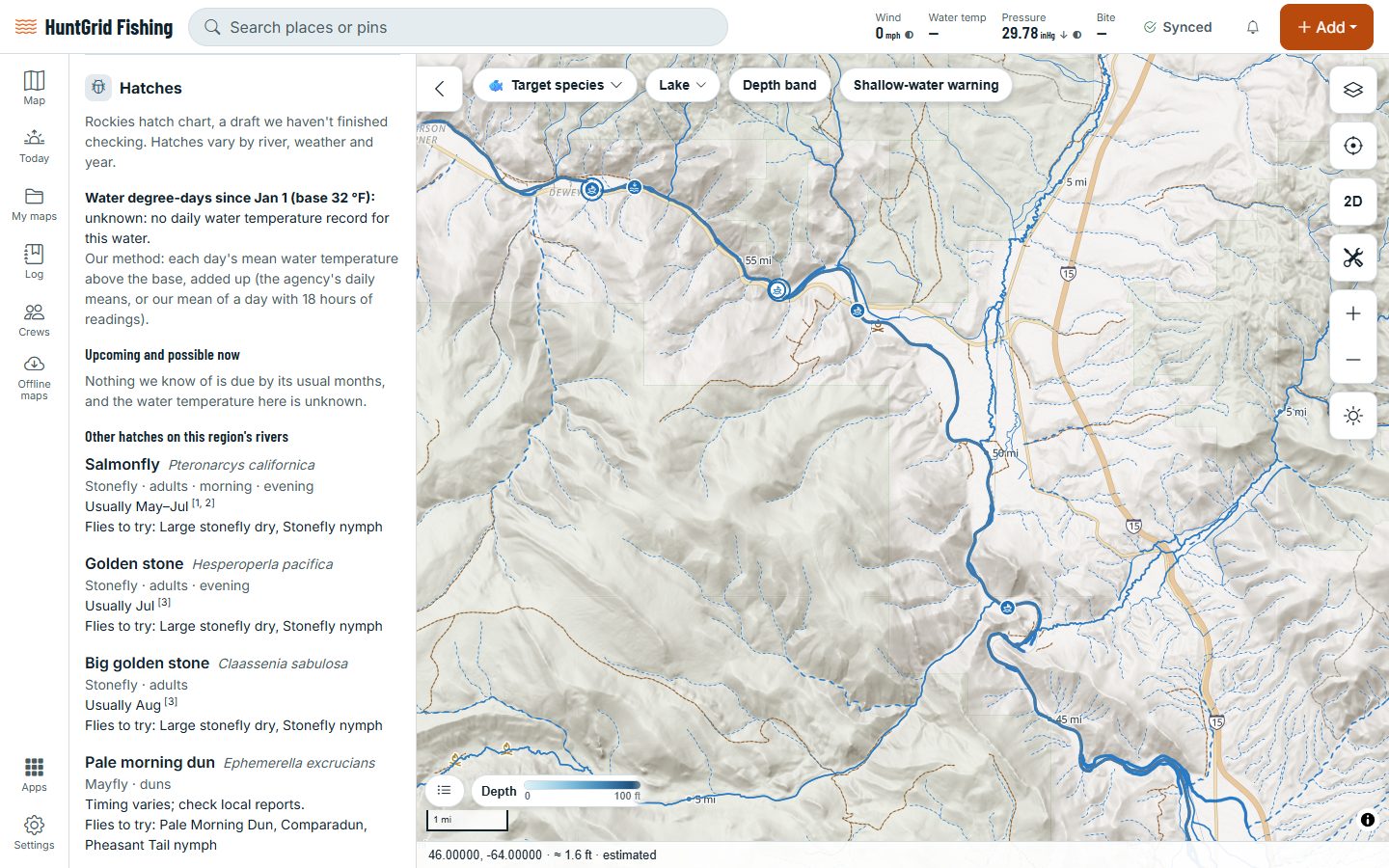
A river’s page lists the hatches likely now and coming up, from the water temperature, the time of year and degree-days, then What to tie on: the patterns for those hatches, marked in your box, lost or not in your box. The Float planner times the trip from put-in to take-out.
Map data © OpenStreetMap contributors, © OpenMapTiles; terrain: Copernicus WorldDEM-30 (credits)
From the hatch to the take-out
Hatch charts cover parts of the United States and are drafts we’re still checking: hatches vary by river, weather and year, so each one is an estimate with its sources.
Upcoming hatches
Likely now, possible now or coming up, each with its reasons, its stage and time of day, and its numbered sources.
Degree-days
Worked out from a gauge’s daily water temperatures with our own stated method. Missing days give “at least”, never a filled-in guess.
What to tie on
Generic patterns for the upcoming hatches, matched with the flies in your tackle box: in your box, lost on the water, or not in your box.
Hazards along the river
The river page lists the hazards marked along the river, each with who says so, and the river’s rules reach by reach.
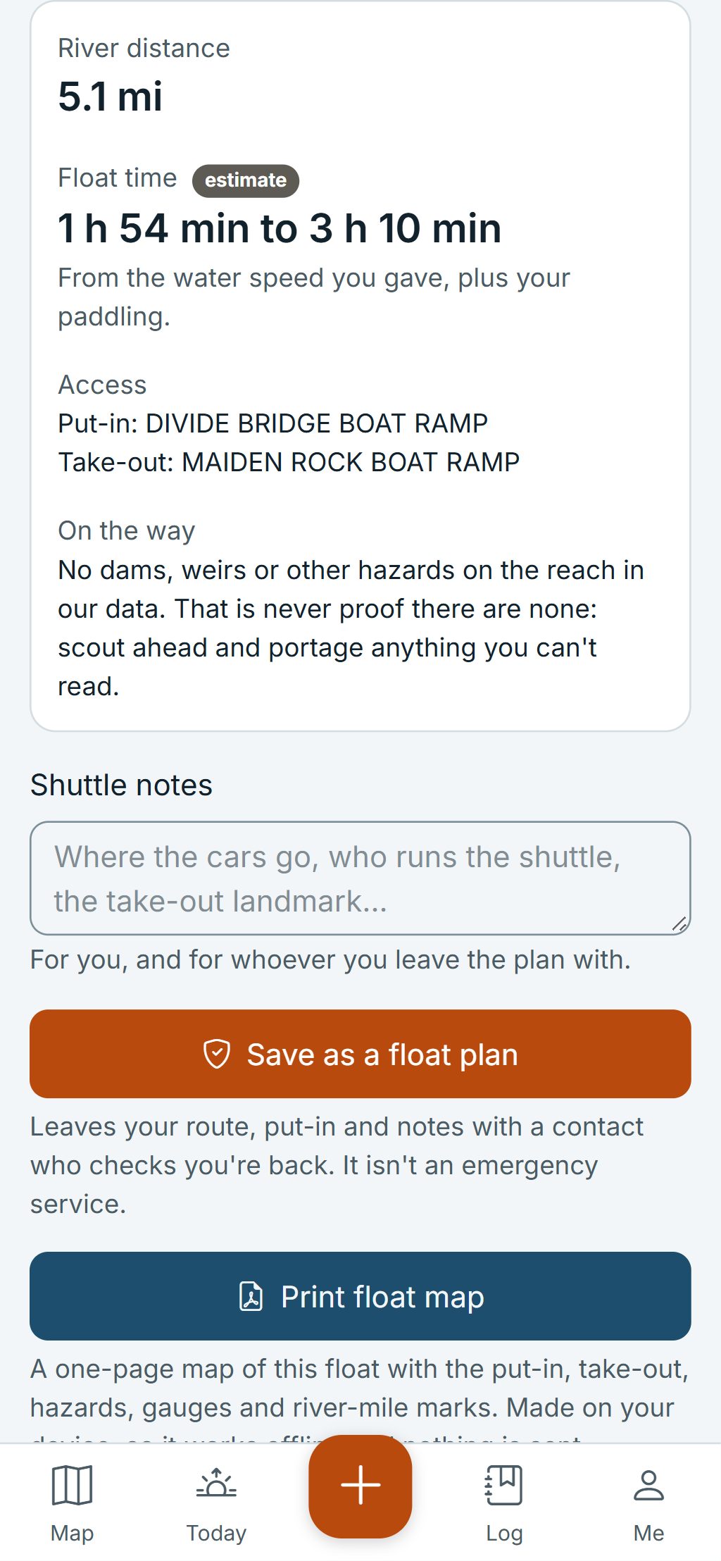
Float time
Put-in and take-out from public access sites or the map: the river distance and a float-time range from the gauge’s flow or your own speed.
Both ends and the shuttle
The access at each end, the gauges on the reach with their flow, and your own shuttle notes.
Map data © OpenStreetMap contributors, © OpenMapTiles; terrain: Copernicus WorldDEM-30 (credits)
Float planner
Know how long the float takes
The time is always a range with its basis, the gauge’s flow or the speed you gave, and an “estimate” badge. Where the map data doesn’t say which way a river flows, the planner says so and doesn’t add a current.
- Already know the distance? Type it with a water speed and get a range on your phone, offline.
- Drift, casual or steady paddling changes the time.
- Save the float as a float plan: if you’re not back by the time you set, your contacts are told.
- Print a float map with the put-in, take-out, hazards, gauges and river-mile ticks.
- See the hatches other anglers reported on that water.
- Fly-fishing how-to and wading tips, saved for offline reading.
Float times and hatches are estimates. Scout the river, check the flow before you launch and wear a life jacket.
Questions
Still have a question? Read the HuntGrid Fishing help pages or email support@huntgrid.net.
How does it know which hatches are coming?
From hatch charts we wrote from cited sources: each hatch’s months, its water-temperature window and, where a source gives one, a degree-day threshold. The river’s water temperature and degree-days then say which are likely now and which are coming up.
Does it know which flies I have?
Yes, if you add them to your tackle box. What to tie on then marks each suggested pattern as in your box, lost or not in your box. Without flies in your box, it lists the generic patterns.
How accurate is the float time?
It’s an estimate, shown as a range. From a gauge it uses the river’s measured flow; otherwise it uses the speed you give. Wind, low water and stops all change the real time.
Can someone know when I should be back?
Yes. Save the float as a float plan with your contacts and a back-by time. If you’re overdue, they’re told. HuntGrid Fishing isn’t an emergency device.
Your next fishing trip starts on the map
Create a free account and open HuntGrid Fishing in your browser. The same account works for HuntGrid Hunt.
Already have an account? Sign in