 HuntGrid
Tuna, mahi and the blue water
The offshore fishing app for tuna and mahi
Offshore fish follow edges: temperature breaks, weed lines, canyon walls and reefs, and the day depends on the weather window. HuntGrid Fishing checks the marine forecast against your boat’s limits, keeps your numbers private and logs every fish in three taps.
Map data © OpenStreetMap contributors, © OpenMapTiles; terrain: Copernicus WorldDEM-30 (credits)
Know the blue-water fish
Fast, far-ranging and always on the move.
Mahi live fast
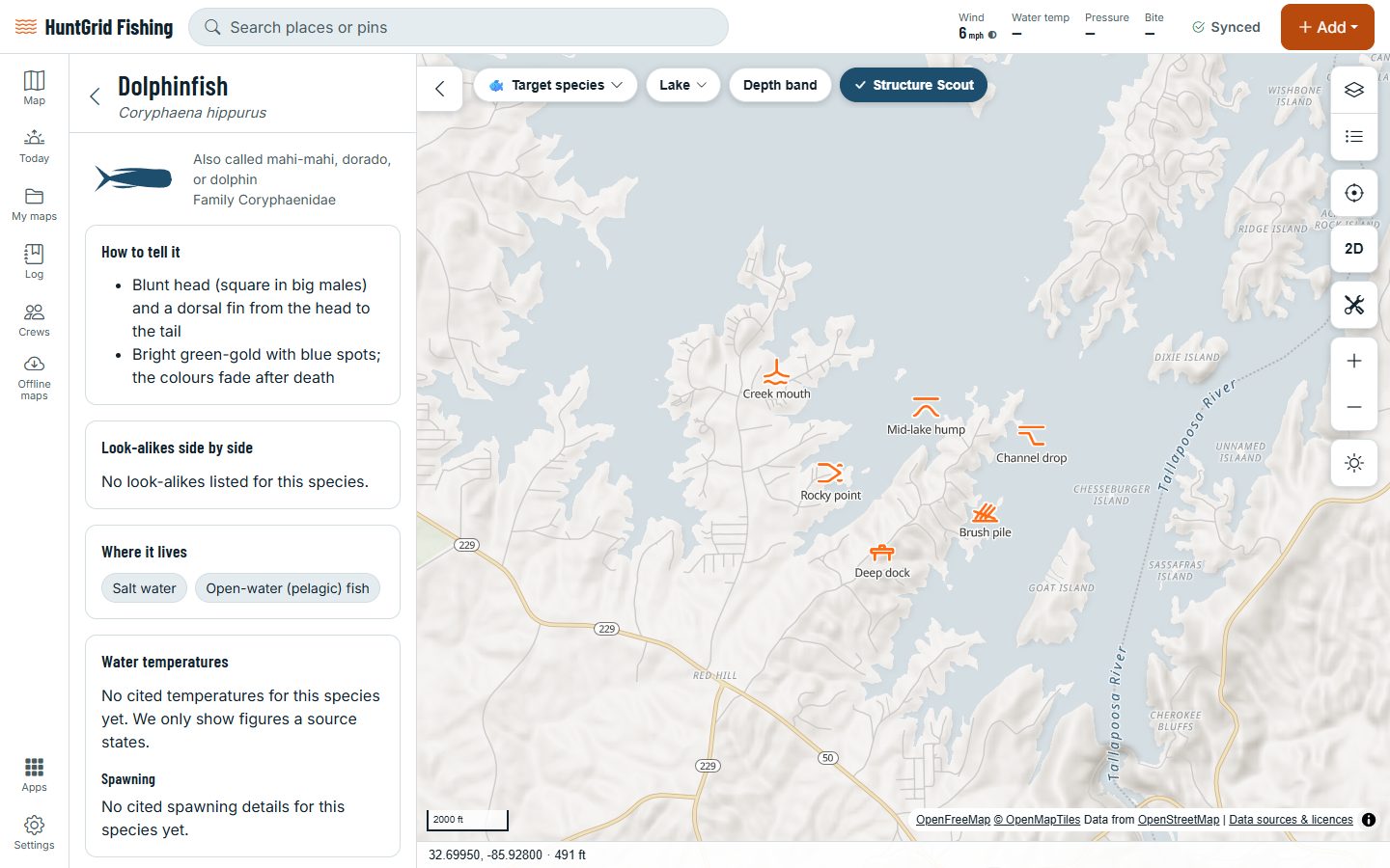
Dolphinfish, also sold as mahi-mahi, grow fast, live short lives and gather under floating weed, logs and debris. They’re fish, no relation to dolphins.
Tuna travel far
Bluefin, bigeye, albacore and skipjack tuna cross whole oceans after warm water and schools of bait. Bluefin keep their bodies warmer than the sea, so they hunt in cold water too.
Life on the edges
Where warm water meets cooler water, or blue water meets green, bait gathers and predators patrol. Many crews troll along these breaks until they find fish.
The window decides
Offshore days are made or lost on wind and waves, for the whole trip and the ride home. Short-period waves are steeper and rougher than their height suggests.
Map data © OpenStreetMap contributors, © OpenMapTiles; terrain: Copernicus WorldDEM-30 (credits)
Species guide
Bluefin or albacore? The guide shows you
The species guide in HuntGrid Fishing works with no signal. Each species has its own page (open this species in the app):
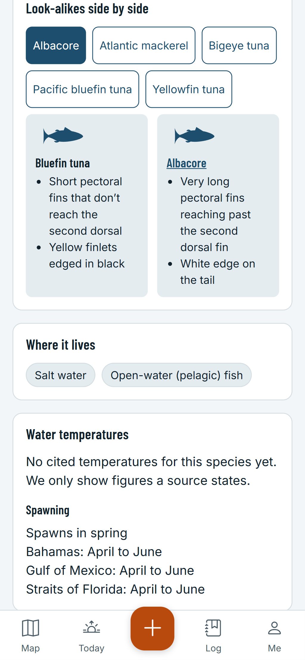
- The marks that tell them apart: an albacore has very long pectoral fins that reach past the second dorsal fin and a white edge on its tail; a bluefin tuna has short pectorals and yellow finlets edged in black.
- Look-alikes side by side, like the skipjack tuna and the Atlantic bonito, or the bigeye tuna and the bluefin.
- The dolphinfish’s blunt head and the dorsal fin that runs from head to tail, and its bright colours, which fade after death.
- Yellowfin tuna, blackfin tuna, wahoo and sailfish, with the other fish of warm seas.
- A question key: answer a few questions about the fish in your hand and it narrows down the candidates.
- Waters near you where agency surveys or stocking records show the species, with the year.
Offshore rules stack up: state or provincial rules, federal rules, and permits for tunas, billfish and sharks in many waters. HuntGrid never guesses them: the official regulations always have the final word.
How offshore anglers use HuntGrid Fishing
Go, Caution or No-go
Add your boat once: each hour’s wind, gusts, wave height and wave period are checked against its limits, with the reasons. A second opinion, not a promise.
The forecast as issued
Marine forecasts from the US National Weather Service and Environment and Climate Change Canada, unaltered, with the issuing office.
Your numbers stay yours
Mark ledges, wrecks, weed lines and canyon edges with fishing icons, with the depth, the bottom and the months each one fishes best. Nobody sees them unless you share them.
Log a mahi in three taps
Tap +, Catch, Dolphinfish: the place and time are saved, even far offshore with no signal. Note whether you kept it or released it.
Offshore how-tos, offline
The how-to library covers offshore fishing, the high-low rig, sending a fish from deep water back down with a descending device, and keeping your catch fresh.
Temperature breaks
Sea surface temperature with break lines where warm and cool water meet, and the date of each image.
Colour breaks
Chlorophyll maps show where blue water meets green, with their date.
Reefs, wrecks and platforms
Artificial reefs, wrecks and platforms from official sources, each with its source.
Plan the run
Pick an inlet and a target: distance, bearing, run time and a fuel range ring that keeps a reserve.
State or federal waters?
The lines between state and federal waters, so you know whose rules apply where you fish.
Trolling speed
Fish Mode shows your speed over the ground and a trolling speed bar that sounds when you leave your range.
Can I keep it?
Fish Check gives the rules for a tuna or a mahi of that length at that place today, with the official source.
Personal bests
Your biggest mahi and tuna, by length and by weight.
Questions
Still have a question? Read the HuntGrid Fishing help pages or email support@huntgrid.net.
What is the best app for offshore fishing?
The one that fits how you fish. HuntGrid Fishing checks the marine forecast against your boat’s limits, keeps your numbers private, logs a catch in three taps and carries a species guide and a how-to library offline. It’s free: try it before your next run.
Does Go mean the sea will be fine?
No. Go means the forecast is within the limits you set for your boat. Forecasts can be wrong and the weather changes: watch the sky and the water, leave a float plan with someone ashore and turn back early.
Is a dolphinfish a dolphin?
No. The dolphinfish, also sold as mahi-mahi, is a fish, no relation to dolphins.
Does HuntGrid Fishing show tuna and mahi limits?
Fish Check gives the rules for a tuna or a mahi at a water on a date, with the official source. Rules a person hasn’t checked yet are labelled as not verified. The official regulations always have the final word.
Your next fishing trip starts on the map
Create a free account and open HuntGrid Fishing in your browser. The same account works for HuntGrid Hunt.
Already have an account? Sign in