 HuntGrid
The Dig Sheet
The Dig Sheet: everything we know about a spot
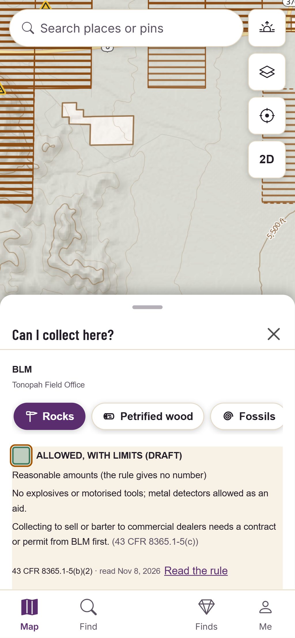
Tap the map and a card opens with who manages the land and what its collecting rule says. Open the full sheet for the claims, what’s on top, what’s under you and today’s alerts, each with its source.
One sheet, in the same order every time
A part with nothing to show is left out, never filled with a guess.
The answer and its rule
The land manager, our summary of the rule for the activity you picked, its citation, link and the day we read it. Where we have no rule yet, it says Unknown and why.
Claims
Up to three mining claims at the spot with their kind, status, serial number and how precisely the record places them. No claim in the data is never a promise there is none.
On top
Orders in force today, wilderness, national monuments, mineral withdrawals and developed recreation sites at the spot, and tribal boundaries within 10 km, each as published.
Under you
The geology unit at the point with its rock, age and the map it comes from, the mineral occurrences recorded within 5 km and the fossil formations, each credited.
Today
Weather alerts in force at the spot as the agency wrote them (NWS or Environment Canada), with the time they were checked.
Getting there
The nearest road end the map knows and the walk from it, with the sources behind them.
Map data © OpenStreetMap contributors, © OpenMapTiles; terrain: Copernicus WorldDEM-30 (credits)
Good to know
Save it, print it, check it
- Save the spot to your own private folder, even with no signal.
- Print the sheet on Letter or A4 with the map and its key; coordinates only if you tick them.
- The footer lists every source the sheet used, with its date.
- Links to a spot never put its coordinates in the address.
Information, not legal advice: rules change, and posted signs and the land manager have the final word.
Questions
Still have a question? Read the HuntGrid Rockhounding help pages or email support@huntgrid.net.
Does the sheet tell me I may dig here?
No. It shows what the rule we found says, with its source and read date, and the facts around the spot. Posted signs and the land manager have the final word.
Is it free?
Yes. Everything on this page is in the free plan, with no credit card. HuntGrid Rockhounding is in open beta, and the rules, claims and geology are never behind a paywall.
See what the rule says before you dig
Create a free account and open HuntGrid Rockhounding in your browser. The same account works for every HuntGrid app.
Already have an account? Sign in